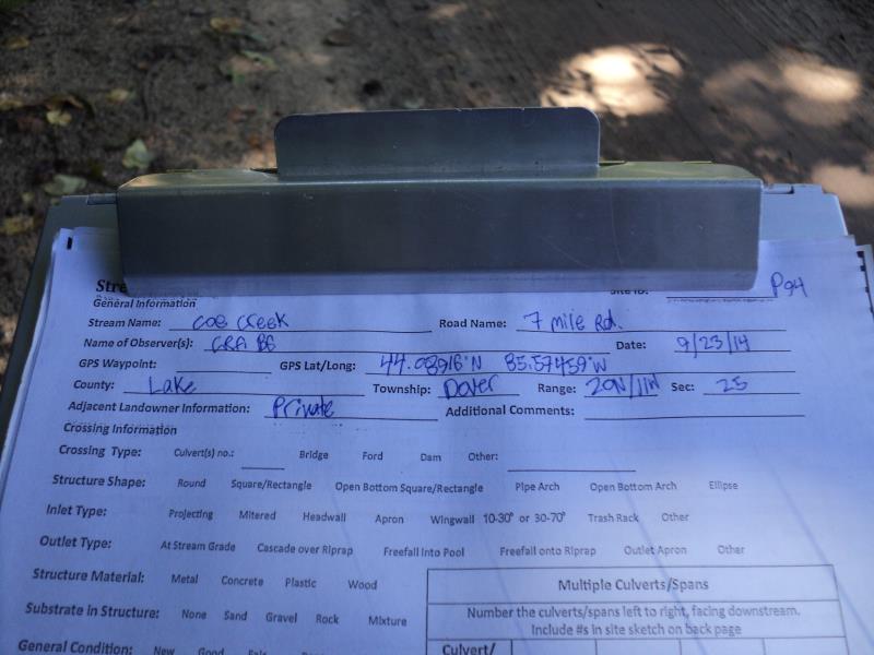
Road Stream Crossing Site P094
Pine River Watershed, Coe Creek
7 Mile Rd
Dover Twp,
Lake County
Information collected by:
Site Location
GPS Coordinates: 44.08914
, -85.57475
T20N
R11W
Sec 25
Owned by Private
Structure is NOT Perched
Total Erosion: 1.0579 tons/year
Severity: Severe
Year Inventoried: 2014
Site ID
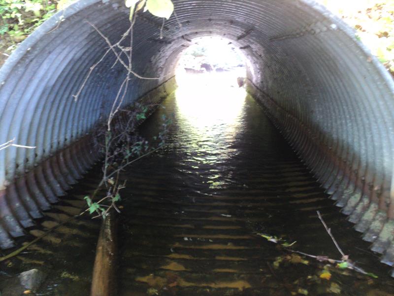
Inlet
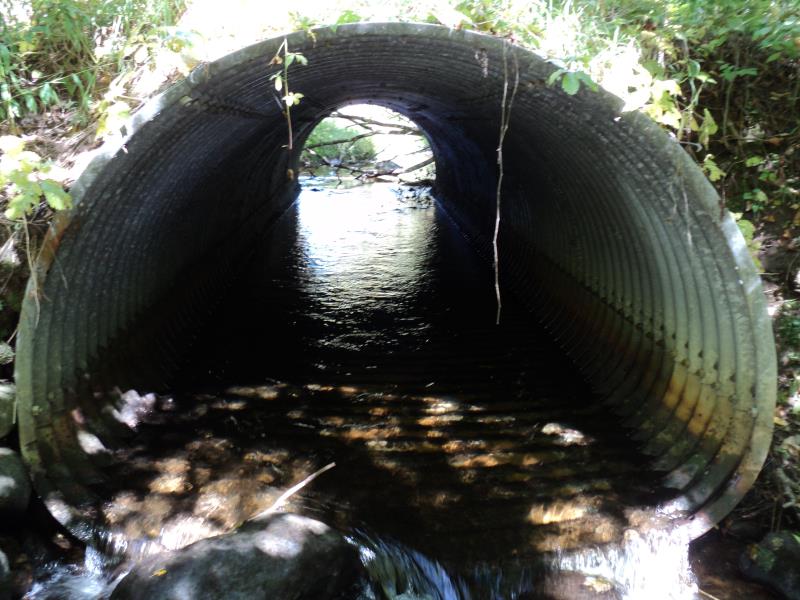
Outlet
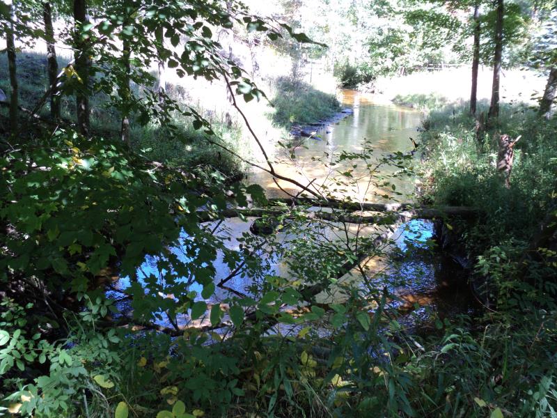
Upstream Conditions
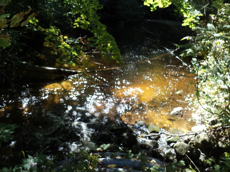
Downstream Conditions
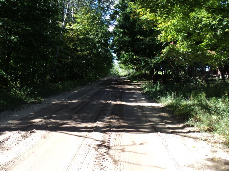
Road Approach - Left
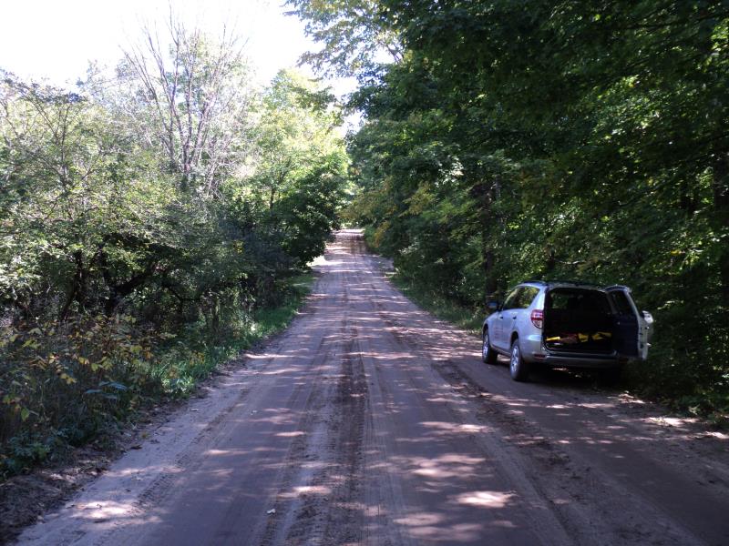
Road Approach - Right
Crossing Information
Type of Crossing: culvert(s)
Number of Structures: 1
Structure Shape: Pipe Arch
Inlet Type: Projecting
Outlet Type: Cascade over Riprap
Structure Material: Metal
Structure Substrate: None
General Conditions: Good
Structure Interior: corrugated
Dimensions of Structure: Length 40 ft.
, Width 8.5 ft.
, Height 6 ft.
Structure is NOT Perched
Structure Inlet
Water Depth: 1 ft.
Embedded Depth of Structure: 0 ft.
Water Velocity*: 1.5 ft./sec.
Structure Outlet
Water Depth: 1.3 ft.
Embedded Depth of Structure: 0 ft.
Water Velocity*: 6 ft./sec.
*Water Velocities were measured 0.6 ft. below Surface
(with Meter)
Stream Information
Stream Flow: Less than Bankfull
Scour Pool: Length 0 ft.
, Width 0 ft.
, Depth 0 ft.
Upstream Pond: Length 0 ft.
, Width 0 ft.
, Depth 0 ft.
Riffle Information
Water Depth: 0.8 ft.
Bankfull Width: 16 ft.
Wetted Width: 14 ft.
Water Velocity: 1 ft./sec.
(Measured with Meter)
Dominant Substrate: Sand
Road Information
Gravel
County Road
Road Condition: Fair
Road Width at Culvert: 20 ft.
Location of Low Point: Other
Runoff Path: Roadway
Embankments
Upstream
Fill Depth: 0.6 ft.
Slope: More than 1:2
Downstream
Fill Depth: 0.8 ft.
Slope: More than 1:2
Approaches
Left Approach
Length: 400 ft.
Slope: 1% to 5%
Vegetation: Heavy
LS Factor: 0.48
Erosion: 1.0579 tons/year
Right Approach
Length: 0 ft.
Slope: Less Than 1%
Vegetation: Heavy
LS Factor: 0.05
Erosion: 0 tons/year
Erosion Information
Total Erosion at Crossing: 1.0579 tons/year
Extent of Erosion: Moderate
Summary Information
Fish Passage is an area of concern for this site.
Yes, high outlet velocity.
�