Road Stream Crossing Site P116
Pine River Watershed, Unknown (tributary to Silver Creek)
Saddler Rd
Dover Twp,
Lake County
Information collected by:
Site Location
GPS Coordinates: 44.1213
, -85.63412
T20N
R11W
Sec 16
Owned by State
Private
Private
Fish Passability 0.5
Structure is NOT Perched
Total Erosion: 0.903 tons/year
Severity: Moderate
Year Inventoried: 2014
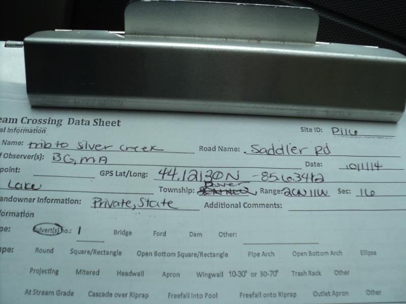
Site ID
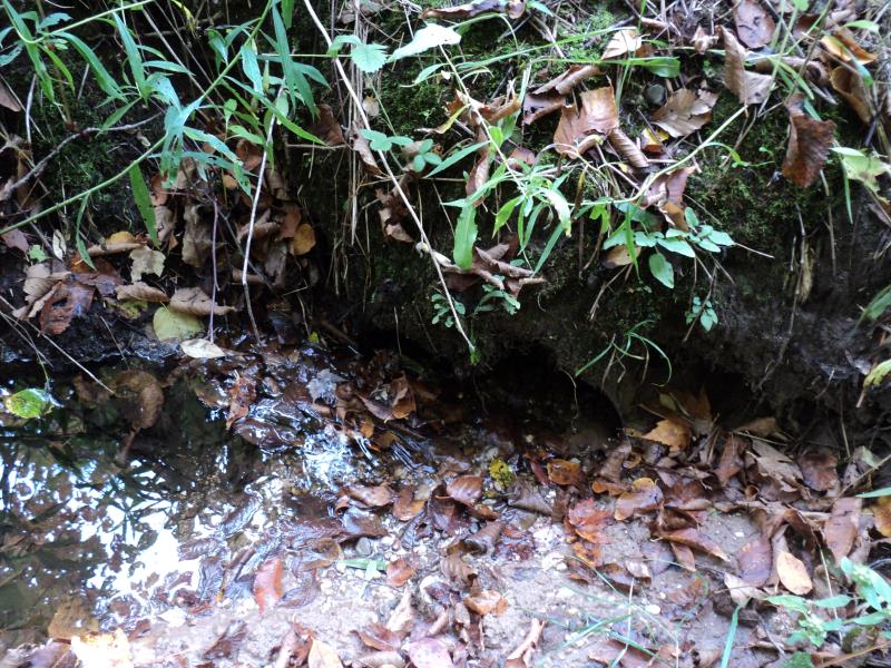
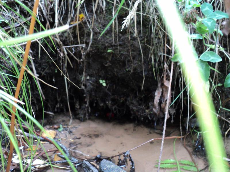
Inlet
Outlet
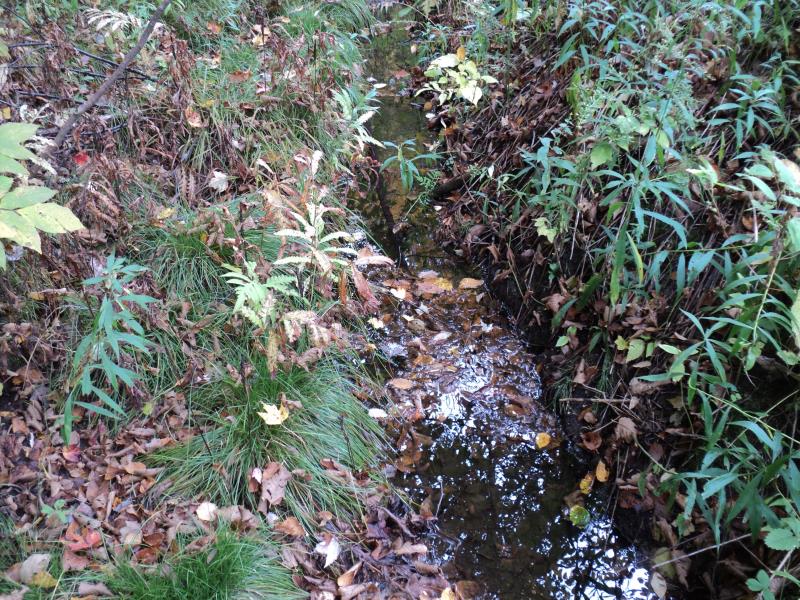
Upstream Conditions
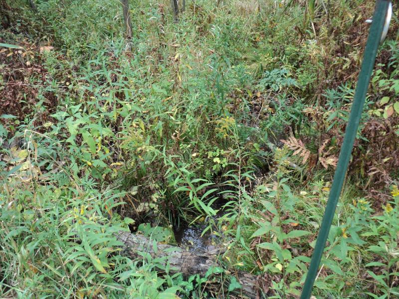
Downstream Conditions
Road Approach - Left
Road Approach - Right
Erosion
Crossing Information
Type of Crossing: culvert(s)
Number of Structures: 1
Structure Shape: Round
Inlet Type: Projecting
Outlet Type: At Stream Grade
Structure Material: Metal
Structure Substrate: Sand
General Conditions: Fair
Structure Interior: corrugated
Dimensions of Structure: Length 32 ft.
, Width 1.5 ft.
, Height 1.5 ft.
Percentage Plugged:
Inlet: 1% to 25%
Outlet: 0%
In Pipe: 0%
Structure is NOT Perched
Structure Inlet
Water Depth: 0.1 ft.
Embedded Depth of Structure: 0.8 ft.
Water Velocity*: 0.2 ft./sec.
Structure Outlet
Water Depth: 0.1 ft.
Embedded Depth of Structure: 0.8 ft.
Water Velocity*: 0.1 ft./sec.
*Water Velocities were measured at the Surface
(with Meter)
Stream Information
Stream Flow: Less than Bankfull
Scour Pool: Length 0 ft.
, Width 0 ft.
, Depth 0 ft.
Upstream Pond: Length 0 ft.
, Width 0 ft.
, Depth 0 ft.
Riffle Information
Water Depth: 0.2 ft.
Bankfull Width: 2 ft.
Wetted Width: 1.8 ft.
Water Velocity: 0.1 ft./sec.
(Measured with Meter)
Dominant Substrate: Sand
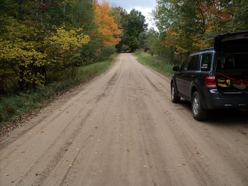
Road Information
Gravel
County Road
Road Condition: Good
Road Width at Culvert: 19 ft.
Location of Low Point: Other
Runoff Path: Roadway
Embankments
Upstream
Fill Depth: 1.5 ft.
Slope: More than 1:2
Downstream
Fill Depth: 2 ft.
Slope: 1:1
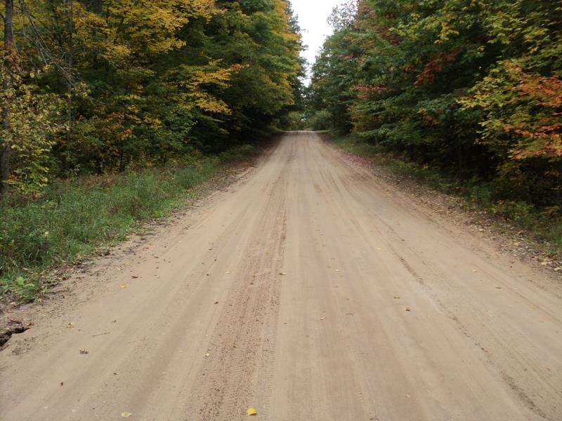
Approaches
Left Approach
Length: 350 ft.
Slope: 1% to 5%
Vegetation: Heavy
LS Factor: 0.47
Erosion: 0.861 tons/year
Right Approach
Length: 0 ft.
Slope: Less Than 1%
Vegetation: Heavy
LS Factor: 0.05
Erosion: 0 tons/year
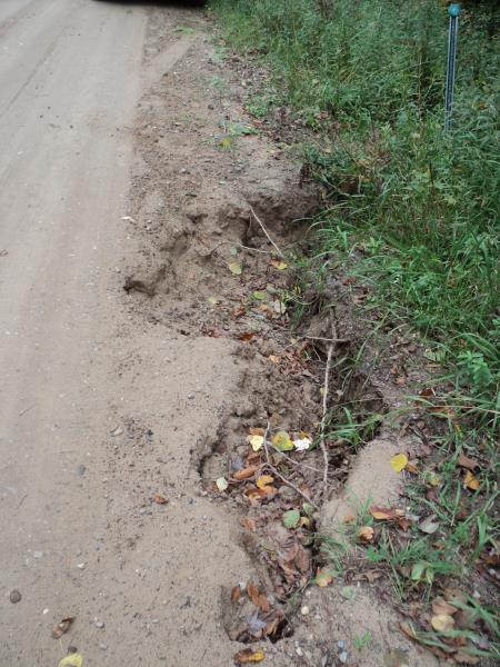
Erosion Information
Total Erosion at Crossing: 0.903 tons/year
Extent of Erosion: Moderate
Erosion is occurring and corrective actions can be installed to address the problem.
Location of Erosion | Erosion Dimensions | Eroded Material | Material Eroded | Total Erosion | ||
facing downstream | Length | Width | Depth | Reaching Stream? | (tons/year) | |
Left Approach |
6 ft. |
2.5 ft. |
1 ft. |
no |
Gravelly Loam |
0.042 |
Summary Information
Fish Passability 0.5
Erosion is an area of concern for this site.
Yes, high potential for washout with present erosion.
A future visit to this site is recommended. Yes, due to erosion on approach and potential to washout.
�