Road Stream Crossing Site P127
Pine River Watershed, Pine River
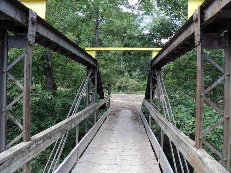
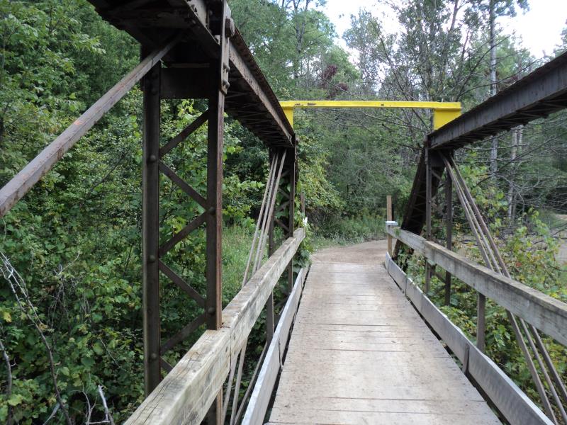
Lincoln Bridge (ORV Trail)
Newkirk Twp,
Lake County
Information collected by:
Site Location
GPS Coordinates: 44.13352
, -85.69534
T20N
R12W
Sec 12
Owned by State
Structure is NOT Perched
Total Erosion: 0.1653 tons/year
Severity: Minor
Year Inventoried: 2014
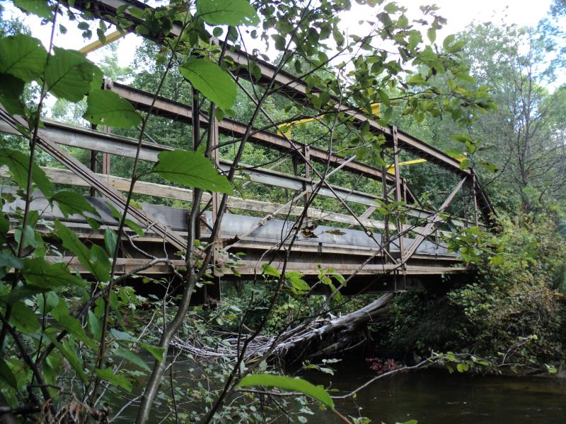
Inlet
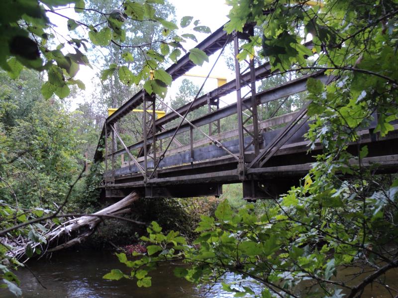
Outlet
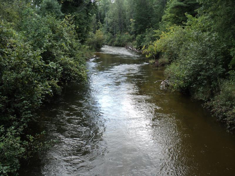
Upstream Conditions
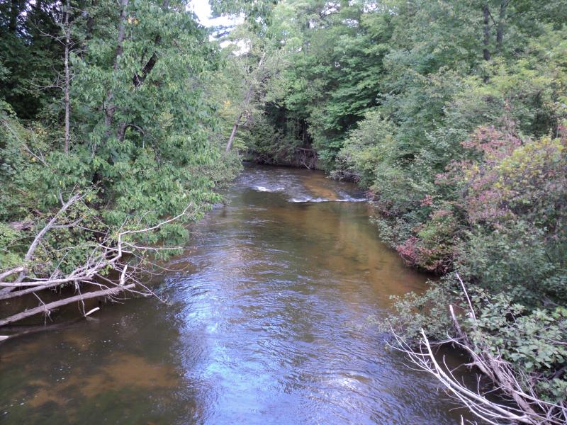
Downstream Conditions
Road Approach - Left
Road Approach - Right
Crossing Information
Type of Crossing: Bridge
Structure Shape: Open Bottom Square/Rectangle
Inlet Type: Other
Outlet Type: At Stream Grade
Structure Material: Metal
Structure Substrate: Mixture
General Conditions: Fair
Structure Interior: smooth
Dimensions of Structure: Length 5.5 ft.
, Width 82.5 ft.
, Height 10 ft.
Structure is NOT Perched
Structure Inlet
Water Depth: 2.6 ft.
Embedded Depth of Structure: 0 ft.
Water Velocity*: 4.5 ft./sec.
Structure Outlet
Water Depth: 2.4 ft.
Embedded Depth of Structure: 0 ft.
Water Velocity*: 4.5 ft./sec.
*Water Velocities were measured 1 ft. below Surface
(with Meter)
Additional Comments
Crossing for ORV and snowmobiles only. No riffle Available, larger main branch crossing.
Stream Information
Stream Flow: Less than Bankfull
Scour Pool: Length 0 ft.
, Width 0 ft.
, Depth 0 ft.
Upstream Pond: Length 0 ft.
, Width 0 ft.
, Depth 0 ft.
Road Information
Sand
Other Road
Road Condition: Fair
Road Width at Culvert: 5 ft.
Location of Low Point: At Stream
Runoff Path: Roadway
Fill Depth: 0 ft.
Slope: Vertical
Fill Depth: 0 ft.
Slope: Vertical
Approaches
Left Approach
Length: 150 ft.
Slope: 1% to 5%
Vegetation: Heavy
LS Factor: 0.4
Erosion: 0.0826 tons/year
Right Approach
Length: 150 ft.
Slope: 1% to 5%
Vegetation: Heavy
LS Factor: 0.4
Erosion: 0.0826 tons/year
Erosion Information
Total Erosion at Crossing: 0.1653 tons/year
Summary Information
�