Road Stream Crossing Site P151
Pine River Watershed, Sixteen Creek
48 Rd
Cherry Grove Twp,
Wexford County
Information collected by:
Site Location
GPS Coordinates: 44.19393
, -85.52043
T21N
R10W
Sec 21
Owned by Private
Fish Passability 0
Perch Height: 1.6 ft.
Total Erosion: 4.8513 tons/year
Severity: Severe
Year Inventoried: 2014
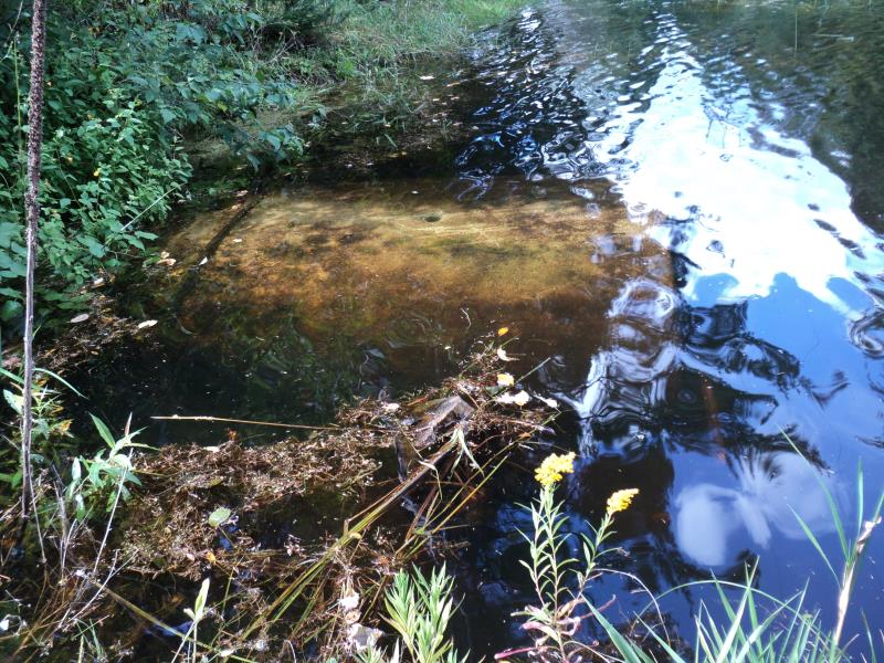
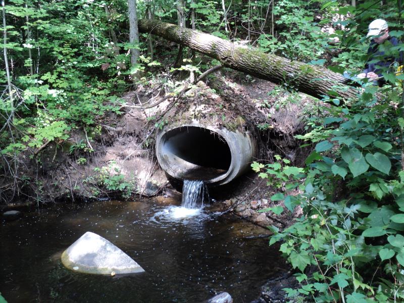
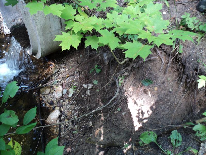
Inlet
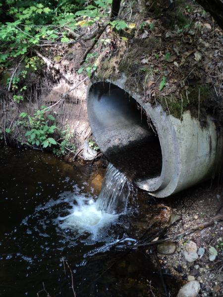
Outlet
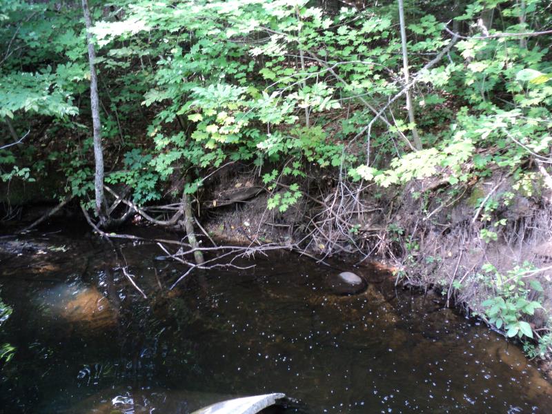
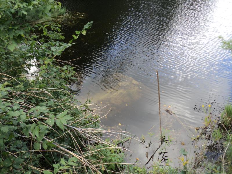
Upstream Conditions
Downstream Conditions
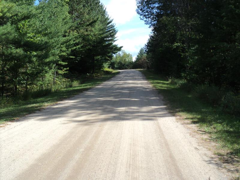
Road Approach - Left
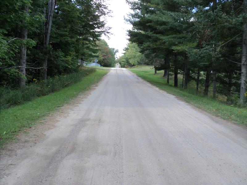
Road Approach - Right
Other
Other
Other
Other
Crossing Information
Type of Crossing: culvert(s)
Number of Structures: 1
Structure Shape: Ellipse
Inlet Type: Projecting
Outlet Type: Freefall into Pool
Structure Material: Concrete
Structure Substrate: None
General Conditions: Poor
Structure Interior: smooth
Dimensions of Structure: Length 84 ft.
, Width 5 ft.
, Height 3.1 ft.
Percentage Plugged:
Inlet: 0%
Outlet: 0%
In Pipe: 26% to 50%
Percentage Crushed:
Inlet: 0%
Outlet: 1% to 25%
In Pipe: 0%
Perch Height: 1.6 ft.
Structure Inlet
Water Depth: 4.1 ft.
Embedded Depth of Structure: 0 ft.
Water Velocity*: 0.1 ft./sec.
Structure Outlet
Water Depth: 1.6 ft.
Embedded Depth of Structure: 0 ft.
Water Velocity*: 3.5 ft./sec.
*Water Velocities were measured 0.8 ft. below Surface
(with Meter)
Stream Information
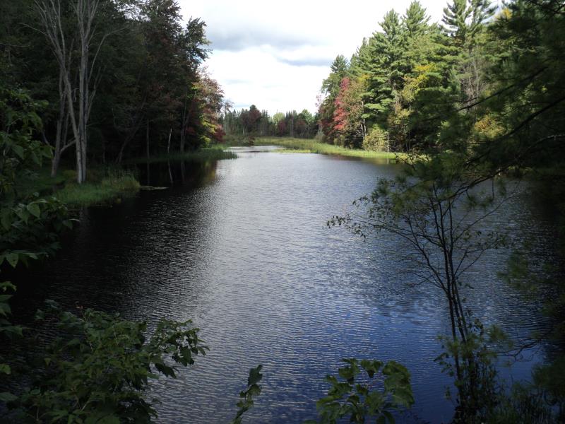
Stream Flow: Less than Bankfull
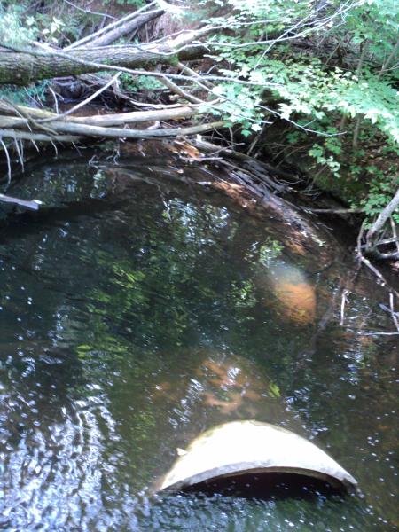
Scour Pool: Length 28 ft.
, Width 20 ft.
, Depth 5 ft.
Upstream Pond: Length 0 ft.
, Width 0 ft.
, Depth 0 ft.
Riffle Information
Water Depth: 0.5 ft.
Bankfull Width: 10 ft.
Wetted Width: 7.4 ft.
Water Velocity: 0.4 ft./sec.
(Measured with Meter)
Dominant Substrate: Gravel
Road Information
Gravel
County Road
Road Condition: Good
Road Width at Culvert: 20 ft.
Location of Low Point: At Stream
Runoff Path: Roadway
Embankments
Upstream
Fill Depth: 6 ft.
Slope: More than 1:2
Downstream
Fill Depth: 7.9 ft.
Slope: More than 1:2
Approaches
Left Approach
Length: 450 ft.
Slope: 1% to 5%
Vegetation: Heavy
LS Factor: 0.49
Erosion: 1.2149 tons/year
Right Approach
Length: 220 ft.
Slope: 1% to 5%
Vegetation: Heavy
LS Factor: 0.434
Erosion: 0.5261 tons/year
Erosion Information
Total Erosion at Crossing: 4.8513 tons/year
Extent of Erosion: Severe
Notes: Very severe around scour pool, right bank also undercut throughout downsteam portion.
Location of Erosion | Erosion Dimensions | Eroded Material | Material Eroded | Total Erosion | ||
facing downstream | Length | Width | Depth | Reaching Stream? | (tons/year) | |
Left Downstream Embankment |
10 ft. |
2.5 ft. |
5.4 ft. |
yes |
Sandy Loam |
1.0368 |
Right Downstream Streambank |
20 ft. |
2 ft. |
5.4 ft. |
yes |
Sandy Loam |
2.0736 |
Summary Information
Fish Passability 0
A future visit to this site is recommended. Yes, culvert is falling apart, lost one section in scour pool at outlet. Severe erosion and inlet is under water in lake upstream.
These non-native species were observerd at this site: Spotted knapweed
�