Road Stream Crossing Site P168
Pine River Watershed, Poplar Creek
S 11 1/2 Rd
South Branch Twp,
Wexford County
Information collected by:
Site Location
GPS Coordinates: 44.17093
, -85.70928
T21N
R12W
Sec 36
Owned by Federal
Fish Passability 0.5
Structure is NOT Perched
Total Erosion: 0.2826 tons/year
Severity: Severe
Year Inventoried: 2014
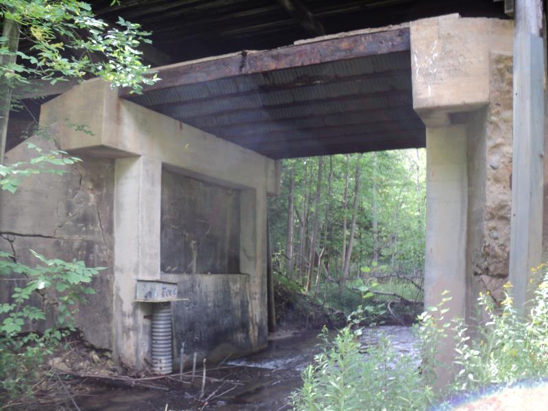
Inlet
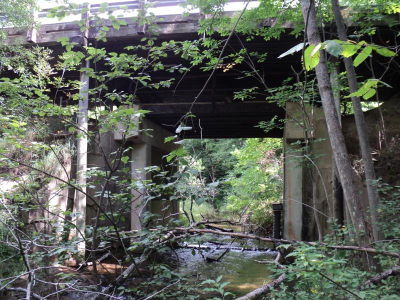
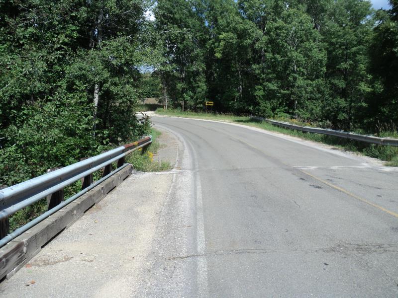
Outlet
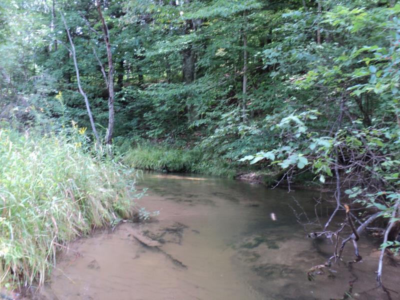
Upstream Conditions
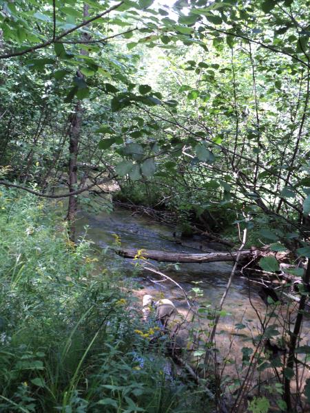
Downstream Conditions
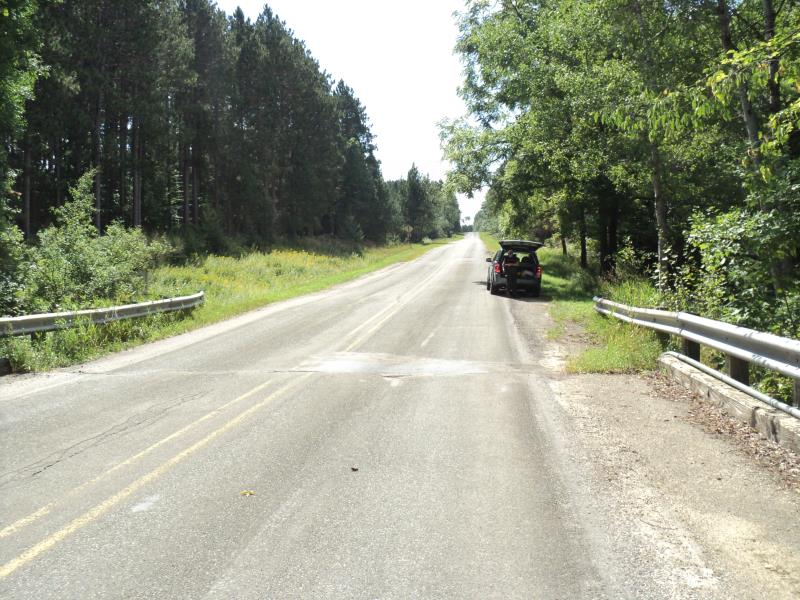
Road Approach - Left
Road Approach - Right
Crossing Information
Type of Crossing: Bridge
Structure Shape: Open Bottom Square/Rectangle
Inlet Type: Wingwall 30-70 Degree
Outlet Type: At Stream Grade
Structure Material: Concrete
Structure Substrate: Mixture
General Conditions: Poor
Structure Interior: smooth
Dimensions of Structure: Length 20 ft.
, Width 16 ft.
, Height 18 ft.
Structure is NOT Perched
Structure Inlet
Water Depth: 1.9 ft.
Embedded Depth of Structure: 0 ft.
Water Velocity*: 2.4 ft./sec.
Structure Outlet
Water Depth: 1 ft.
Embedded Depth of Structure: 0 ft.
Water Velocity*: 1.7 ft./sec.
*Water Velocities were measured 0.6 ft. below Surface
(with Meter)
Additional Comments
Bridge built over old existing structure.
Stream Information
Stream Flow: Less than Bankfull
Scour Pool: Length 0 ft.
, Width 0 ft.
, Depth 0 ft.
Upstream Pond: Length 0 ft.
, Width 0 ft.
, Depth 0 ft.
Riffle Information
Water Depth: 0.7 ft.
Bankfull Width: 25.5 ft.
Wetted Width: 19.2 ft.
Water Velocity: 3.2 ft./sec.
(Measured with Meter)
Dominant Substrate: Gravel
Road Information
Paved
County Road
Road Condition: Fair
Road Width at Culvert: 19 ft.
Location of Low Point: At Stream
Runoff Path: Roadway
Fill Depth: 0 ft.
Slope: Vertical
Fill Depth: 0 ft.
Slope: Vertical
Approaches
Left Approach
Length: 300 ft.
Slope: 1% to 5%
Vegetation: Heavy
LS Factor: 0.46
Erosion: 0.0867 tons/year
Right Approach
Length: 600 ft.
Slope: 1% to 5%
Vegetation: Heavy
LS Factor: 0.52
Erosion: 0.196 tons/year
Erosion Information
Total Erosion at Crossing: 0.2826 tons/year
Extent of Erosion: Very Severe
Notes: Structure underlying roadway is in terrible condition with numerous eroding areas. Too dangerous and difficult to measure, see pictures for more information.
Summary Information
Fish Passability 0.5
Erosion is an area of concern for this site.
old structure is constricting stream and causing obstructions due to disrepair, high velocities surrounding structure. Fish passage and and erosion are both of equal concern.
A future visit to this site is recommended. High velocities due to old concrete bridge left in place at stream. The structure is falling apart and abutement walls are crumbling. Consider removing old structure/monitor bridge deteriotion.
�