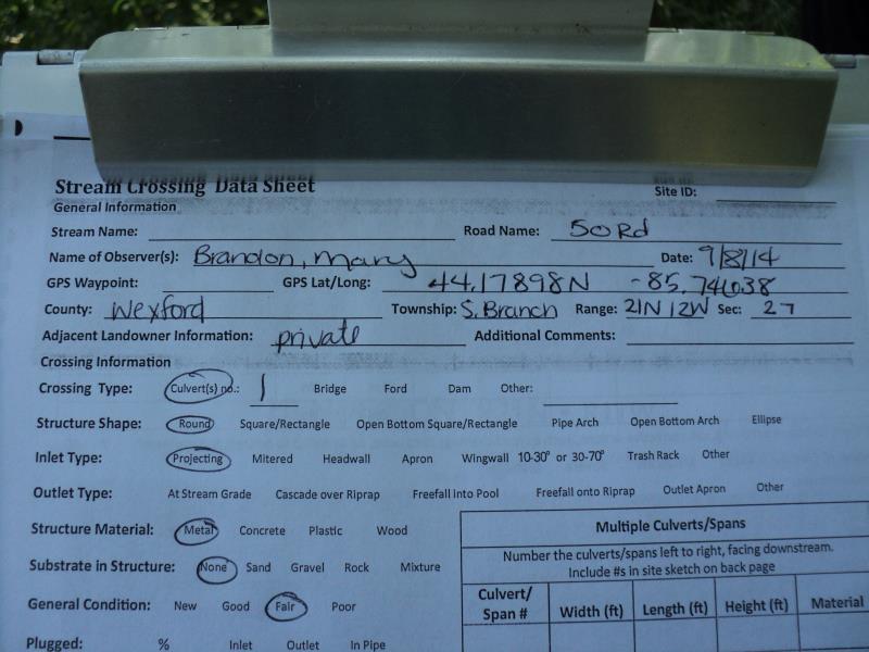
Road Stream Crossing Site P174
Pine River Watershed, Unknown (tributary to Pine River)
50 Rd
South Branch Twp,
Wexford County
Information collected by:
Site Location
GPS Coordinates: 44.17898
, -85.74638
T21N
R12W
Sec 27
Owned by Private
Fish Passability 0.5
Structure is NOT Perched
Total Erosion: 1.3763 tons/year
Severity: Severe
Year Inventoried: 2014
Site ID
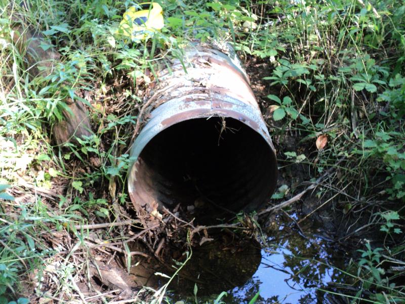
Inlet
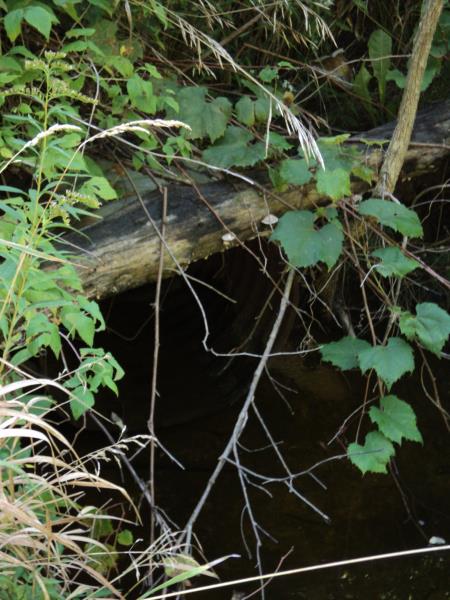
Outlet
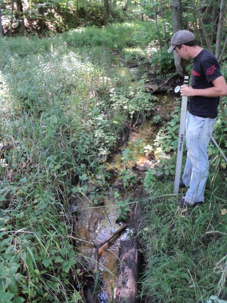
Upstream Conditions
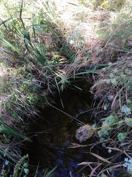
Downstream Conditions
Road Approach - Left
Road Approach - Right
Crossing Information
Type of Crossing: culvert(s)
Number of Structures: 1
Structure Shape: Round
Inlet Type: Projecting
Outlet Type: At Stream Grade
Structure Material: Metal
Structure Substrate: None
General Conditions: Fair
Structure Interior: corrugated
Structure is Rusted through
Dimensions of Structure: Length 63 ft.
, Width 2 ft.
, Height 2 ft.
Structure is NOT Perched
Structure Inlet
Water Depth: 0.1 ft.
Embedded Depth of Structure: 0 ft.
Water Velocity*: 0.3 ft./sec.
Structure Outlet
Water Depth: 0.9 ft.
Embedded Depth of Structure: 0 ft.
Water Velocity*: 0.1 ft./sec.
*Water Velocities were measured at the Surface
(with Meter)
Stream Information
Stream Flow: Less than Bankfull
Scour Pool: Length 15 ft.
, Width 8 ft.
, Depth 1.4 ft.
Upstream Pond: Length 0 ft.
, Width 0 ft.
, Depth 0 ft.
Riffle Information
Water Depth: 0.1 ft.
Bankfull Width: 4 ft.
Wetted Width: 2.5 ft.
Water Velocity: 0.4 ft./sec.
(Measured with Meter)
Dominant Substrate: Sand
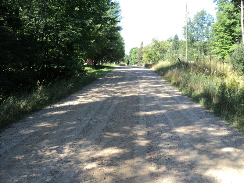
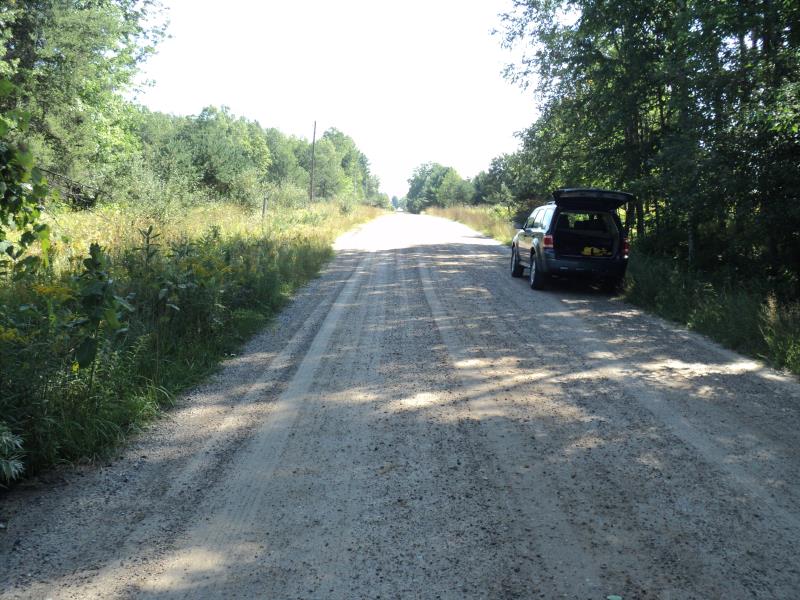
Road Information
Gravel
County Road
Road Condition: Good
Road Width at Culvert: 20 ft.
Location of Low Point: At Stream
Runoff Path: Ditch
Embankments
Upstream
Fill Depth: 6 ft.
Slope: 1:1
Downstream
Fill Depth: 8 ft.
Slope: 1:1
Approaches
Left Approach
Length: 210 ft.
Slope: 1% to 5%
Vegetation: Heavy
LS Factor: 0.432
Erosion: 0.4998 tons/year
Right Approach
Length: 270 ft.
Slope: 1% to 5%
Vegetation: Heavy
LS Factor: 0.448
Erosion: 0.6664 tons/year
Erosion Information
Total Erosion at Crossing: 1.3763 tons/year
Extent of Erosion: Moderate
Notes: Eroding on embankment behind culvert closer to roadway than inlet. Some undercutting of scour pool banks at high water times.
Location of Erosion | Erosion Dimensions | Eroded Material | Material Eroded | Total Erosion | ||
facing downstream | Length | Width | Depth | Reaching Stream? | (tons/year) | |
Right Downstream Embankment |
10 ft. |
6 ft. |
3 ft. |
yes |
Gravelly Loam |
0.21 |
Summary Information
Fish Passability 0.5
�