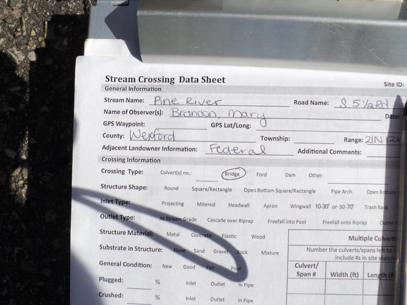
Road Stream Crossing Site P176
Pine River Watershed, Pine River
S 5 1/2 Rd
South Branch Twp,
Wexford County
Information collected by:
Site Location
GPS Coordinates: 44.19323
, -85.76994
T21N
R12W
Sec 28
Owned by Federal
Fish Passability 0.5
Structure is NOT Perched
Total Erosion: 0.687 tons/year
Severity: Moderate
Year Inventoried: 2014
Site ID
Inlet
Outlet
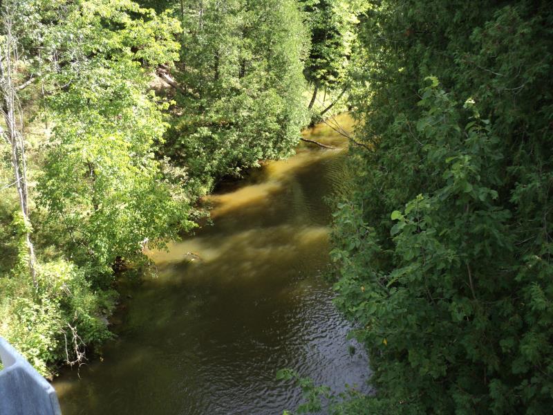
Upstream Conditions
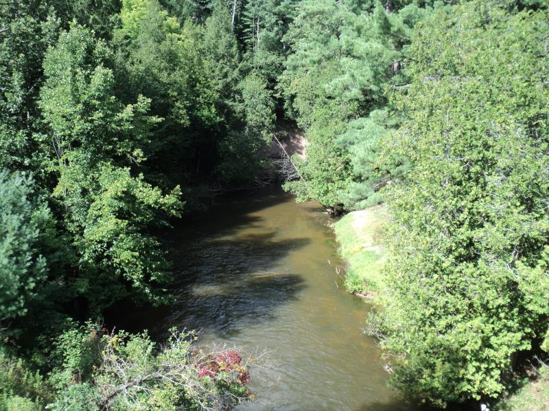
Downstream Conditions
Road Approach - Left
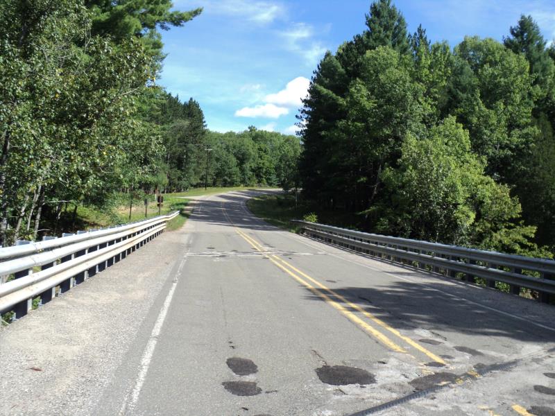
Road Approach - Right
Crossing Information
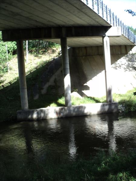
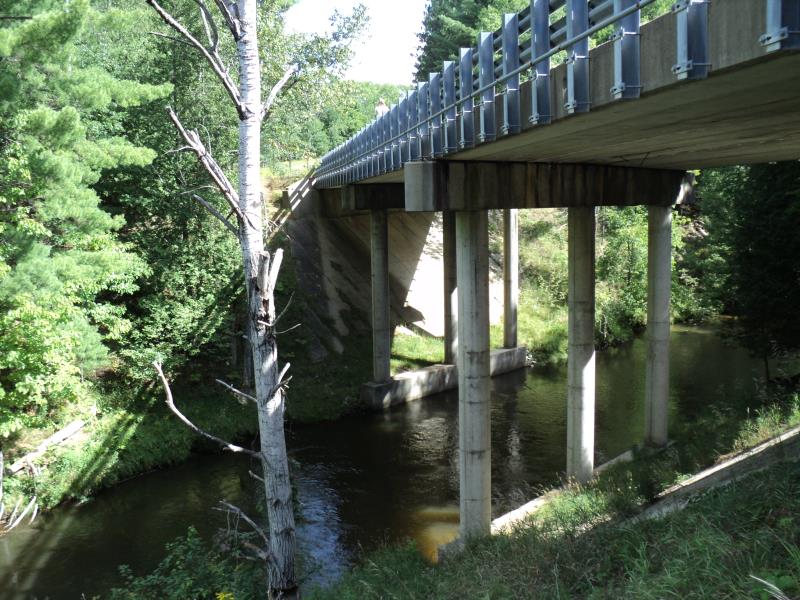
Type of Crossing: Bridge
Structure Shape: Open Bottom Square/Rectangle
Inlet Type: Other
Outlet Type: At Stream Grade
Structure Material: Concrete
Structure Substrate: Sand
General Conditions: Good
Structure Interior: smooth
Dimensions of Structure: Length 35 ft.
, Width 165 ft.
, Height 38.5 ft.
Structure is NOT Perched
Structure Inlet
Water Depth: 40 ft.
Embedded Depth of Structure: 0 ft.
Water Velocity*: 2.9 ft./sec.
Structure Outlet
Water Depth: 3.6 ft.
Embedded Depth of Structure: 0 ft.
Water Velocity*: 2.9 ft./sec.
*Water Velocities were measured 0.5 ft. below Surface
(with Meter)
Additional Comments
Hoxeyville High School Bridge
Stream Information
Stream Flow: Less than Bankfull
Scour Pool: Length 0 ft.
, Width 0 ft.
, Depth 0 ft.
Upstream Pond: Length 0 ft.
, Width 0 ft.
, Depth 0 ft.
Riffle Information
Water Depth: 3 ft.
Bankfull Width: 70 ft.
Wetted Width: 55 ft.
Water Velocity: 2.9 ft./sec.
(Measured with Meter)
Dominant Substrate: Sand
Road Information
Paved
County Road
Road Condition: Good
Road Width at Culvert: 33 ft.
Location of Low Point: At Stream
Runoff Path: Roadway
Fill Depth: 0 ft.
Slope: Vertical
Fill Depth: 0 ft.
Slope: Vertical
Approaches
Left Approach
Length: 630 ft.
Slope: 1% to 5%
Vegetation: Heavy
LS Factor: 0.525
Erosion: 0.3605 tons/year
Right Approach
Length: 580 ft.
Slope: 1% to 5%
Vegetation: Heavy
LS Factor: 0.516
Erosion: 0.3265 tons/year
Erosion Information
Total Erosion at Crossing: 0.687 tons/year
Summary Information
Fish Passability 0.5
�