Road Stream Crossing Site B-012
Betsie River Watershed, Little Betsie River
Nessen Rd
Colfax Twp,
Benzie County
Information collected by:
Site Location
GPS Coordinates: 44.53317
, -85.87827
T25N
R13W
Sec 28
Owned by Private
Structure is NOT Perched
Total Erosion: 0 tons/year
Severity: Restored
Year Inventoried: 2015
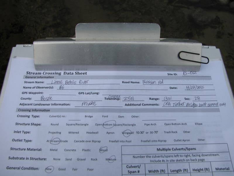
Site ID
Inlet
Outlet
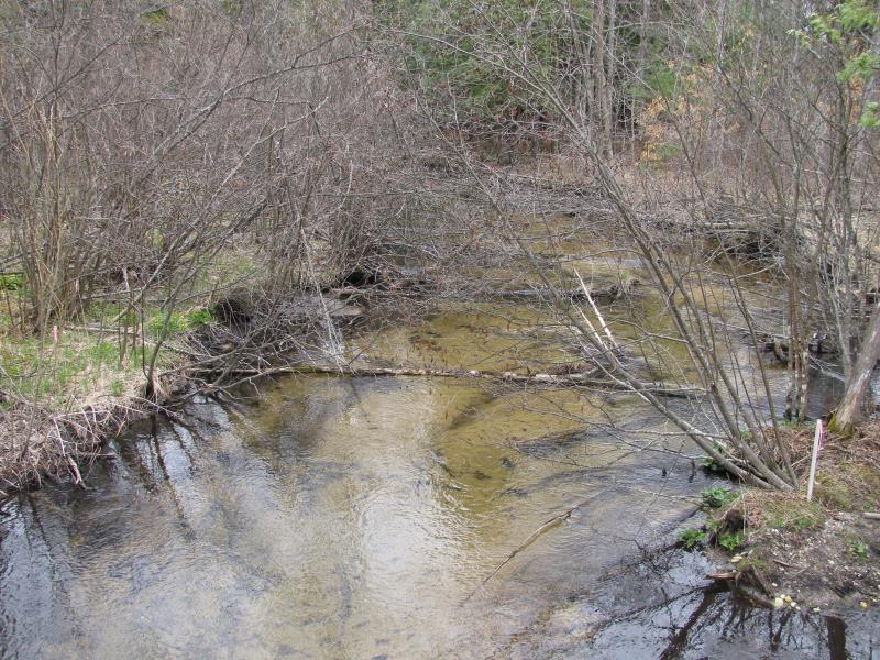
Upstream Conditions
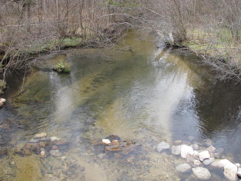
Downstream Conditions
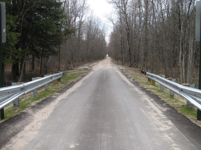
Road Approach - Left
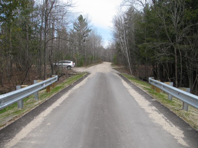
Road Approach - Right
Crossing Information
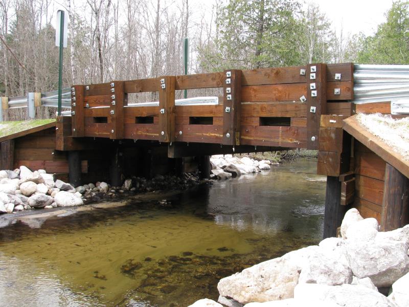
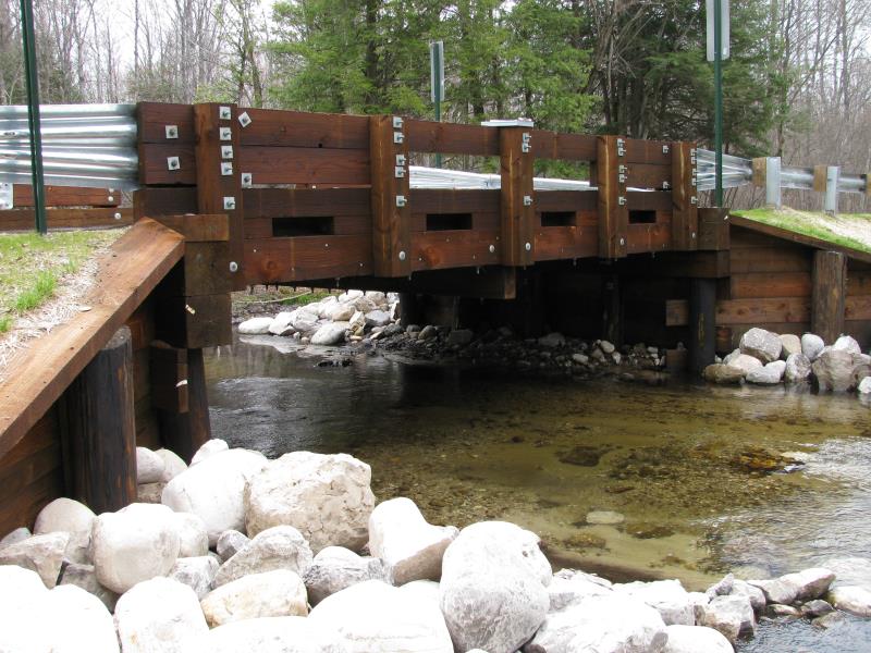
Type of Crossing: Bridge
Structure Shape: Open Bottom Square/Rectangle
Inlet Type: Wingwall 30-70 Degree
Outlet Type: At Stream Grade
Structure Material: Wood
Structure Substrate: Mixture
General Conditions: New
Structure Interior: smooth
Dimensions of Structure: Length 15.5 ft.
, Width 22 ft.
, Height 5.4 ft.
Structure is NOT Perched
Structure Inlet
Water Depth: 0.8 ft.
Embedded Depth of Structure: 0 ft.
Water Velocity*: 1.3 ft./sec.
Structure Outlet
Water Depth: 0.8 ft.
Embedded Depth of Structure: 0 ft.
Water Velocity*: 1.3 ft./sec.
*Water Velocities were measured 0.5 ft. below Surface
(with Meter)
Additional Comments
CRA timber bridge built summer 2014.
Stream Information
Stream Flow: Less than Bankfull
Scour Pool: Length 0 ft.
, Width 0 ft.
, Depth 0 ft.
Upstream Pond: Length 0 ft.
, Width 0 ft.
, Depth 0 ft.
Riffle Information
Water Depth: 1 ft.
Bankfull Width: 28 ft.
Wetted Width: 24 ft.
Water Velocity: 0.7 ft./sec.
(Measured with Meter)
Dominant Substrate: Sand
Road Information
Paved
County Road
(Seasonal)
Road Condition: Good
Road Width at Culvert: 25 ft.
Location of Low Point: Other
Runoff Path: Roadway
Fill Depth: 0 ft.
Slope: Vertical
Fill Depth: 0 ft.
Slope: Vertical
Approaches
Left Approach
Length: 0 ft.
Slope: Less Than 1%
Vegetation: Heavy
LS Factor: 0.05
Erosion: 0 tons/year
Right Approach
Length: 0 ft.
Slope: Less Than 1%
Vegetation: Heavy
LS Factor: 0.05
Erosion: 0 tons/year
Erosion Information
Total Erosion at Crossing: 0 tons/year
Extent of Erosion: Moderate
Summary Information
Erosion is an area of concern for this site.
No.
�