Road Stream Crossing Site B-020
Betsie River Watershed, Betsie River
King Rd
Weldon Twp,
Benzie County
Information collected by:
Site Location
GPS Coordinates: 44.54221
, -85.94246
T25N
R14W
Sec 24
Owned by Private
State
State
Structure is NOT Perched
Total Erosion: 1.8505 tons/year
Severity: Restored
Year Inventoried: 2015
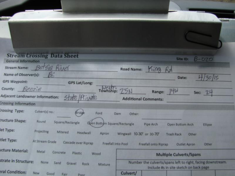
Site ID
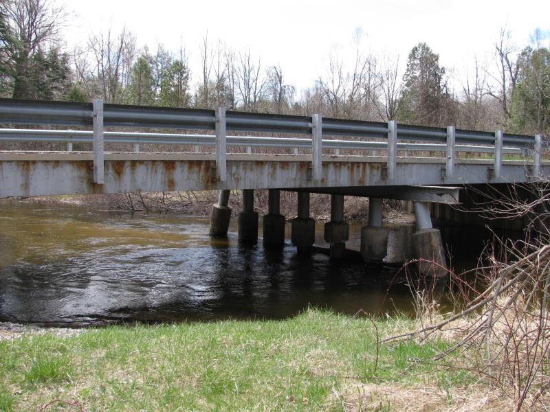
Inlet
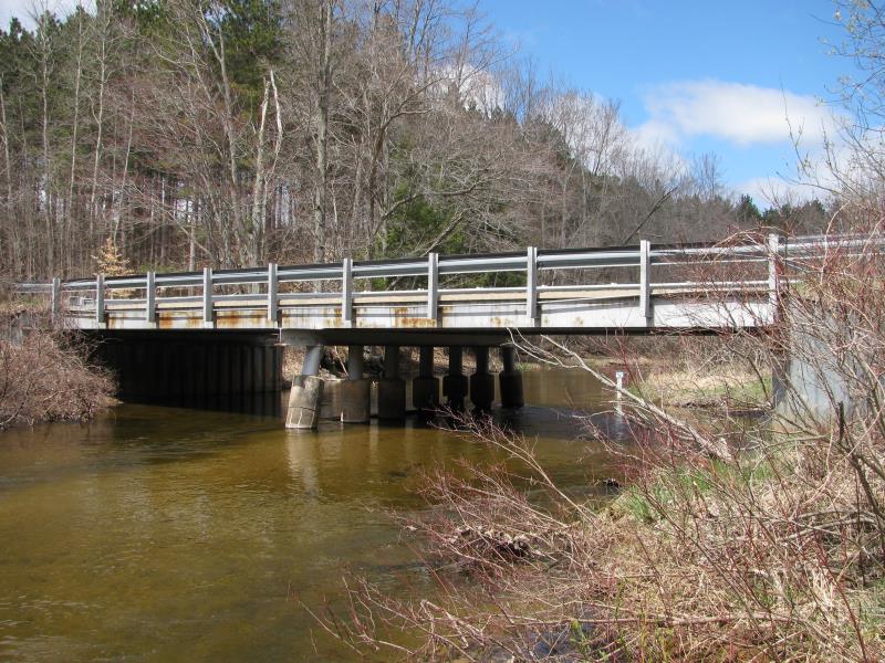
Outlet
Upstream Conditions
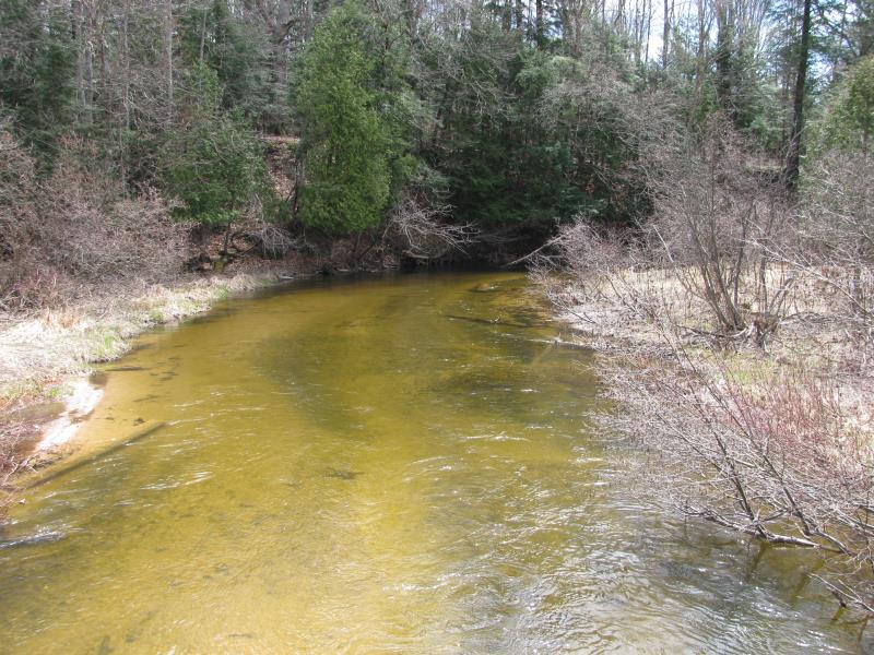
Downstream Conditions
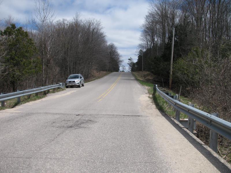
Road Approach - Left
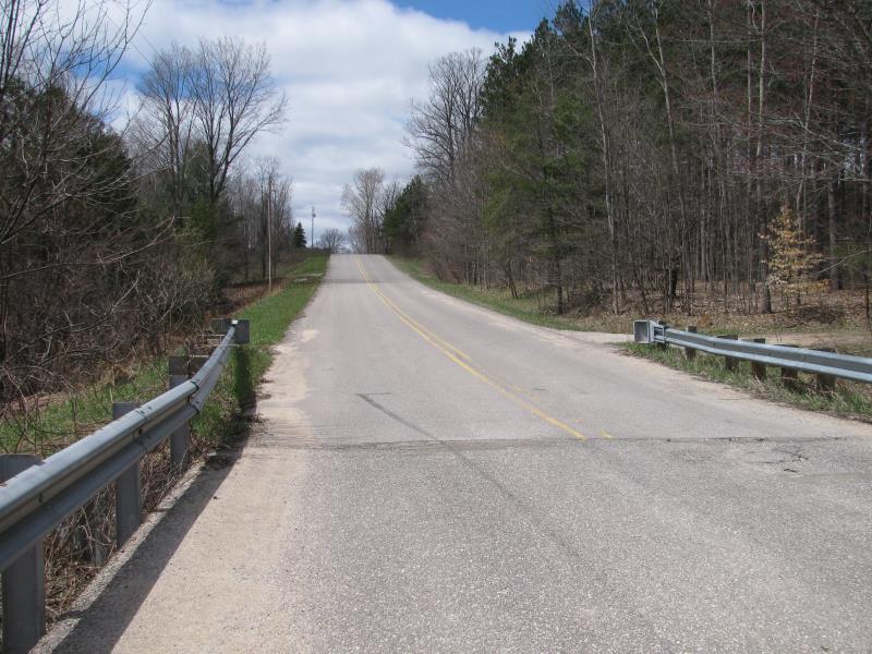
Road Approach - Right
Erosion
Crossing Information
Type of Crossing: Bridge
Structure Shape: Open Bottom Square/Rectangle
Inlet Type: Wingwall 10-30 Degree
Outlet Type: At Stream Grade
Structure Material: Metal
Structure Substrate: Sand
General Conditions: Fair
Structure Interior: corrugated
Dimensions of Structure: Length 25 ft.
, Width 58 ft.
, Height 10 ft.
Structure is NOT Perched
Structure Inlet
Water Depth: 2 ft.
Embedded Depth of Structure: 0 ft.
Water Velocity*: 3 ft./sec.
Structure Outlet
Water Depth: 2.6 ft.
Embedded Depth of Structure: 0 ft.
Water Velocity*: 2 ft./sec.
*Water Velocities were measured 1.5 ft. below Surface
(with Meter)
Stream Information
Stream Flow: Less than Bankfull
Scour Pool: Length 0 ft.
, Width 0 ft.
, Depth 0 ft.
Upstream Pond: Length 0 ft.
, Width 0 ft.
, Depth 0 ft.
Riffle Information
Water Depth: 1.5 ft.
Bankfull Width: 45 ft.
Wetted Width: 40 ft.
Water Velocity: 2 ft./sec.
(Measured with Meter)
Dominant Substrate: Gravel
Road Information
Paved
County Road
Road Condition: Good
Road Width at Culvert: 24 ft.
Location of Low Point: At Stream
Runoff Path: Roadway
Fill Depth: 0 ft.
Slope: Vertical
Fill Depth: 0 ft.
Slope: Vertical
Approaches
Left Approach
Length: 650 ft.
Slope: 6% to 10%
Vegetation: Heavy
LS Factor: 1.783
Erosion: 0.9192 tons/year
Right Approach
Length: 650 ft.
Slope: 6% to 10%
Vegetation: Heavy
LS Factor: 1.783
Erosion: 0.9192 tons/year
Erosion Information
Total Erosion at Crossing: 1.8505 tons/year
Extent of Erosion: Minor
Erosion is occurring and corrective actions can be installed to address the problem.
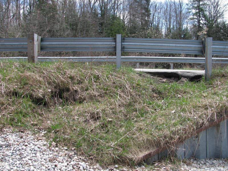
Notes:
Erosion between road and wingwall. Pavement is starting to crumble, see picture.
Location of Erosion | Erosion Dimensions | Eroded Material | Material Eroded | Total Erosion | ||
facing downstream | Length | Width | Depth | Reaching Stream? | (tons/year) | |
Left Upstream Embankment |
6 ft. |
10 ft. |
1 ft. |
no |
Gravelly Loam |
0.006 |
Left Downstream Embankment |
6 ft. |
10 ft. |
1 ft. |
no |
Gravelly Loam |
0.006 |
Summary Information
Erosion is an area of concern for this site.
No.
A future visit to this site is recommended.
Yes, to monitor erosion.
�