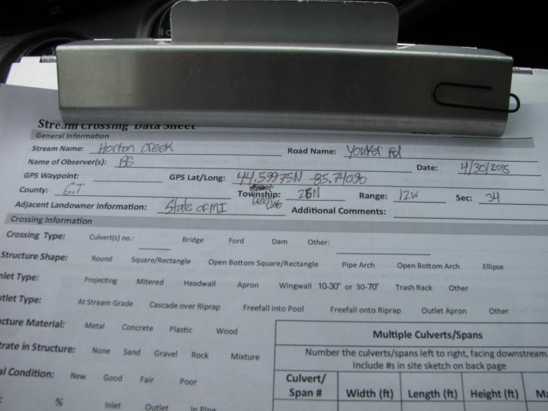
Road Stream Crossing Site BT_G014
Betsie River Watershed, Horton Creek
Youker Rd
Green Lake Twp,
Grand Traverse County
Information collected by:
Site Location
GPS Coordinates: 44.59975
, -85.7409
T26N
R12W
Sec 34
Owned by State
Structure is NOT Perched
Total Erosion: 0.6559 tons/year
Severity: Minor
Year Inventoried: 2015
Site ID
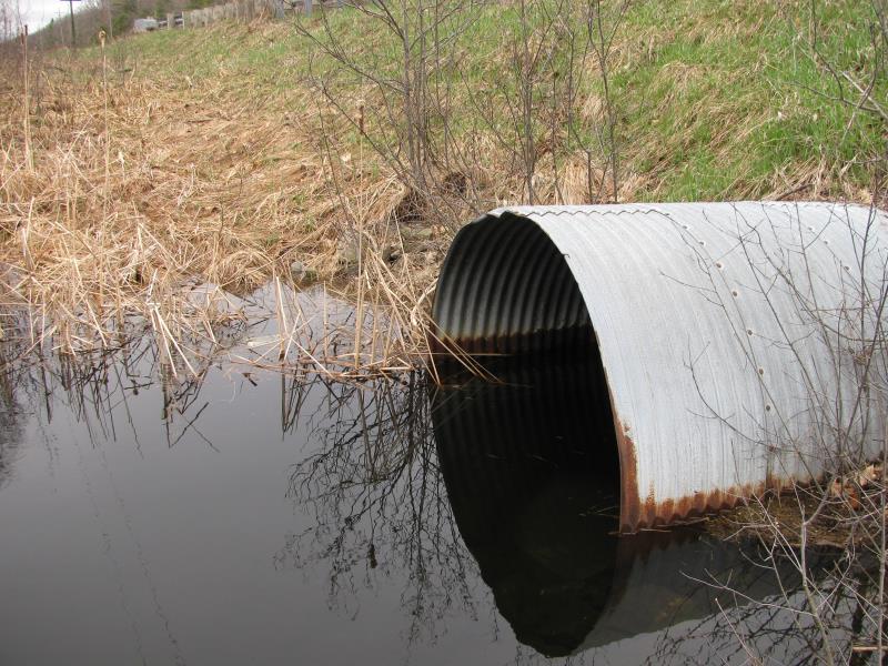
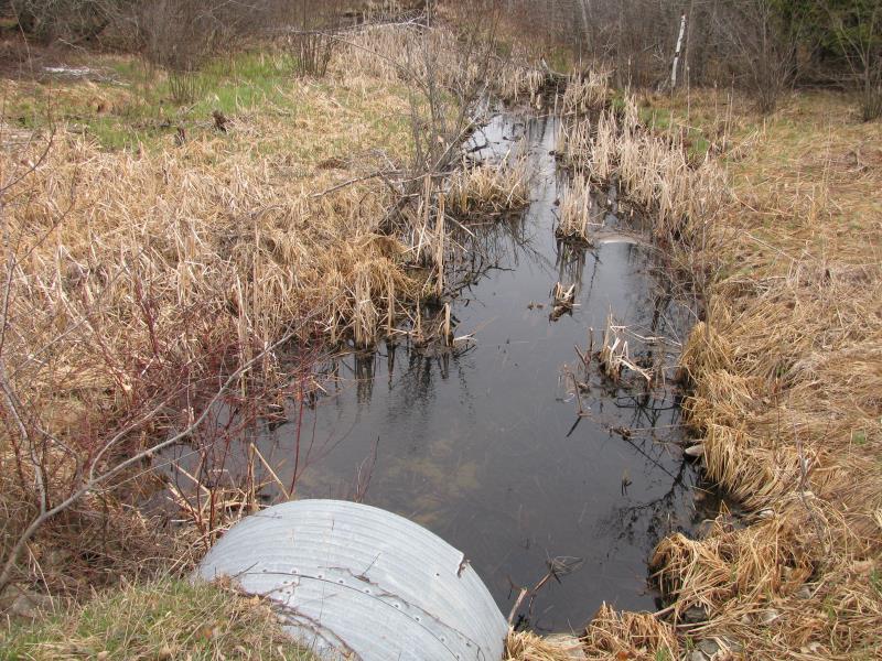
Inlet
Outlet
Upstream Conditions
Downstream Conditions
Road Approach - Left
Road Approach - Right
Crossing Information
Type of Crossing: culvert(s)
Number of Structures: 1
Structure Shape: Round
Inlet Type: Projecting
Outlet Type: At Stream Grade
Structure Material: Metal
Structure Substrate: Mixture
General Conditions: Good
Structure Interior: corrugated
Dimensions of Structure: Length 68 ft.
, Width 6 ft.
, Height 6 ft.
Percentage Plugged:
Inlet: 1% to 25%
Outlet: 0%
In Pipe: 0%
Structure is NOT Perched
Structure Inlet
Water Depth: 2.8 ft.
Embedded Depth of Structure: 0.1 ft.
Water Velocity*: 0.2 ft./sec.
Structure Outlet
Water Depth: 1.1 ft.
Embedded Depth of Structure: 0.8 ft.
Water Velocity*: 1.3 ft./sec.
*Water Velocities were measured 0.6 ft. below Surface
(with Meter)
Additional Comments
Beaver activity noted upstream and downstream. No riffle-swamp land.
Stream Information
Stream Flow: Less than Bankfull
Scour Pool: Length 0 ft.
, Width 0 ft.
, Depth 0 ft.
Upstream Pond: Length 30 ft.
, Width 20 ft.
, Depth 3 ft.
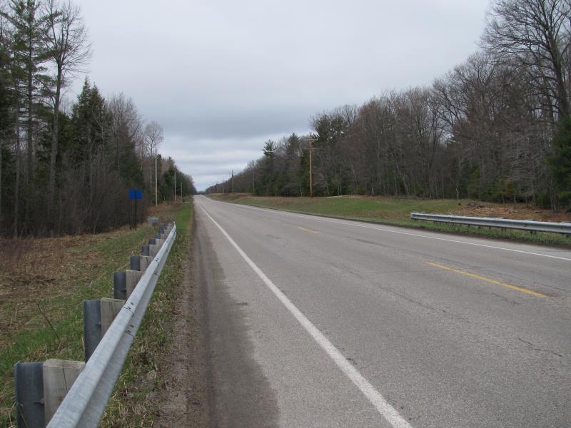
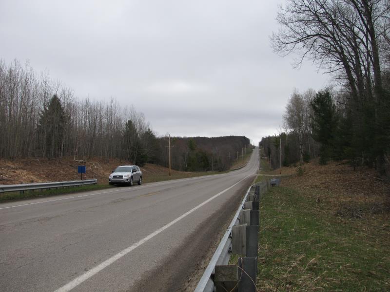
Road Information
Paved
County Road
Road Condition: Good
Road Width at Culvert: 32 ft.
Location of Low Point: At Stream
Runoff Path: Roadway
Embankments
Upstream
Fill Depth: 5 ft.
Slope: More than 1:2
Downstream
Fill Depth: 5.5 ft.
Slope: More than 1:2
Approaches
Left Approach
Length: 1000 ft.
Slope: Less Than 1%
Vegetation: Heavy
LS Factor: 0.05
Erosion: 0.0529 tons/year
Right Approach
Length: 1000 ft.
Slope: 1% to 5%
Vegetation: Heavy
LS Factor: 0.57
Erosion: 0.603 tons/year
Erosion Information
Total Erosion at Crossing: 0.6559 tons/year
Summary Information
A future visit to this site is recommended. Yes, possibly to remove beaver debris at inlet.
�