Road Stream Crossing Site PLT-B-7
Platte River Watershed, Brozofsky Creek
US-31
Benzonia Twp,
Benzie County
Information collected by:
Site Location
GPS Coordinates: 44.66489
, -86.05189
T26N
R14W
Sec 7
Owned by Private
Fish Passability 1
Structure is NOT Perched
Total Erosion: 0.9409 tons/year
Severity: Minor
Year Inventoried: 2015
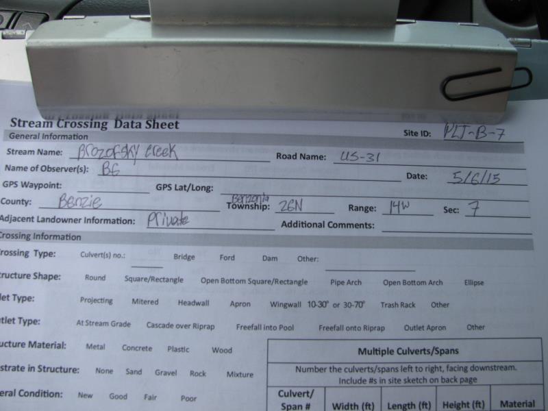
Site ID
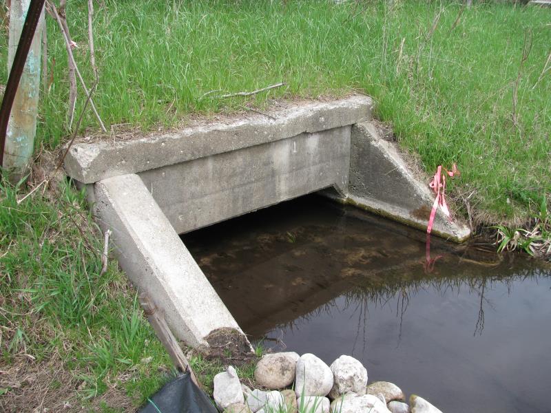
Inlet
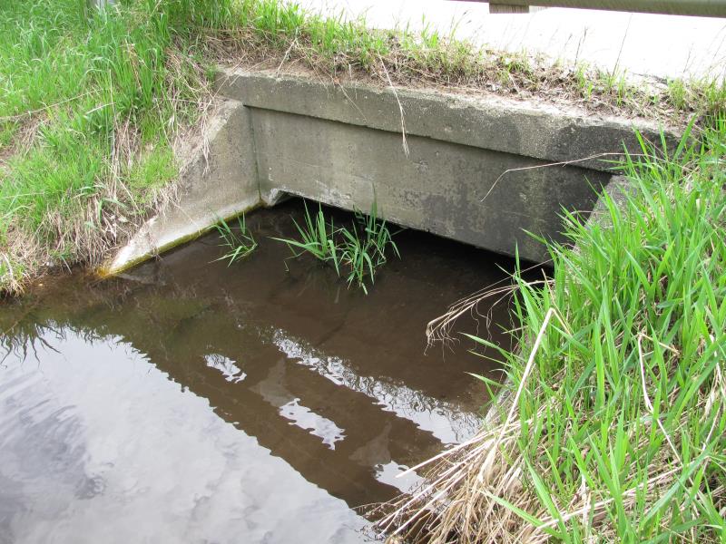
Outlet
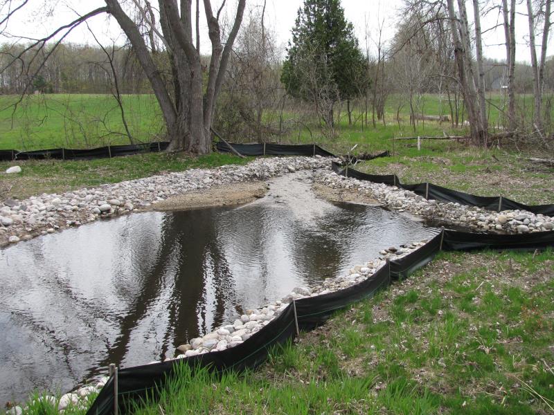
Upstream Conditions
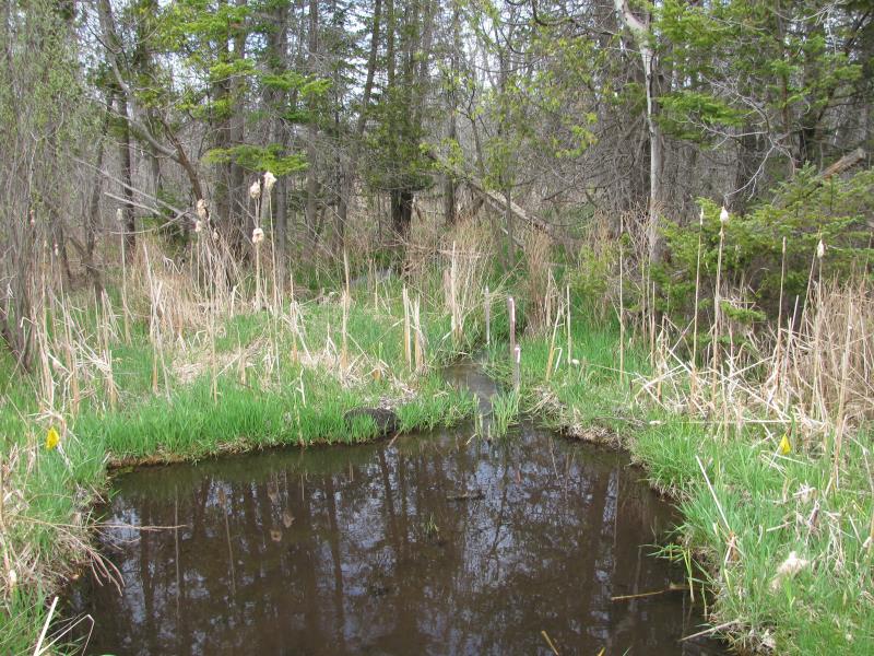
Downstream Conditions
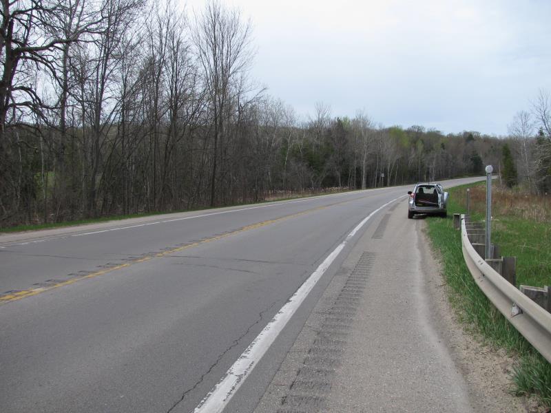
Road Approach - Left
Road Approach - Right
Crossing Information
Type of Crossing: culvert(s)
Number of Structures: 1
Structure Shape: Open Bottom Square/Rectangle
Inlet Type: Headwall
Outlet Type: Other
Structure Material: Concrete
Structure Substrate: Mixture
General Conditions: Fair
Structure Interior: smooth
Dimensions of Structure: Length 48 ft.
, Width 6.2 ft.
, Height 1.2 ft.
Structure is NOT Perched
Structure Inlet
Water Depth: 0.4 ft.
Embedded Depth of Structure: 0 ft.
Water Velocity*: 0.2 ft./sec.
Structure Outlet
Water Depth: 0.4 ft.
Embedded Depth of Structure: 0 ft.
Water Velocity*: 0.3 ft./sec.
*Water Velocities were measured 0.2 ft. below Surface
(with Meter)
Additional Comments
Sediment basin upstream at inlet.
Stream Information
Stream Flow: Less than Bankfull
Scour Pool: Length 0 ft.
, Width 0 ft.
, Depth 0 ft.
Upstream Pond: Length 0 ft.
, Width 0 ft.
, Depth 0 ft.
Riffle Information
Water Depth: 0.4 ft.
Bankfull Width: 5 ft.
Wetted Width: 3 ft.
Water Velocity: 1.5 ft./sec.
(Measured with Meter)
Dominant Substrate: Gravel
Road Information
Paved
Federal Road
Road Condition: Good
Road Width at Culvert: 38 ft.
Location of Low Point: At Stream
Runoff Path: Roadway
Embankments
Upstream
Fill Depth: 1.8 ft.
Slope: More than 1:2
Downstream
Fill Depth: 2 ft.
Slope: Vertical
Approaches
Left Approach
Length: 700 ft.
Slope: 1% to 5%
Vegetation: Heavy
LS Factor: 0.535
Erosion: 0.4704 tons/year
Right Approach
Length: 700 ft.
Slope: 1% to 5%
Vegetation: Heavy
LS Factor: 0.535
Erosion: 0.4704 tons/year
Erosion Information
Total Erosion at Crossing: 0.9409 tons/year
Summary Information
Fish Passability 1
�