Road Stream Crossing Site PLT-I-10
Platte River Watershed, Platte River
Burnt Mill Rd
Inland Twp,
Benzie County
Information collected by:
Site Location
GPS Coordinates: 44.68509
, -85.88867
T26N
R13W
Sec 4
Owned by State
Structure is NOT Perched
Total Erosion: 0.4318 tons/year
Severity: Restored
Year Inventoried: 2015
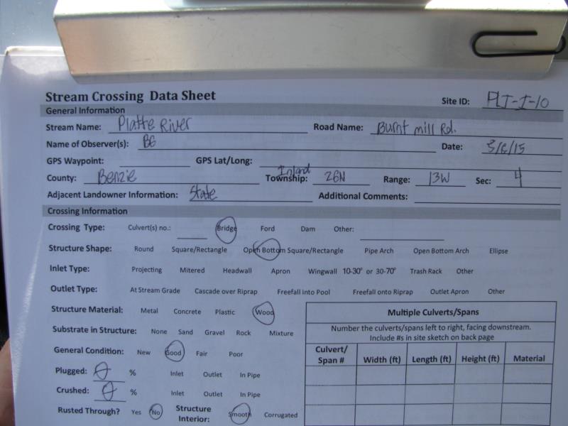
Site ID
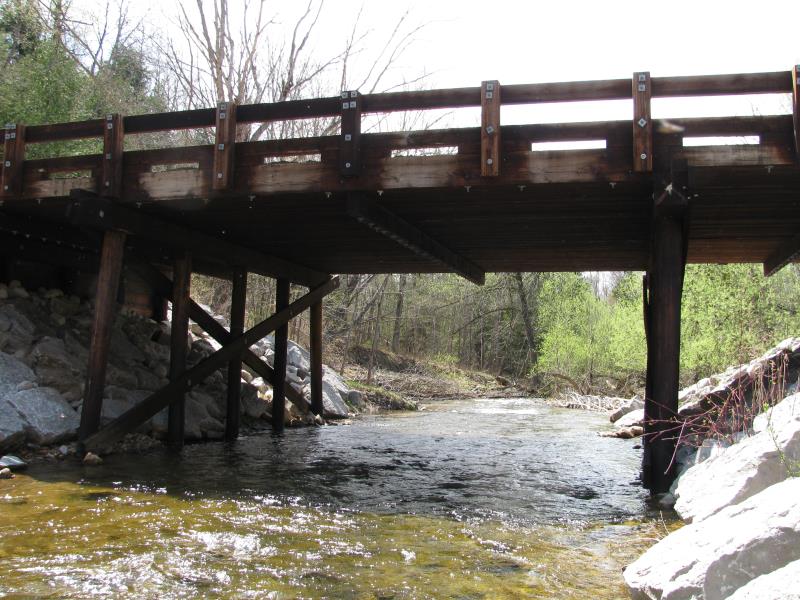
Inlet
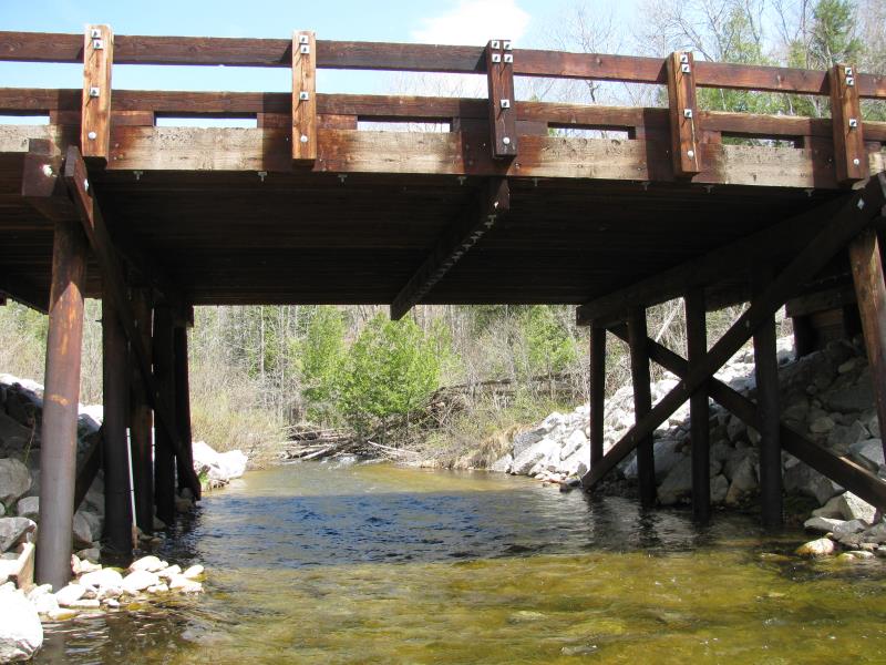
Outlet
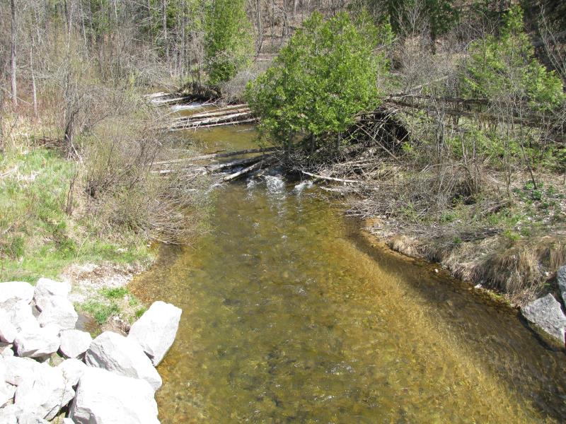
Upstream Conditions
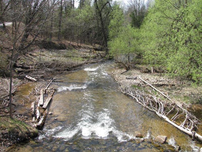
Downstream Conditions
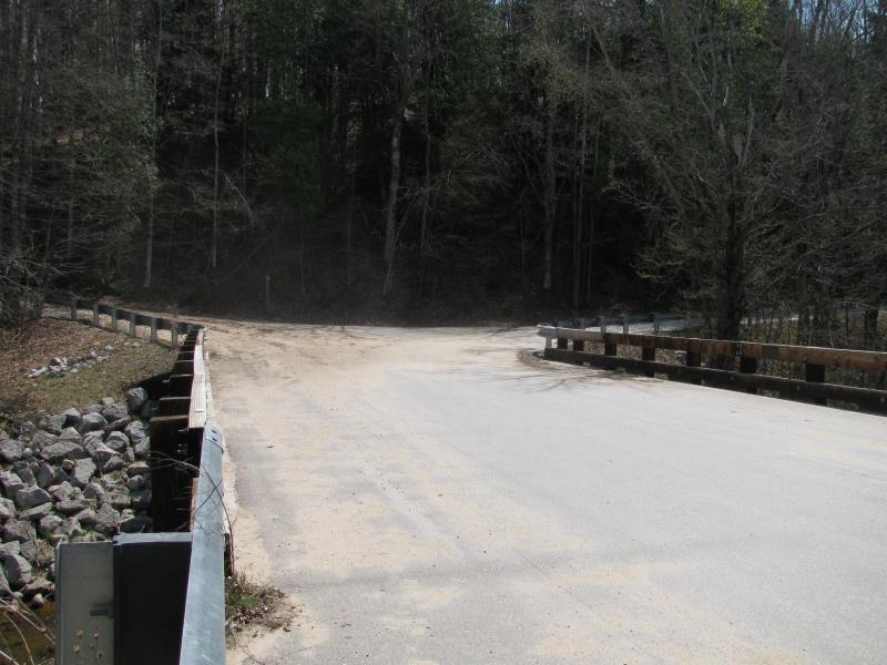
Road Approach - Left
Road Approach - Right
Crossing Information
Type of Crossing: Bridge
Structure Shape: Open Bottom Square/Rectangle
Inlet Type: Wingwall 30-70 Degree
Outlet Type: Other
Structure Material: Wood
Structure Substrate: Rock
General Conditions: Good
Structure Interior: smooth
Dimensions of Structure: Length 28 ft.
, Width 56 ft.
, Height 13.5 ft.
Structure is NOT Perched
Structure Inlet
Water Depth: 1.5 ft.
Embedded Depth of Structure: 0 ft.
Water Velocity*: 3.7 ft./sec.
Structure Outlet
Water Depth: 1.5 ft.
Embedded Depth of Structure: 0 ft.
Water Velocity*: 3.3 ft./sec.
*Water Velocities were measured 1 ft. below Surface
(with Meter)
Additional Comments
CRA assisted with installation summer 2010.
Stream Information
Stream Flow: Less than Bankfull
Scour Pool: Length 0 ft.
, Width 0 ft.
, Depth 0 ft.
Upstream Pond: Length 0 ft.
, Width 0 ft.
, Depth 0 ft.
Riffle Information
Water Depth: 1.2 ft.
Bankfull Width: 28 ft.
Wetted Width: 22 ft.
Water Velocity: 2.8 ft./sec.
(Measured with Meter)
Dominant Substrate: Gravel
Road Information
Paved
County Road
Road Condition: Good
Road Width at Culvert: 26 ft.
Location of Low Point: At Stream
Runoff Path: Roadway
Fill Depth: 0 ft.
Slope: Vertical
Fill Depth: 0 ft.
Slope: Vertical
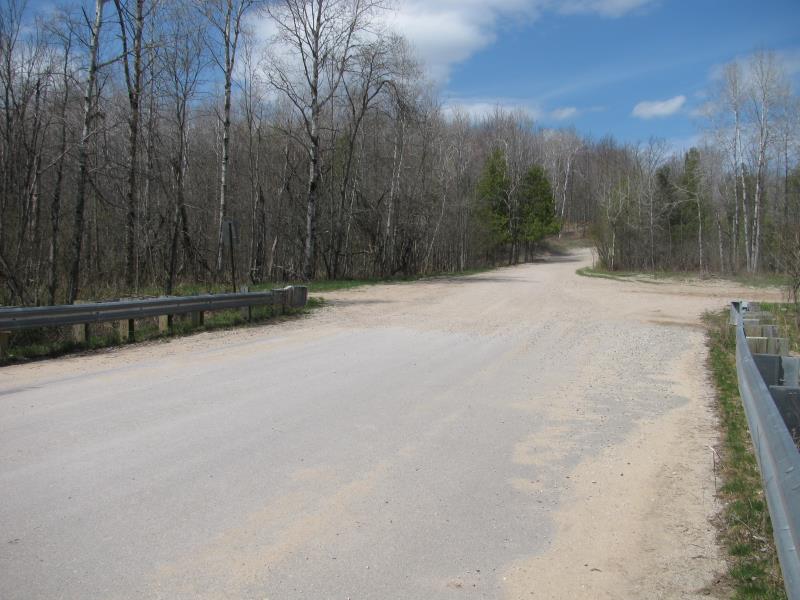
Approaches
Left Approach
Length: 500 ft.
Slope: 1% to 5%
Vegetation: Heavy
LS Factor: 0.5
Erosion: 0.2149 tons/year
Right Approach
Length: 500 ft.
Slope: 1% to 5%
Vegetation: Heavy
LS Factor: 0.5
Erosion: 0.2149 tons/year
Erosion Information
Total Erosion at Crossing: 0.4318 tons/year
Extent of Erosion: Minor
Erosion is occurring and corrective actions can be installed to address the problem.
Notes:
Erosion behind right downstream wingwall, starting to undercut pavement.
Location of Erosion | Erosion Dimensions | Eroded Material | Material Eroded | Total Erosion | ||
facing downstream | Length | Width | Depth | Reaching Stream? | (tons/year) | |
Right Downstream Embankment |
2 ft. |
3 ft. |
1 ft. |
yes |
Gravel |
0.002 |
Summary Information
Erosion is an area of concern for this site.
No.
�