Road Stream Crossing Site PM_L041
Pere Marquette River Watershed, Middle Branch
Saddler Rd
Chase Twp,
Lake County
Information collected by:
Site Location
GPS Coordinates: 43.88272
, -85.62225
T17N
R11W
Sec 9
Owned by Private
Structure is NOT Perched
Total Erosion: 1.2491 tons/year
Severity: Restored
Year Inventoried: 2015
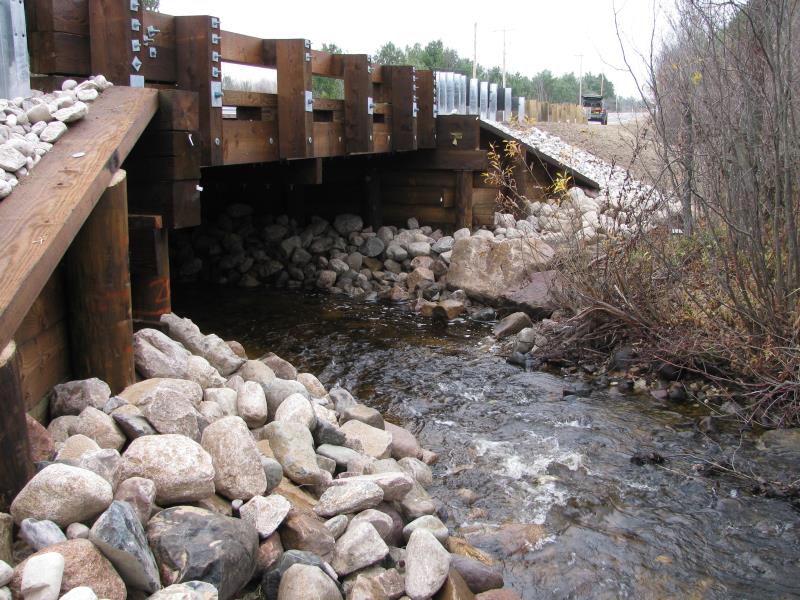
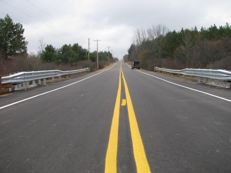
Inlet
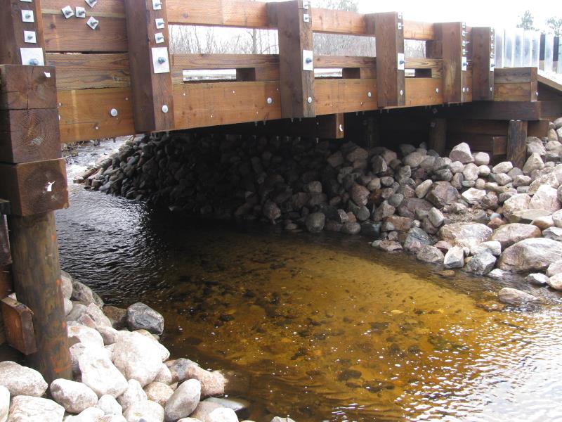
Outlet
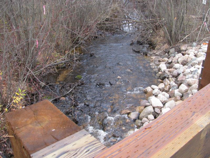
Upstream Conditions
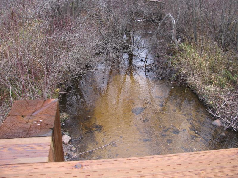
Downstream Conditions
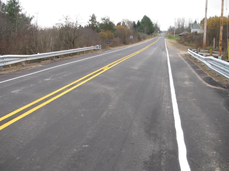
Road Approach - Left
Road Approach - Right
Crossing Information
Type of Crossing: Bridge
Structure Shape: Open Bottom Square/Rectangle
Inlet Type: Wingwall 30-70 Degree
Outlet Type: At Stream Grade
Structure Material: Wood
Structure Substrate: Mixture
General Conditions: New
Structure Interior: smooth
Dimensions of Structure: Length 36 ft.
, Width 28 ft.
, Height 7.5 ft.
Structure is NOT Perched
Structure Inlet
Water Depth: 0.5 ft.
Embedded Depth of Structure: 0 ft.
Water Velocity*: 2.7 ft./sec.
Structure Outlet
Water Depth: 1 ft.
Embedded Depth of Structure: 0 ft.
Water Velocity*: 0.7 ft./sec.
*Water Velocities were measured 0.5 ft. below Surface
(with Meter)
Additional Comments
Installed October 2015.
Stream Information
Stream Flow: Less than Bankfull
Scour Pool: Length 0 ft.
, Width 0 ft.
, Depth 0 ft.
Upstream Pond: Length 0 ft.
, Width 0 ft.
, Depth 0 ft.
Riffle Information
Water Depth: 0.8 ft.
Bankfull Width: 23 ft.
Wetted Width: 18 ft.
Water Velocity: 0.5 ft./sec.
(Measured with Meter)
Dominant Substrate: Sand
Road Information
Paved
County Road
Road Condition: Good
Road Width at Culvert: 32 ft.
Location of Low Point: At Stream
Runoff Path: Roadway
Fill Depth: 0 ft.
Slope: Vertical
Fill Depth: 0 ft.
Slope: Vertical
Approaches
Left Approach
Length: 1000 ft.
Slope: 1% to 5%
Vegetation: Partial
LS Factor: 0.8
Erosion: 0.8463 tons/year
Right Approach
Length: 570 ft.
Slope: 1% to 5%
Vegetation: Partial
LS Factor: 0.668
Erosion: 0.4028 tons/year
Erosion Information
Total Erosion at Crossing: 1.2491 tons/year
Extent of Erosion: Moderate
Summary Information
Erosion is an area of concern for this site.
No.
�