Road Stream Crossing Site Boyne_BE-3
Lake Charlevoix Watershed, Unnamed tributary to Boyne River North Branch
Kuzmik Rd
Charlevoix County
Information collected by:
Site Location
GPS Coordinates: 45.1686251040223
, -84.8562170884454
Owned by Private
Fish Passability 0.9
Total Erosion: 0.376 tons/year
Severity: Minor
Year Inventoried: 2015
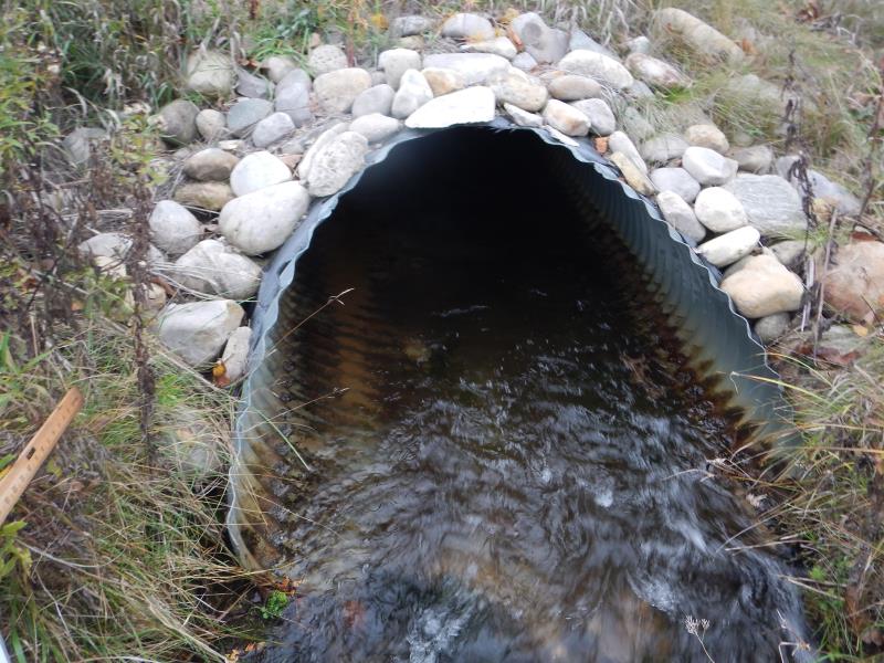
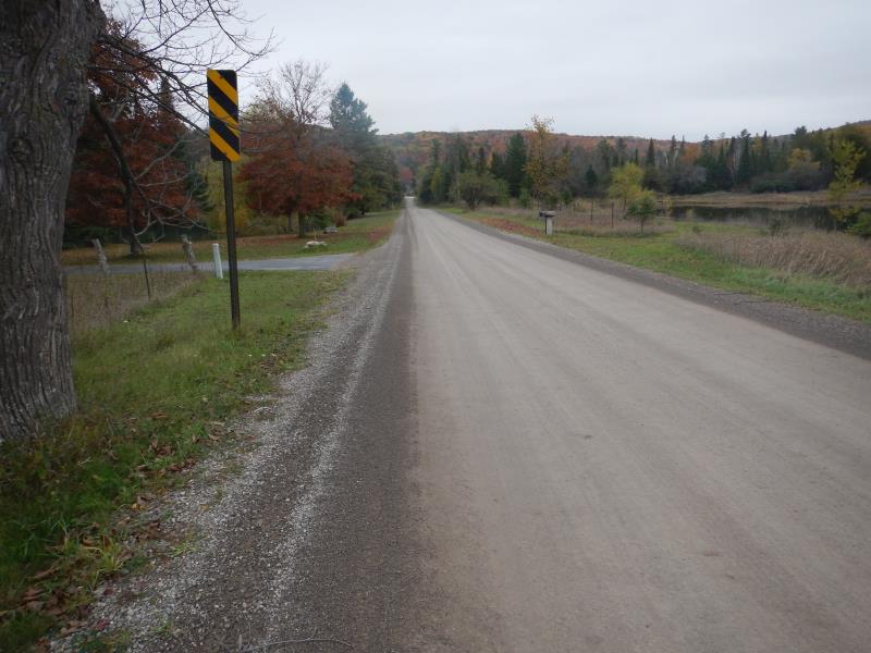
Inlet
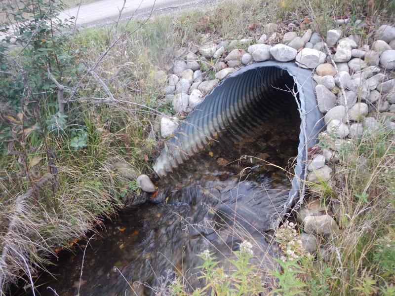
Outlet
Upstream Conditions
Downstream Conditions
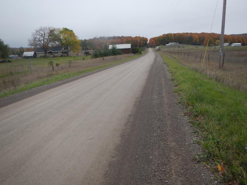
Road Approach - Left
Road Approach - Right
Crossing Information
Type of Crossing: culvert(s)
Number of Structures: 1
Structure Shape: Round
Inlet Type: Mitered
Outlet Type: At Stream Grade
Structure Material: Metal
Structure Substrate: Mixture
General Conditions: Good
Structure Interior: corrugated
Dimensions of Structure: Length 38 ft.
, Width 4 ft.
, Height 3.83 ft.
Structure Inlet
Water Depth: 0.75 ft.
Embedded Depth of Structure: 0 ft.
Water Velocity*: 0.54 ft./sec.
Structure Outlet
Water Depth: 0.5 ft.
Embedded Depth of Structure: 0.17 ft.
Water Velocity*: 1.3 ft./sec.
*Water Velocities were measured 0.3 ft. below Surface
(with Meter)
Additional Comments
Julia Klepach's cottage
Stream Information
Stream Flow: Less than 1/2 Bankfull
Riffle Information
Water Depth: 0.5 ft.
Bankfull Width: 5.17 ft.
Wetted Width: 4.67 ft.
Water Velocity: 1 ft./sec.
(Measured with Meter)
Dominant Substrate: Gravel
Road Information
Gravel
County Road
Road Condition: Good
Road Width at Culvert: 21 ft.
Location of Low Point: At Stream
Runoff Path: Ditch
Embankments
Upstream
Fill Depth: 1.25 ft.
Slope: More than 1:2
Downstream
Fill Depth: 1.25 ft.
Slope: More than 1:2
Approaches
Left Approach
Length: 1000 ft.
Slope: Less Than 1%
Vegetation: Partial
LS Factor: 0.06
Erosion: 0.3471 tons/year
Right Approach
Length: 100 ft.
Slope: Less Than 1%
Vegetation: Partial
LS Factor: 0.05
Erosion: 0.0289 tons/year
Erosion Information
Total Erosion at Crossing: 0.376 tons/year
Notes: none
Summary Information
Fish Passability 0.9
�