Road Stream Crossing Site Boyne_BV-12
Lake Charlevoix Watershed, Boyne River
Dam Road
Charlevoix County
Information collected by:
Site Location
GPS Coordinates: 45.1966437627971
, -84.9573532142859
Fish Passability 0
Total Erosion: 1.1057 tons/year
Severity: Severe
Year Inventoried: 2015
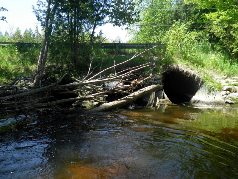
Inlet
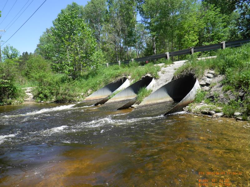
Outlet
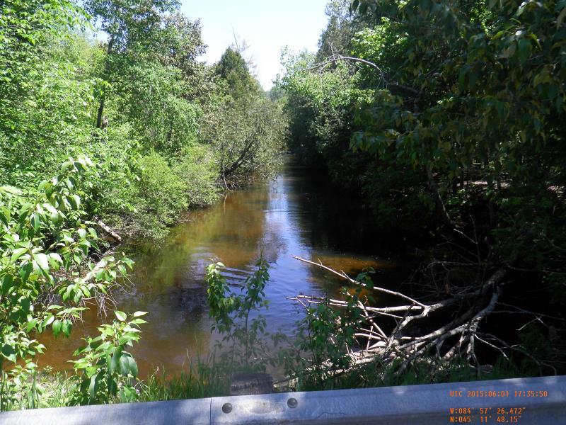
Upstream Conditions
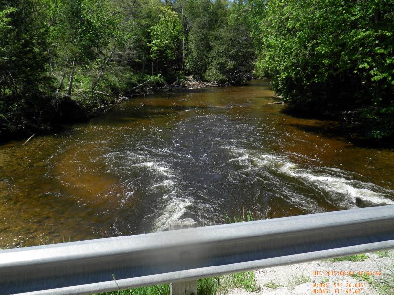
Downstream Conditions
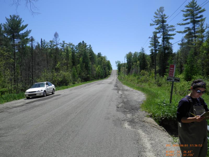
Road Approach - Left
Road Approach - Right
Crossing Information
Type of Crossing: culvert(s)
Number of Structures: 3
Structure Shape: Round
Inlet Type: Mitered
Structure Material: Metal
Structure Substrate: None
General Conditions: Fair
Multiple Culverts/Spans | ||||
Culvert/Span | Width | Length | Height | Material |
1 |
8 ft. |
44 ft. |
7 ft. |
Metal |
2 |
8 ft. |
44 ft. |
7 ft. |
Metal |
3 |
8 ft. |
44 ft. |
7 ft. |
Metal |
Structure Interior: corrugated
Dimensions of Structure: Length 44 ft.
, Width 8 ft.
, Height 7 ft.
Percentage Plugged:
Inlet: 1% to 25%
Outlet: 0%
In Pipe: 0%
Structure Inlet
Water Depth: 1.92 ft.
Embedded Depth of Structure: 0 ft.
Water Velocity*: 4.9 ft./sec.
Structure Outlet
Water Depth: 1.7 ft.
Embedded Depth of Structure: 0 ft.
Water Velocity*: 5.8 ft./sec.
*Water Velocities were measured 1 ft. below Surface
(with Meter)
Stream Information
Stream Flow: Less than Bankfull
Scour Pool: Length 50 ft.
, Width 30 ft.
, Depth 5.5 ft.
Upstream Pond: Length 0 ft.
, Width 0 ft.
, Depth 0 ft.
Riffle Information
Water Depth: 0.97 ft.
Bankfull Width: 57.83 ft.
Wetted Width: 57.83 ft.
Water Velocity: 1.25 ft./sec.
Road Information
Gravel
County Road
Road Condition: Good
Road Width at Culvert: 29.5 ft.
Location of Low Point: At Stream
Runoff Path: Ditch
Embankments
Upstream
Fill Depth: 4 ft.
Slope: 1:2
Downstream
Fill Depth: 3 ft.
Slope: 1:2
Approaches
Left Approach
Length: 100 ft.
Slope: 1% to 5%
Vegetation: Heavy
LS Factor: 0.38
Erosion: 0.3088 tons/year
Right Approach
Length: 200 ft.
Slope: 1% to 5%
Vegetation: Heavy
LS Factor: 0.43
Erosion: 0.6989 tons/year
Erosion Information
Total Erosion at Crossing: 1.1057 tons/year
Extent of Erosion: Moderate
Notes: eroding down bank and road
Location of Erosion | Erosion Dimensions | Eroded Material | Material Eroded | Total Erosion | ||
facing downstream | Length | Width | Depth | Reaching Stream? | (tons/year) | |
Left Downstream Embankment |
7 ft. |
4 ft. |
2 ft. |
yes |
Gravel |
0.098 |
Summary Information
Fish Passability 0
Fish Passage is an area of concern for this site.
and erosion
A future visit to this site is recommended. fish passage and erosion
�