Road Stream Crossing Site Boyne_BV-15
Lake Charlevoix Watershed, Moyer Creek
Metros Rd
Charlevoix County
Information collected by:
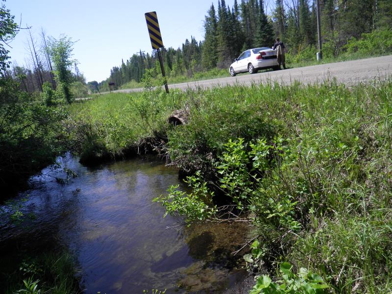
Site Location
GPS Coordinates: 45.1464080562481
, -84.9165554893599
Fish Passability 0.9
Total Erosion: 0.3537 tons/year
Severity: Moderate
Year Inventoried: 2015
Inlet
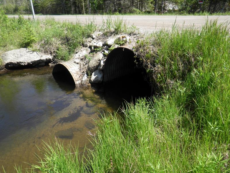
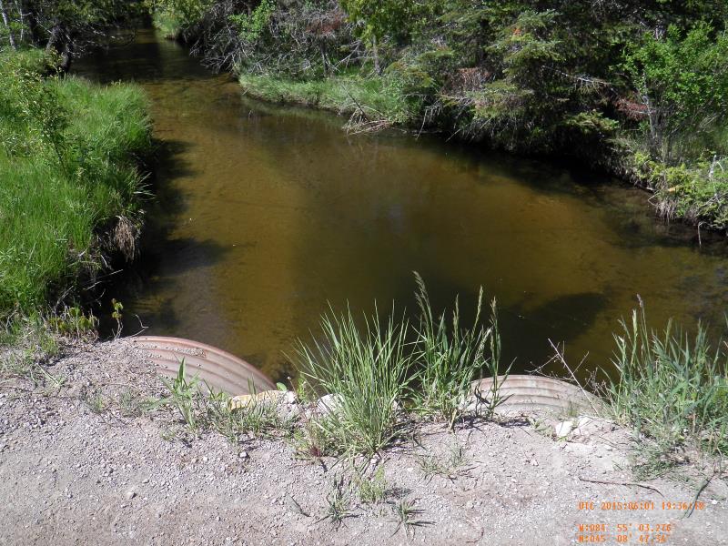
Outlet
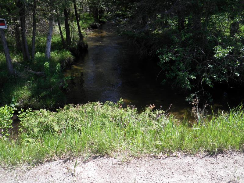
Upstream Conditions
Downstream Conditions
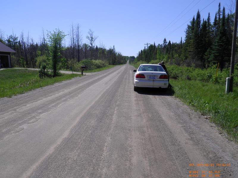
Road Approach - Left
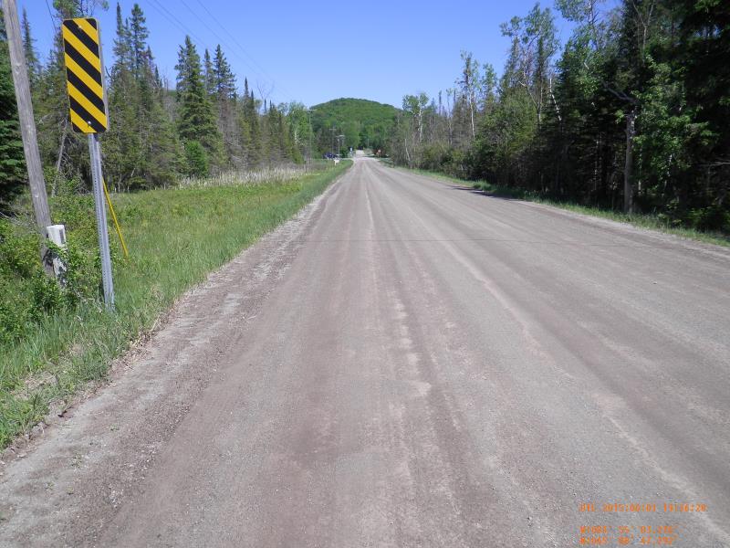
Road Approach - Right
Crossing Information
Type of Crossing: culvert(s)
Number of Structures: 2
Structure Shape: Round
Inlet Type: Projecting
Outlet Type: At Stream Grade
Structure Material: Metal
Structure Substrate: Sand
General Conditions: Good
Multiple Culverts/Spans | ||||
Culvert/Span | Width | Length | Height | Material |
1 |
3.5 ft. |
3.3 ft. |
Metal |
|
2 |
4.42 ft. |
4 ft. |
Metal |
|
Structure Interior: corrugated
Dimensions of Structure: Length 33 ft.
, Width 3.5 ft.
, Height 3.3 ft.
Structure Inlet
Water Depth: 2 ft.
Embedded Depth of Structure: 0 ft.
Water Velocity*: 1.66 ft./sec.
Structure Outlet
Water Depth: 2.5 ft.
Embedded Depth of Structure: 0 ft.
Water Velocity*: 1.08 ft./sec.
*Water Velocities were measured 1.2 ft. below Surface
(with Meter)
Scour Pool: Length 15 ft.
, Width 9 ft.
, Depth 4 ft.
Upstream Pond: Length 0 ft.
, Width 0 ft.
, Depth 0 ft.
Riffle Information
Water Depth: 1.16 ft.
Bankfull Width: 11 ft.
Wetted Width: 10 ft.
Water Velocity: 1.13 ft./sec.
(Measured with Meter)
Dominant Substrate: Sand
Road Information
Gravel
County Road
Road Condition: Good
Road Width at Culvert: 24 ft.
Location of Low Point: At Stream
Runoff Path: Roadway
Embankments
Upstream
Fill Depth: 2.5 ft.
Slope: 1:1.5
Downstream
Fill Depth: 2.5 ft.
Slope: 1:1.5
Approaches
Left Approach
Length: 600 ft.
Slope: Less Than 1%
Vegetation: Partial
LS Factor: 0.06
Erosion: 0.238 tons/year
Right Approach
Length: 350 ft.
Slope: Less Than 1%
Vegetation: Partial
LS Factor: 0.05
Erosion: 0.1157 tons/year
Erosion Information
Total Erosion at Crossing: 0.3537 tons/year
Extent of Erosion: Minor
Erosion is occurring and corrective actions can be installed to address the problem.
Notes: eroding roadway
Summary Information
Fish Passability 0.9
Erosion is an area of concern for this site.
eroding roadway
�