Road Stream Crossing Site Boyne_RR-01
Lake Charlevoix Watershed, Schoolhouse Creek
RR by Skop Road
Charlevoix County
Information collected by:
Site Location
GPS Coordinates: 45.1828473635557
, -84.913827832047
Fish Passability 0
Perch Height: 1 ft.
Total Erosion: 0.0769 tons/year
Severity: Severe
Year Inventoried: 2015
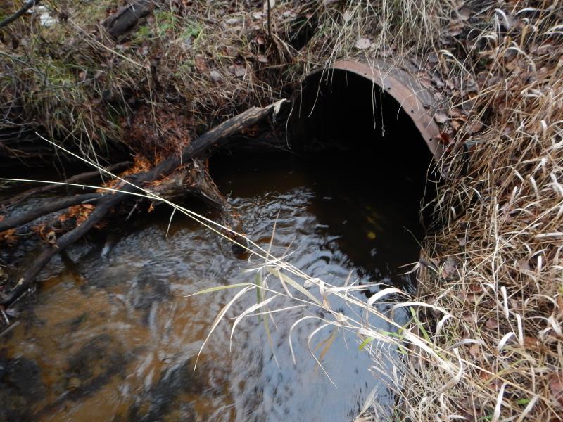
Inlet
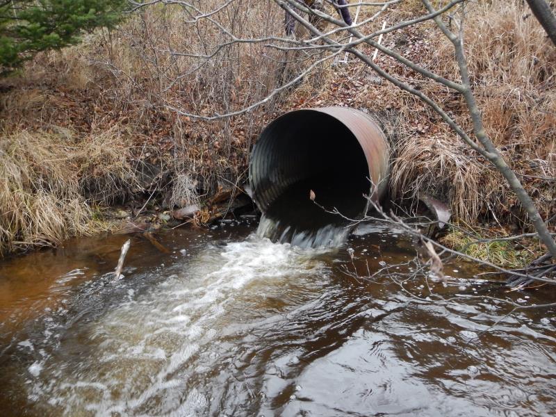
Outlet
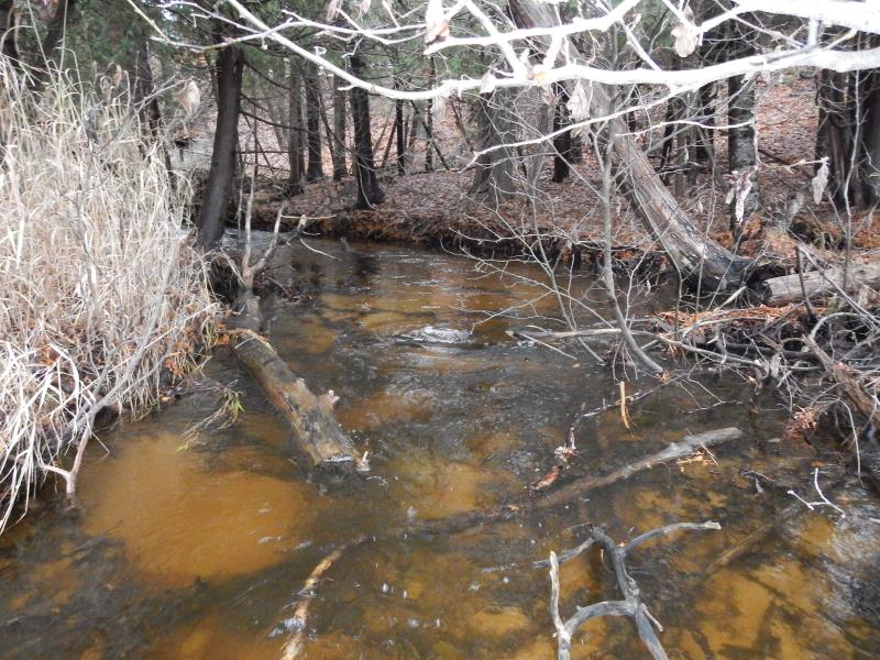
Upstream Conditions
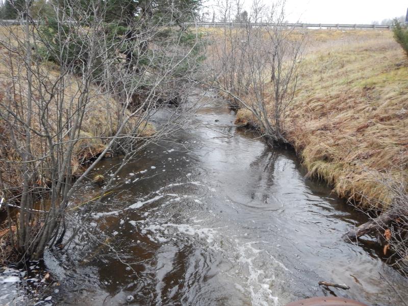
Downstream Conditions
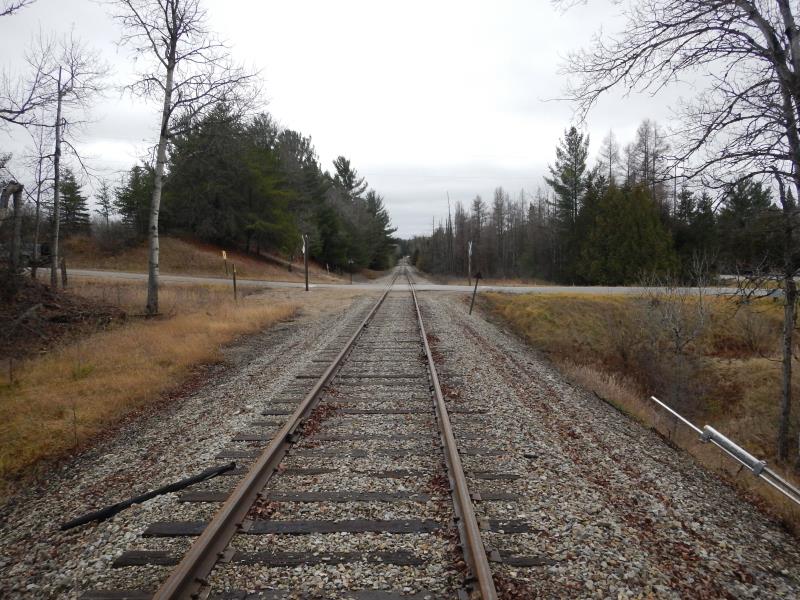
Road Approach - Left
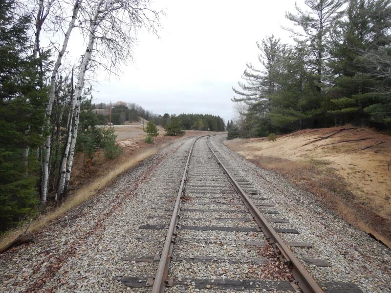
Road Approach - Right
Crossing Information
Type of Crossing: culvert(s)
Number of Structures: 1
Structure Shape: Round
Inlet Type: Wingwall 10-30 Degree
Outlet Type: Freefall into Pool
Structure Material: Metal
Structure Substrate: None
General Conditions: Good
Structure Interior: corrugated
Dimensions of Structure: Length 66 ft.
, Width 3.33 ft.
, Height 3.33 ft.
Percentage Plugged:
In Pipe: 1% to 25%
Perch Height: 1 ft.
Structure Inlet
Water Depth: 1.4 ft.
Water Velocity*: 1.9 ft./sec.
Structure Outlet
Water Depth: 0.75 ft.
Water Velocity*: 5.95 ft./sec.
*Water Velocities were measured 1 ft. below Surface
(with Meter)
Additional Comments
ROW; private
Stream Information
Stream Flow: Less than 1/2 Bankfull
Scour Pool: Length 25 ft.
, Width 19.5 ft.
, Depth 3 ft.
Riffle Information
Water Depth: 0.75 ft.
Bankfull Width: 11 ft.
Wetted Width: 9.08 ft.
Water Velocity: 0.96 ft./sec.
(Measured with Meter)
Dominant Substrate: Gravel
Road Information
Gravel
Other Road
Road Condition: Good
Road Width at Culvert: 10 ft.
Location of Low Point: At Stream
Runoff Path: Ditch
Embankments
Upstream
Fill Depth: 15 ft.
Slope: 1:2
Downstream
Fill Depth: 14.5 ft.
Slope: 1:2
Approaches
Left Approach
Length: 25 ft.
Slope: Less Than 1%
Vegetation: Heavy
LS Factor: 0.05
Erosion: 0.0034 tons/year
Right Approach
Length: 25 ft.
Slope: Less Than 1%
Vegetation: Heavy
LS Factor: 0.05
Erosion: 0.0034 tons/year
Erosion Information
Total Erosion at Crossing: 0.0769 tons/year
Extent of Erosion: Moderate
Notes: RR gravel unstable but veg growing on lower half. More foot traffic would create problem.
Location of Erosion | Erosion Dimensions | Eroded Material | Material Eroded | Total Erosion | ||
facing downstream | Length | Width | Depth | Reaching Stream? | (tons/year) | |
Right Upstream Embankment |
20 ft. |
10 ft. |
0.5 ft. |
no |
Gravel |
0.07 |
Summary Information
Fish Passability 0
Fish Passage is an area of concern for this site.
Perch; high velocity; good trout stream (probably)
A future visit to this site is recommended. Monitor possible erosion
These non-native species were observerd at this site: canary grass
�