Road Stream Crossing Site Jordan_EX-04
Lake Charlevoix Watershed, Unnamed tributary to Deer Creek
Healy Rd
Charlevoix County
Information collected by:
Site Location
GPS Coordinates: 45.1540870160409
, -85.0660773965817
Fish Passability 0
Perch Height: 1 ft.
Total Erosion: 0.5096 tons/year
Severity: Severe
Year Inventoried: 2015
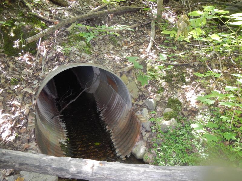
Inlet
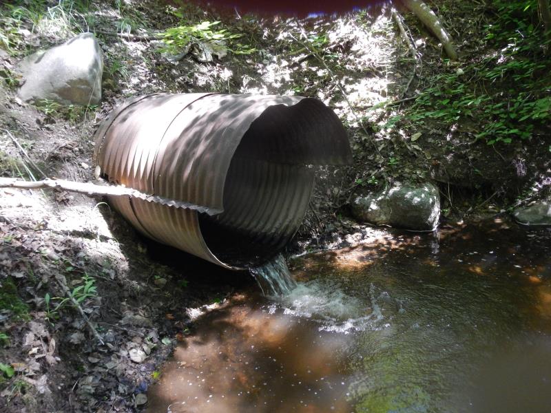
Outlet
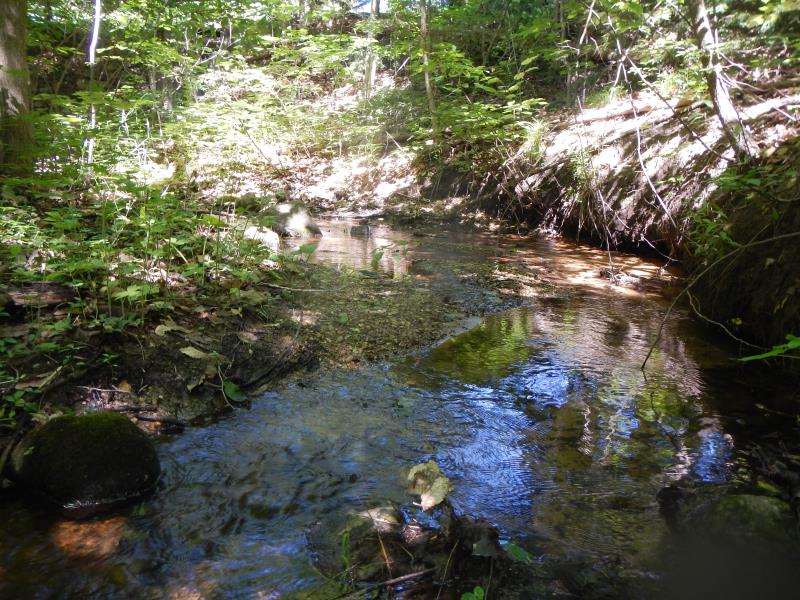
Upstream Conditions
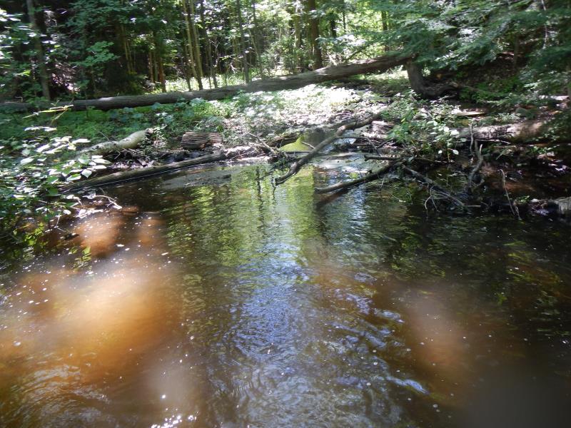
Downstream Conditions
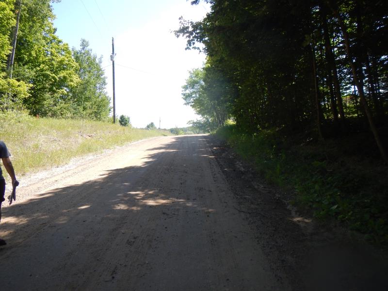
Road Approach - Left
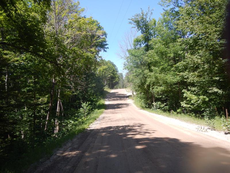
Road Approach - Right
Crossing Information
Type of Crossing: culvert(s)
Number of Structures: 1
Structure Shape: Round
Inlet Type: Projecting
Outlet Type: Freefall into Pool
Structure Material: Metal
Structure Substrate: None
General Conditions: Good
Structure Interior: corrugated
Structure is Rusted through
Dimensions of Structure: Length 40 ft.
, Width 3.5 ft.
, Height 3.5 ft.
Perch Height: 1 ft.
Structure Inlet
Water Depth: 0.21 ft.
Water Velocity*: 1.55 ft./sec.
Structure Outlet
Water Depth: 0.17 ft.
Water Velocity*: 3.4 ft./sec.
(with Meter)
Stream Information
Stream Flow: Less than Bankfull
Scour Pool: Length 12 ft.
, Width 10 ft.
, Depth 2 ft.
Riffle Information
Water Depth: 3.5 ft.
Bankfull Width: 4 ft.
Wetted Width: 4 ft.
Water Velocity: 0.45 ft./sec.
(Measured with Meter)
Dominant Substrate: Gravel
Road Information
Gravel
County Road
Road Condition: Good
Road Width at Culvert: 25 ft.
Location of Low Point: At Stream
Runoff Path: Roadway
Embankments
Upstream
Fill Depth: 20 ft.
Slope: Vertical
Downstream
Fill Depth: 20 ft.
Slope: Vertical
Approaches
Left Approach
Length: 50 ft.
Slope: 6% to 10%
Vegetation: Partial
LS Factor: 0.74
Erosion: 0.2548 tons/year
Right Approach
Length: 50 ft.
Slope: 6% to 10%
Vegetation: Partial
LS Factor: 0.74
Erosion: 0.2548 tons/year
Erosion Information
Total Erosion at Crossing: 0.5096 tons/year
Summary Information
Fish Passability 0
Fish Passage is an area of concern for this site.
high perch
�