Road Stream Crossing Site Jordan_JO-33
Lake Charlevoix Watershed, Marvon Creek
Pesek Road
Charlevoix County
Information collected by:
Site Location
GPS Coordinates: 45.1180266937162
, -85.012423657436
Owned by Private
Fish Passability 0
Perch Height: 0.2 ft.
Total Erosion: 0.8553 tons/year
Severity: Severe
Year Inventoried: 2015
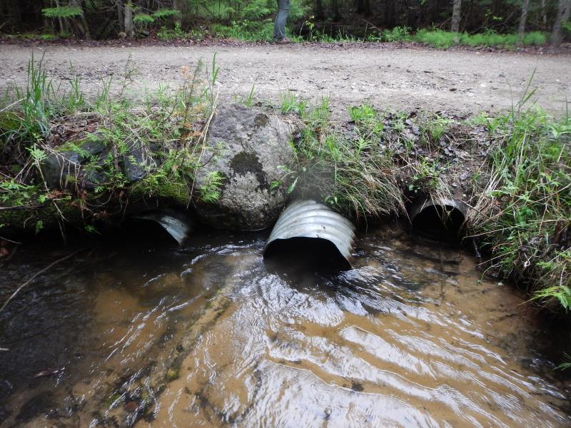
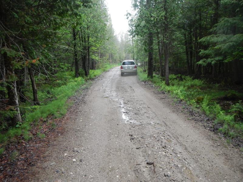
Inlet
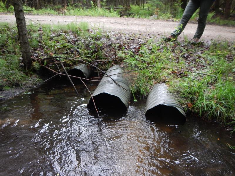
Outlet
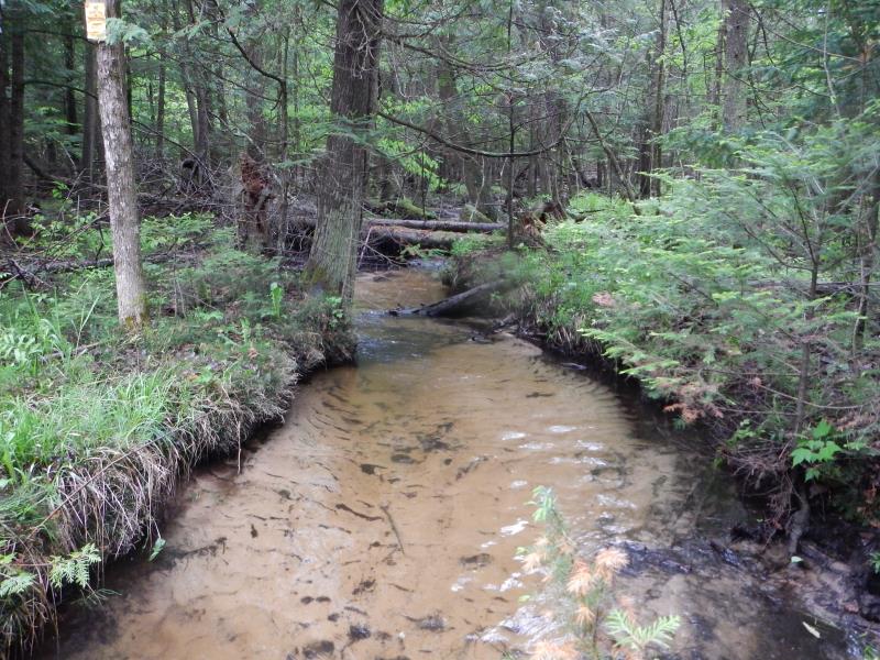
Upstream Conditions
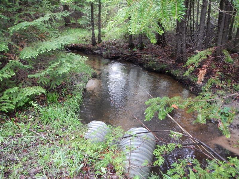
Downstream Conditions
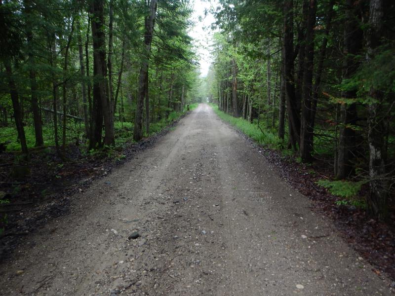
Road Approach - Left
Road Approach - Right
Crossing Information
Type of Crossing: culvert(s)
Number of Structures: 3
Structure Shape: Round
Inlet Type: Projecting
Outlet Type: At Stream Grade
Structure Material: Metal
Structure Substrate: None
General Conditions: Good
Multiple Culverts/Spans | ||||
Culvert/Span | Width | Length | Height | Material |
1 |
1.5 ft. |
23.5 ft. |
1.5 ft. |
Metal |
2 |
1.5 ft. |
23.5 ft. |
1.5 ft. |
Metal |
3 |
1 ft. |
23.5 ft. |
1 ft. |
Metal |
Structure Interior: corrugated
Dimensions of Structure: Length 23.5 ft.
, Width 1.5 ft.
, Height 1.5 ft.
Percentage Plugged:
Inlet: 26% to 50%
Outlet: 0%
In Pipe: 0%
Perch Height: 0.2 ft.
Structure Inlet
Water Depth: 1 ft.
Embedded Depth of Structure: 0 ft.
Water Velocity*: 1.02 ft./sec.
Structure Outlet
Water Depth: 0.8 ft.
Embedded Depth of Structure: 0 ft.
Water Velocity*: 2.25 ft./sec.
*Water Velocities were measured 0.66 ft. below Surface
(with Meter)
Stream Information
Stream Flow: Less than Bankfull
Scour Pool: Length 10 ft.
, Width 8 ft.
, Depth 1.3 ft.
Upstream Pond: Length 0 ft.
, Width 0 ft.
, Depth 0 ft.
Riffle Information
Water Depth: 0.35 ft.
Bankfull Width: 8.17 ft.
Wetted Width: 8.17 ft.
Water Velocity: 0.43 ft./sec.
(Measured with Meter)
Dominant Substrate: Sand
Road Information
Sand
County Road
(Seasonal)
Road Condition: Fair
Road Width at Culvert: 17 ft.
Location of Low Point: At Stream
Runoff Path: Ditch
Embankments
Upstream
Fill Depth: 0.92 ft.
Slope: More than 1:2
Downstream
Fill Depth: 0.92 ft.
Slope: More than 1:2
Approaches
Left Approach
Length: 0 ft.
Slope: Less Than 1%
Vegetation: Heavy
LS Factor: 0.05
Erosion: 0 tons/year
Right Approach
Length: 300 ft.
Slope: 1% to 5%
Vegetation: Heavy
LS Factor: 0.46
Erosion: 0.6463 tons/year
Erosion Information
Total Erosion at Crossing: 0.8553 tons/year
Extent of Erosion: Moderate
Erosion is occurring and corrective actions can be installed to address the problem.
Notes: downstream erosion- minor stream running parallel to the road
Location of Erosion | Erosion Dimensions | Eroded Material | Material Eroded | Total Erosion | ||
facing downstream | Length | Width | Depth | Reaching Stream? | (tons/year) | |
Left Upstream Streambank |
3 ft. |
3 ft. |
2 ft. |
yes |
Silt |
0.0357 |
Right Downtream Ditch |
30 ft. |
2.5 ft. |
0.75 ft. |
yes |
Sand |
0.1733 |
Summary Information
Fish Passability 0
�