Road Stream Crossing Site Jordan_WA-7
Lake Charlevoix Watershed, Warner Creek
Tebo School Road
Antrim County
Information collected by:
Site Location
GPS Coordinates: 45.1129105694974
, -84.9670911367196
Fish Passability 0
Perch Height: 0.83 ft.
Total Erosion: 0.481 tons/year
Severity: Severe
Year Inventoried: 2015
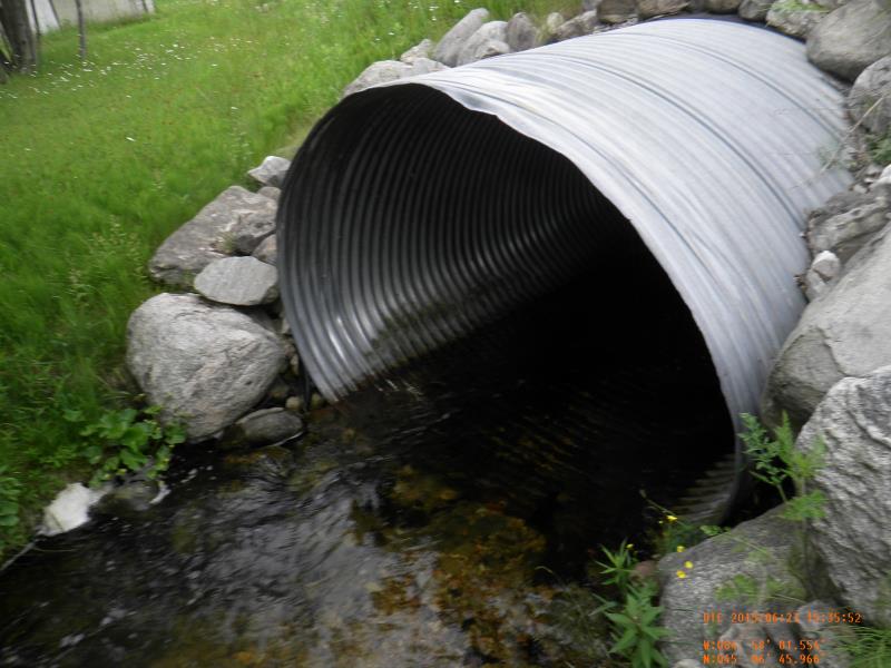
Inlet
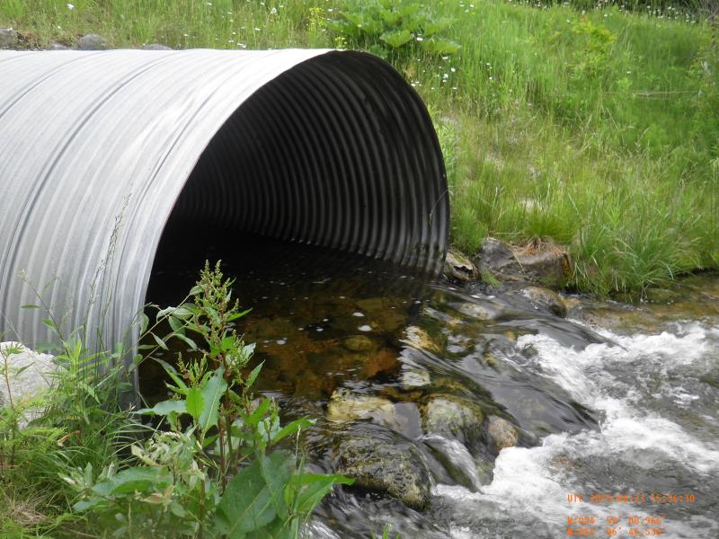
Outlet
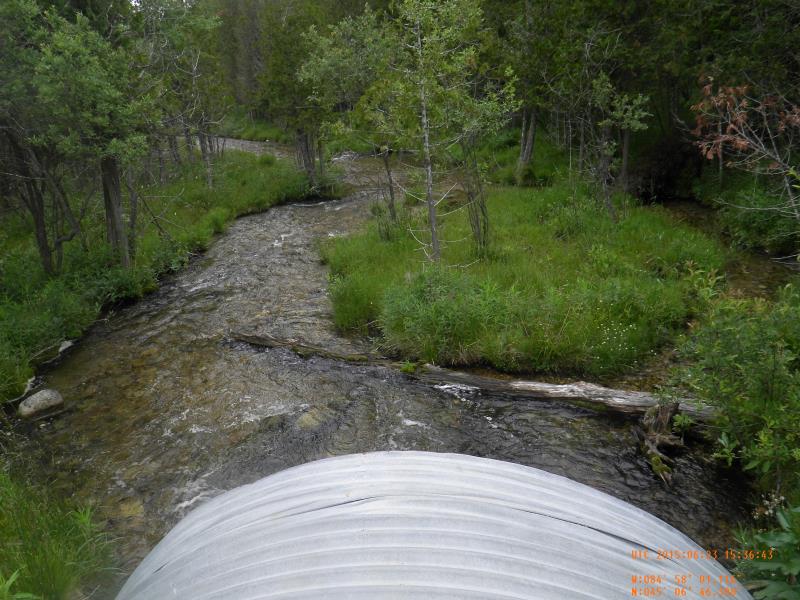
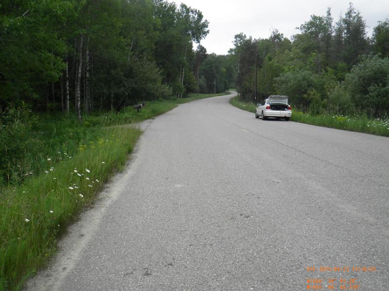
Upstream Conditions
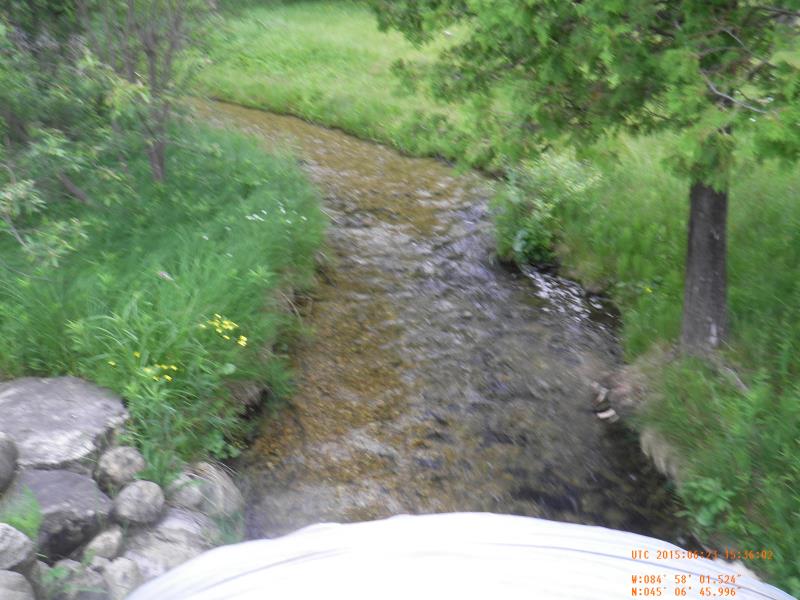
Downstream Conditions
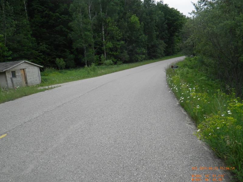
Road Approach - Left
Road Approach - Right
Crossing Information
Type of Crossing: culvert(s)
Number of Structures: 1
Structure Shape: Round
Inlet Type: Projecting
Outlet Type: Cascade over Riprap
Structure Material: Metal
Structure Substrate: Mixture
General Conditions: Good
Structure Interior: corrugated
Dimensions of Structure: Length 60 ft.
, Width 9 ft.
, Height 6 ft.
Perch Height: 0.83 ft.
Structure Inlet
Water Depth: 0.8 ft.
Embedded Depth of Structure: 0 ft.
Water Velocity*: 3.25 ft./sec.
Structure Outlet
Water Depth: 1.05 ft.
Embedded Depth of Structure: 0.33 ft.
Water Velocity*: 4.11 ft./sec.
*Water Velocities were measured 0.48 ft. below Surface
(with Meter)
Stream Information
Stream Flow: Less than Bankfull
Scour Pool: Length 10 ft.
, Width 10 ft.
, Depth 1.6 ft.
Riffle Information
Water Depth: 1.05 ft.
Bankfull Width: 17.5 ft.
Wetted Width: 16.5 ft.
Water Velocity: 2.85 ft./sec.
(Measured with Meter)
Dominant Substrate: Cobble
Road Information
Paved
County Road
Road Condition: Good
Road Width at Culvert: 30 ft.
Location of Low Point: At Stream
Runoff Path: Ditch
Embankments
Upstream
Fill Depth: 2.25 ft.
Slope: More than 1:2
Downstream
Fill Depth: 2.25 ft.
Slope: More than 1:2
Approaches
Left Approach
Length: 300 ft.
Slope: 1% to 5%
Vegetation: Partial
LS Factor: 0.55
Erosion: 0.1636 tons/year
Right Approach
Length: 500 ft.
Slope: 1% to 5%
Vegetation: Partial
LS Factor: 0.64
Erosion: 0.3174 tons/year
Erosion Information
Total Erosion at Crossing: 0.481 tons/year
Summary Information
Fish Passability 0
Fish Passage is an area of concern for this site.
high velocity
�