Road Stream Crossing Site Jordan_WI-23
Lake Charlevoix Watershed, Brown Creek
Pesek Road
Charlevoix County
Information collected by:
Site Location
GPS Coordinates: 45.1179307235459
, -85.0267524422819
Owned by Private
Fish Passability 0
Perch Height: 1.25 ft.
Total Erosion: 2.4313 tons/year
Severity: Severe
Year Inventoried: 2015
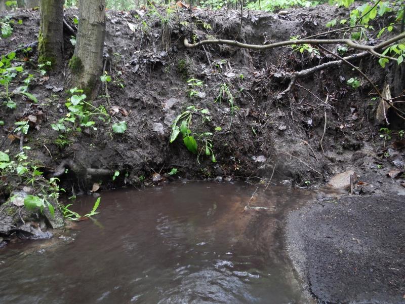
Inlet
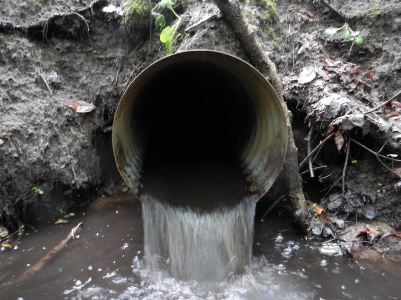
Outlet
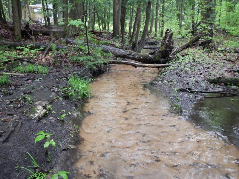
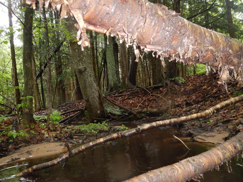
Upstream Conditions
Road Approach - Left
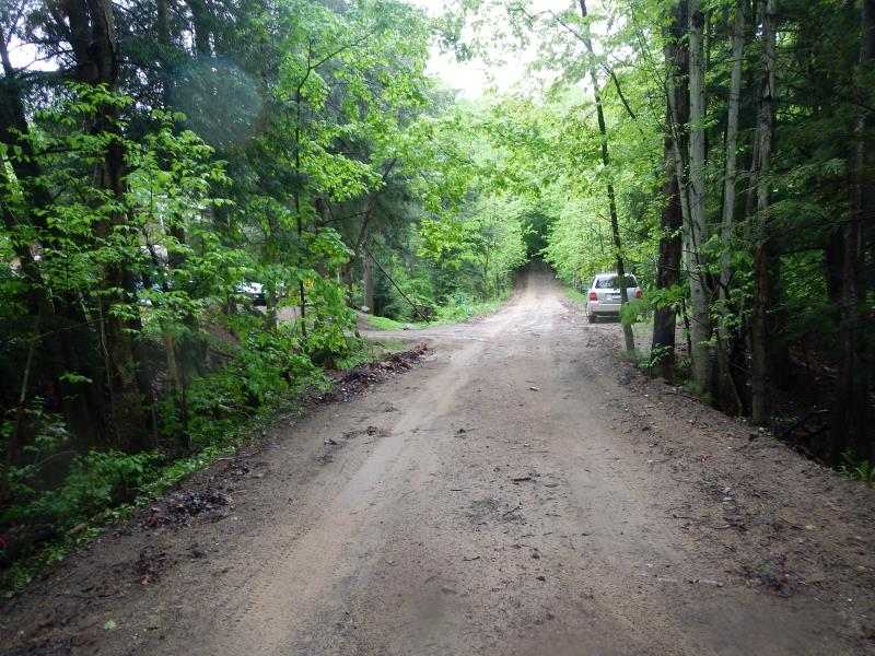
Road Approach - Right
Crossing Information
Type of Crossing: culvert(s)
Number of Structures: 1
Structure Shape: Round
Inlet Type: Projecting
Outlet Type: Freefall into Pool
Structure Material: Metal
Structure Substrate: Sand
General Conditions: Good
Structure Interior: corrugated
Dimensions of Structure: Length 18.5 ft.
, Width 1.5 ft.
, Height 1.5 ft.
Percentage Plugged:
Inlet: 76% to 100%
Outlet: 0%
In Pipe: 0%
Perch Height: 1.25 ft.
Structure Inlet
Water Depth: 0.2 ft.
Embedded Depth of Structure: 1.3 ft.
Water Velocity*: 1.12 ft./sec.
Structure Outlet
Water Depth: 0.2 ft.
Embedded Depth of Structure: 0 ft.
Water Velocity*: 3.15 ft./sec.
*Water Velocities were measured 0.132 ft. below Surface
(with Meter)
Stream Information
Stream Flow: More than Bankfull
Scour Pool: Length 10 ft.
, Width 10 ft.
, Depth 2 ft.
Upstream Pond: Length 10 ft.
, Width 5 ft.
, Depth 0.5 ft.
Riffle Information
Water Depth: 0.13 ft.
Bankfull Width: 3.08 ft.
Wetted Width: 3.08 ft.
Water Velocity: 0.75 ft./sec.
(Measured with Meter)
Dominant Substrate: Sand
Road Information
Sand
County Road
Road Condition: Fair
Road Width at Culvert: 13 ft.
Location of Low Point: At Stream
Runoff Path: Ditch
Embankments
Upstream
Fill Depth: 2.5 ft.
Slope: 1:2
Downstream
Fill Depth: 3.58 ft.
Slope: Vertical
Approaches
Left Approach
Length: 300 ft.
Slope: 6% to 10%
Vegetation: Heavy
LS Factor: 1.4
Erosion: 1.5041 tons/year
Right Approach
Length: 200 ft.
Slope: 6% to 10%
Vegetation: Heavy
LS Factor: 1.23
Erosion: 0.881 tons/year
Erosion Information
Total Erosion at Crossing: 2.4313 tons/year
Extent of Erosion: Moderate
Location of Erosion | Erosion Dimensions | Eroded Material | Material Eroded | Total Erosion | ||
facing downstream | Length | Width | Depth | Reaching Stream? | (tons/year) | |
Right Upstream Ditch |
2 ft. |
3 ft. |
3 ft. |
yes |
Sand |
0.0462 |
Summary Information
Fish Passability 0
Fish Passage is an area of concern for this site.
perched culvert, high above stream. Erosion too
A future visit to this site is recommended. above
�