Road Stream Crossing Site Jordan_WI-32
Lake Charlevoix Watershed, Collins Creek
Korthage Rd
Charlevoix County
Information collected by:
Site Location
GPS Coordinates: 45.1511220371947
, -84.9783406385792
Fish Passability 0.5
Total Erosion: 0.1738 tons/year
Severity: Moderate
Year Inventoried: 2015
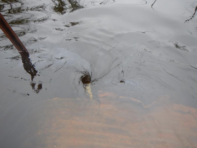
Inlet
Outlet
Upstream Conditions
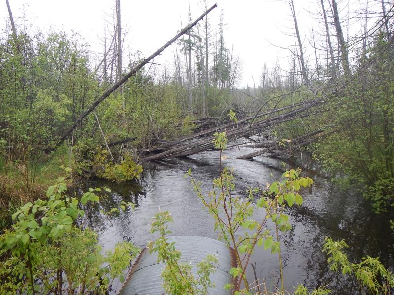
Downstream Conditions
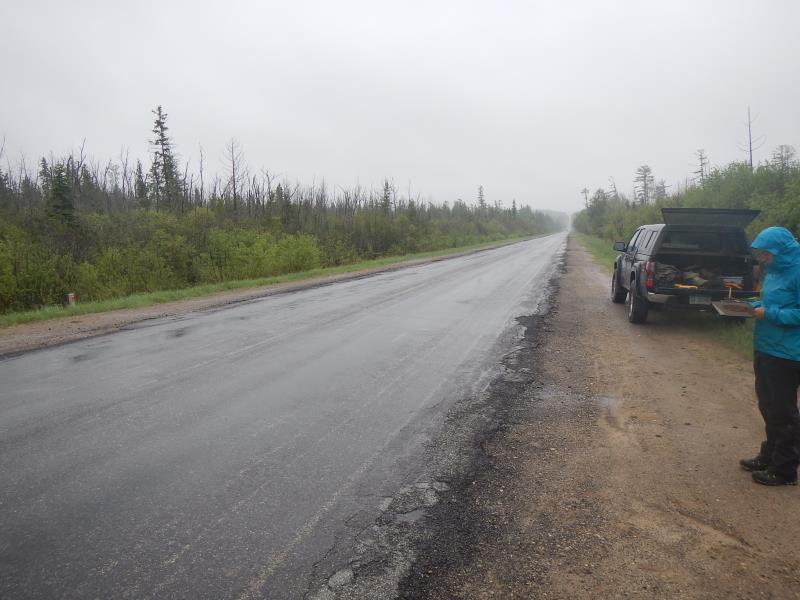
Road Approach - Left
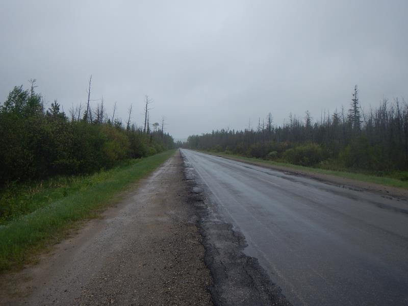
Road Approach - Right
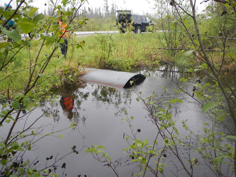
Crossing Information
Type of Crossing: culvert(s)
Number of Structures: 1
Structure Shape: Round
Inlet Type: Projecting
Outlet Type: At Stream Grade
Structure Material: Metal
Structure Substrate: Sand
General Conditions: Good
Structure Interior: corrugated
Dimensions of Structure: Length 87 ft.
, Width 6 ft.
, Height 5 ft.
Structure Inlet
Water Depth: 5 ft.
Embedded Depth of Structure: 1 ft.
Water Velocity*: 2.2 ft./sec.
Structure Outlet
Water Depth: 5 ft.
Embedded Depth of Structure: 1 ft.
Water Velocity*: 2.5 ft./sec.
*Water Velocities were measured 2 ft. below Surface
(with Meter)
Additional Comments
upstream submergent
Stream Information
Stream Flow: More than Bankfull
Scour Pool: Length 30 ft.
, Width 20 ft.
, Depth 6 ft.
Upstream Pond: Length 50 ft.
, Width 40 ft.
Riffle Information
Water Depth: 5 ft.
Bankfull Width: 30 ft.
Wetted Width: 30 ft.
Water Velocity: 0.1 ft./sec.
Road Information
Paved
County Road
Road Condition: Fair
Road Width at Culvert: 42 ft.
Location of Low Point: At Stream
Runoff Path: Roadway
Embankments
Upstream
Fill Depth: 1.75 ft.
Slope: 1:2
Downstream
Fill Depth: 2.08 ft.
Slope: 1:2
Approaches
Left Approach
Length: 1000 ft.
Slope: Less Than 1%
Vegetation: Partial
LS Factor: 0.06
Erosion: 0.0833 tons/year
Right Approach
Length: 1000 ft.
Slope: Less Than 1%
Vegetation: Partial
LS Factor: 0.06
Erosion: 0.0833 tons/year
Erosion Information
Total Erosion at Crossing: 0.1738 tons/year
Extent of Erosion: Minor
Erosion is occurring and corrective actions can be installed to address the problem.
Location of Erosion | Erosion Dimensions | Eroded Material | Material Eroded | Total Erosion | ||
facing downstream | Length | Width | Depth | Reaching Stream? | (tons/year) | |
Right Upstream Embankment |
13 ft. |
5 ft. |
0.5 ft. |
yes |
Sand |
0.0072 |
Summary Information
Fish Passability 0.5
Erosion is an area of concern for this site.
for flooding yes!
�