Road Stream Crossing Site BL-04
Maple River Watershed, Hasler Creek
Hasler Creek
Tuscarora Twp,
Cheboygan County
Information collected by:
Site Location
GPS Coordinates: 45.448561
, -84.718174
T35N
R03W
Sec 6
Owned by Private
Fish Passability 0
Perch Height: 0.33 ft.
Total Erosion: 1.7648 tons/year
Severity: Severe
Year Inventoried: 2014
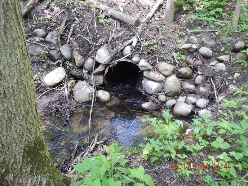
Inlet
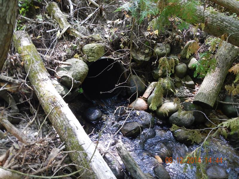
Outlet
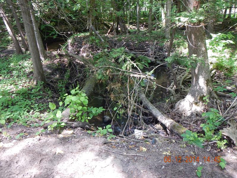
Downstream Conditions
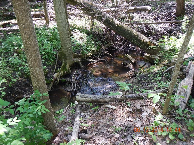
Upstream Conditions
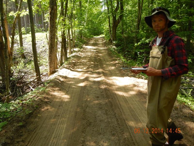
Road Approach - Left
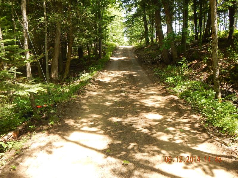
Road Approach - Right
Crossing Information
Type of Crossing: culvert(s)
Number of Structures: 1
Structure Shape: Round
Inlet Type: Projecting
Outlet Type: Cascade over Riprap
Structure Material: Metal
Structure Substrate: None
General Conditions: Good
Structure Interior: corrugated
Dimensions of Structure: Length 21 ft.
, Width 2 ft.
, Height 2 ft.
Perch Height: 0.33 ft.
Structure Inlet
Water Depth: 0.42 ft.
Embedded Depth of Structure: 0 ft.
Water Velocity*: 0.75 ft./sec.
Structure Outlet
Water Depth: 0.25 ft.
Embedded Depth of Structure: 0 ft.
Water Velocity*: 1.95 ft./sec.
*Water Velocities were measured 0.1 ft. below Surface
(with Meter)
Additional Comments
Horse Ranch
Stream Information
Stream Flow: Less than 1/2 Bankfull
Scour Pool: Length 30 ft.
, Width 15 ft.
, Depth 1 ft.
Riffle Information
Water Depth: 0.3 ft.
Bankfull Width: 6 ft.
Wetted Width: 4.8 ft.
Water Velocity: 0.31 ft./sec.
(Measured with Meter)
Dominant Substrate: Sand
Road Information
Sand
Private Road
Road Condition: Fair
Road Width at Culvert: 9 ft.
Location of Low Point: At Stream
Runoff Path: Roadway
Embankments
Upstream
Fill Depth: 3 ft.
Slope: 1:2
Downstream
Fill Depth: 2.5 ft.
Slope: 1:1.5
Approaches
Left Approach
Length: 250 ft.
Slope: 6% to 10%
Vegetation: Partial
LS Factor: 1.62
Erosion: 1.0041 tons/year
Right Approach
Length: 200 ft.
Slope: 6% to 10%
Vegetation: Partial
LS Factor: 1.45
Erosion: 0.719 tons/year
Erosion Information
Total Erosion at Crossing: 1.7648 tons/year
Extent of Erosion: Moderate
Notes: Erosion photos 473, 474, 475, 476
Location of Erosion | Erosion Dimensions | Eroded Material | Material Eroded | Total Erosion | ||
facing downstream | Length | Width | Depth | Reaching Stream? | (tons/year) | |
Right Downstream Streambank |
2 ft. |
2 ft. |
1.5 ft. |
yes |
Sandy Loam |
0.0202 |
Right Downstream Streambank |
5 ft. |
10 ft. |
0.5 ft. |
yes |
Sandy Loam |
0.0168 |
Left Upstream Embankment |
7 ft. |
2 ft. |
0.1 ft. |
yes |
Sandy Loam |
0.0047 |
Summary Information
Fish Passability 0
Erosion is an area of concern for this site.
A future visit to this site is recommended. Monitor erosion in the future
�