Road Stream Crossing Site BL-05
Maple River Watershed, Hasler Creek
Ellinger
Tuscarora Twp,
Cheboygan County
Information collected by:
Site Location
GPS Coordinates: 45.453339
, -84.711121
T35N
R03W
Sec 5
Owned by Private
Fish Passability 0
Perch Height: 0.79 ft.
Total Erosion: 0.4347 tons/year
Severity: Severe
Year Inventoried: 2014
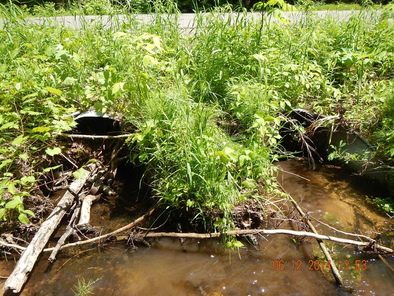
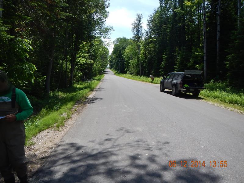
Inlet
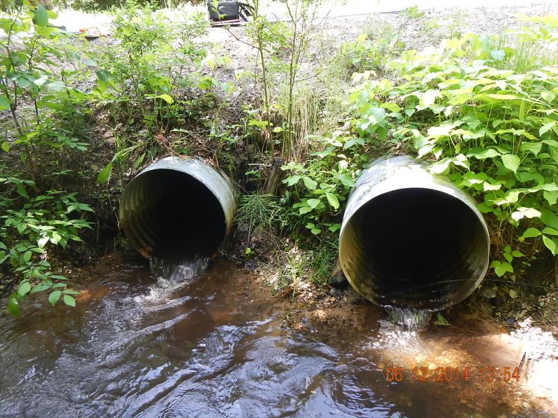
Outlet
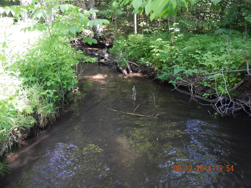
Downstream Conditions
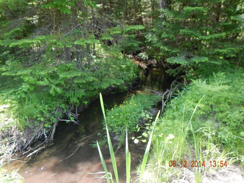
Upstream Conditions
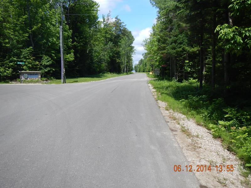
Road Approach - Left
Road Approach - Right
Crossing Information
Type of Crossing: culvert(s)
Number of Structures: 2
Structure Shape: Round
Inlet Type: Projecting
Outlet Type: Freefall into Pool
Structure Material: Metal
Structure Substrate: Sand
General Conditions: Good
Multiple Culverts/Spans | ||||
Culvert/Span | Width | Length | Height | Material |
1 |
2.2 ft. |
38 ft. |
2 ft. |
Metal |
2 |
2.2 ft. |
38 ft. |
2 ft. |
Metal |
Structure Interior: corrugated
Dimensions of Structure: Length 38 ft.
, Width 2.2 ft.
, Height 2 ft.
Percentage Plugged:
Inlet: 51% to 75%
Perch Height: 0.79 ft.
Structure Inlet
Water Depth: 0.5 ft.
Embedded Depth of Structure: 0.1 ft.
Water Velocity*: 0.5 ft./sec.
Structure Outlet
Water Depth: 0.13 ft.
Embedded Depth of Structure: 0 ft.
Water Velocity*: 3.5 ft./sec.
*Water Velocities were measured 0.17 ft. below Surface
(with Meter)
Additional Comments
Hasler Creek Estates
Stream Information
Stream Flow: Less than 1/2 Bankfull
Scour Pool: Length 15 ft.
, Width 8.5 ft.
, Depth 1.5 ft.
Riffle Information
Water Depth: 0.35 ft.
Bankfull Width: 6 ft.
Wetted Width: 5.17 ft.
Water Velocity: 0.21 ft./sec.
(Measured with Meter)
Dominant Substrate: Sand
Road Information
Paved
County Road
Road Condition: Good
Road Width at Culvert: 25 ft.
Location of Low Point: Other
Embankments
Upstream
Fill Depth: 1.5 ft.
Slope: More than 1:2
Downstream
Fill Depth: 2 ft.
Slope: 1:1.5
Approaches
Left Approach
Length: 25 ft.
Slope: Less Than 1%
Vegetation: Heavy
LS Factor: 0.05
Erosion: 0.001 tons/year
Right Approach
Length: 800 ft.
Slope: 1% to 5%
Vegetation: Heavy
LS Factor: 0.55
Erosion: 0.3636 tons/year
Erosion Information
Total Erosion at Crossing: 0.4347 tons/year
Extent of Erosion: Moderate
Erosion is occurring and corrective actions can be installed to address the problem.
Notes: Picture number 466
Location of Erosion | Erosion Dimensions | Eroded Material | Material Eroded | Total Erosion | ||
facing downstream | Length | Width | Depth | Reaching Stream? | (tons/year) | |
Right Downstream Embankment |
20 ft. |
4 ft. |
0.5 ft. |
yes |
Gravel |
0.07 |
Summary Information
Fish Passability 0
Erosion is an area of concern for this site.
Contributing sediments to stream
A future visit to this site is recommended. erosion
These non-native species were observerd at this site: Myrtle
�