Road Stream Crossing Site BL-30
Crooked River Watershed, Iduna Creek
Hiawatha Trail
Bear Creek Twp,
Emmet County
Information collected by:
Site Location
GPS Coordinates: 45.405427
, -84.880463
T35N
R03W
Sec 26
Fish Passability 0.5
Total Erosion: 2.7444 tons/year
Severity: Severe
Year Inventoried: 2014
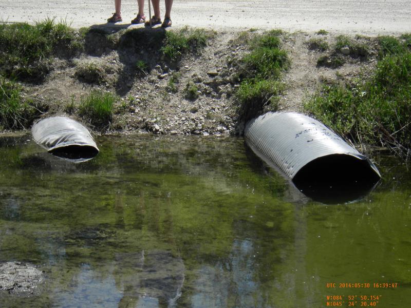
Inlet
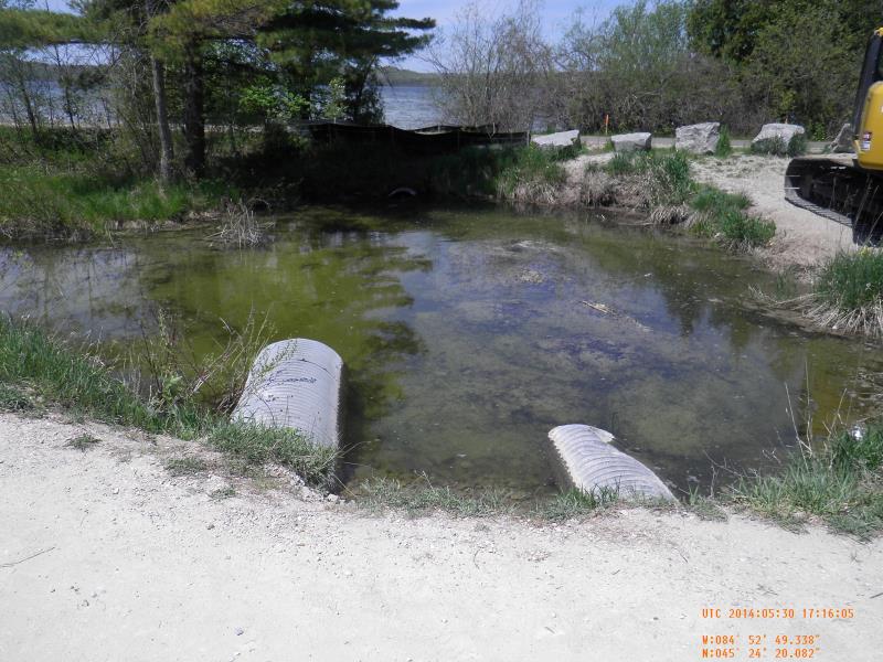
Outlet
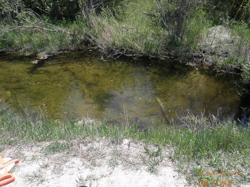
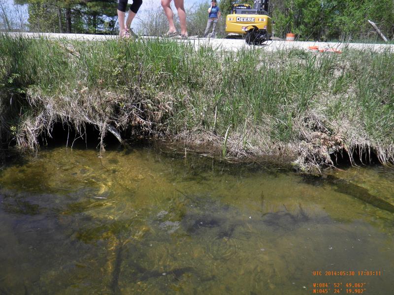
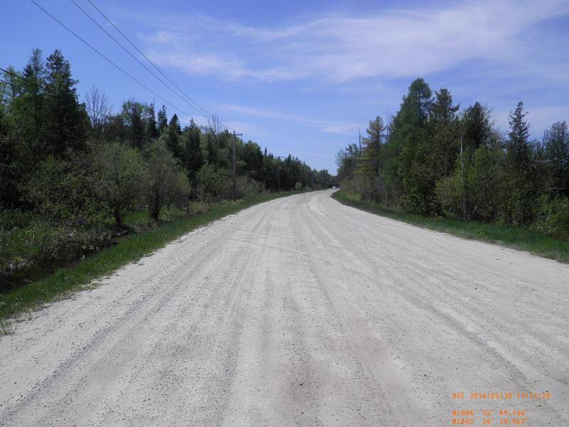
Downstream Conditions
Upstream Conditions
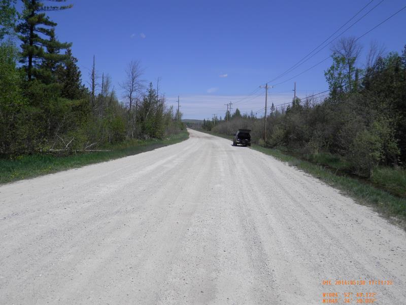
Road Approach - Left
Road Approach - Right
Crossing Information
Type of Crossing: culvert(s)
Number of Structures: 2
Structure Shape: Round
Inlet Type: Projecting
Outlet Type: At Stream Grade
Structure Material: Metal
Structure Substrate: None
General Conditions: Fair
Multiple Culverts/Spans | ||||
Culvert/Span | Width | Length | Height | Material |
1 |
2 ft. |
47 ft. |
2 ft. |
Metal |
2 |
3 ft. |
50.5 ft. |
3 ft. |
Metal |
Structure Interior: corrugated
Dimensions of Structure: Length 50 ft.
, Width 3 ft.
, Height 3 ft.
Percentage Crushed:
Inlet: 1% to 25%
Structure Inlet
Water Depth: 1.8 ft.
Embedded Depth of Structure: 0 ft.
Water Velocity*: 0.13 ft./sec.
Structure Outlet
Water Depth: 1.6 ft.
Embedded Depth of Structure: 0.17 ft.
Water Velocity*: 0.39 ft./sec.
*Water Velocities were measured 1 ft. below Surface
(with Meter)
Additional Comments
LTC Round Lake Preserve
Stream Information
Stream Flow: Less than Bankfull
Riffle Information
Water Depth: 2 ft.
Bankfull Width: 9 ft.
Wetted Width: 9 ft.
Water Velocity: 0.4 ft./sec.
(Measured with Meter)
Road Information
Gravel
County Road
Road Condition: Fair
Road Width at Culvert: 32 ft.
Location of Low Point: At Stream
Runoff Path: Ditch
Embankments
Upstream
Fill Depth: 4 ft.
Slope: 1:1.5
Downstream
Fill Depth: 3 ft.
Slope: Vertical
Approaches
Left Approach
Length: 150 ft.
Slope: 1% to 5%
Vegetation: Heavy
LS Factor: 0.4
Erosion: 0.5289 tons/year
Right Approach
Length: 500 ft.
Slope: 1% to 5%
Vegetation: Heavy
LS Factor: 0.5
Erosion: 2.2039 tons/year
Erosion Information
Total Erosion at Crossing: 2.7444 tons/year
Extent of Erosion: Moderate
Location of Erosion | Erosion Dimensions | Eroded Material | Material Eroded | Total Erosion | ||
facing downstream | Length | Width | Depth | Reaching Stream? | (tons/year) | |
Left Approach |
3 ft. |
15 ft. |
0.5 ft. |
yes |
Sand |
0.0116 |
Summary Information
Fish Passability 0.5
Erosion is an area of concern for this site.
erosion is bad between upstream culvert and c1/c2
�