Road Stream Crossing Site BL-32
Crooked River Watershed, Mud and Round Lake Connection
Hiawatha at bikepath
Bear Creek Twp,
Emmet County
Information collected by:
Site Location
GPS Coordinates: 45.397687
, -84.898557
T35N
R03W
Sec 27
Fish Passability 0.9
Total Erosion: 0.0504 tons/year
Severity: Minor
Year Inventoried: 2014
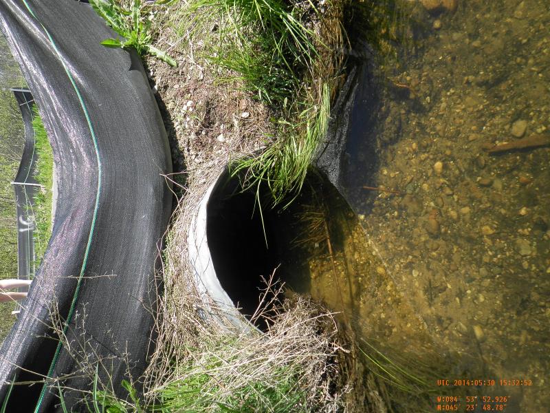
Inlet
Outlet
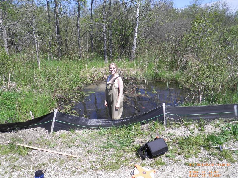
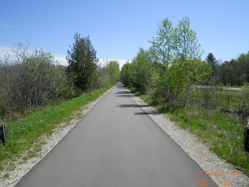
Downstream Conditions
Upstream Conditions
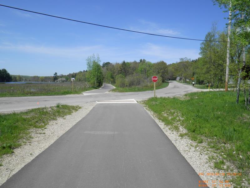
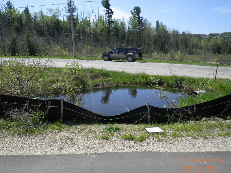
Road Approach - Left
Road Approach - Right
Crossing Information
Type of Crossing: culvert(s)
Number of Structures: 1
Structure Shape: Round
Inlet Type: Projecting
Outlet Type: At Stream Grade
Structure Material: Metal
Structure Substrate: Mixture
General Conditions: New
Structure Interior: corrugated
Dimensions of Structure: Length 20.5 ft.
, Width 2 ft.
, Height 2 ft.
Structure Inlet
Water Depth: 1.38 ft.
Embedded Depth of Structure: 0 ft.
Water Velocity*: 0.04 ft./sec.
Structure Outlet
Water Depth: 1.3 ft.
Embedded Depth of Structure: 0 ft.
Water Velocity*: 0.06 ft./sec.
(with Meter)
Stream Information
Stream Flow: Less than Bankfull
Riffle Information
Water Depth: 0 ft.
Bankfull Width: 0 ft.
Wetted Width: 0 ft.
(Measured with Meter)
Dominant Substrate: Organics
Road Information
Paved
Other Road
(Seasonal)
Road Condition: Good
Road Width at Culvert: 10.5 ft.
Location of Low Point: At Stream
Runoff Path: Ditch
Embankments
Upstream
Fill Depth: 1 ft.
Slope: 1:1.5
Downstream
Fill Depth: 1 ft.
Slope: 1:1.5
Approaches
Left Approach
Length: 25 ft.
Slope: 1% to 5%
Vegetation: Heavy
LS Factor: 0.29
Erosion: 0.0025 tons/year
Right Approach
Length: 300 ft.
Slope: 1% to 5%
Vegetation: Heavy
LS Factor: 0.46
Erosion: 0.0479 tons/year
Erosion Information
Total Erosion at Crossing: 0.0504 tons/year
Summary Information
Fish Passability 0.9
A future visit to this site is recommended. To make sure silt fence is removed
�