Road Stream Crossing Site BL-55
Maple River Watershed, Van Creek
Van Rd
McKinley Twp,
Emmet County
Information collected by:
Site Location
GPS Coordinates: 45.594241
, -84.772702
T37N
R03W
Sec 22
Fish Passability 0.9
Total Erosion: 0.0043 tons/year
Severity: Minor
Year Inventoried: 2014
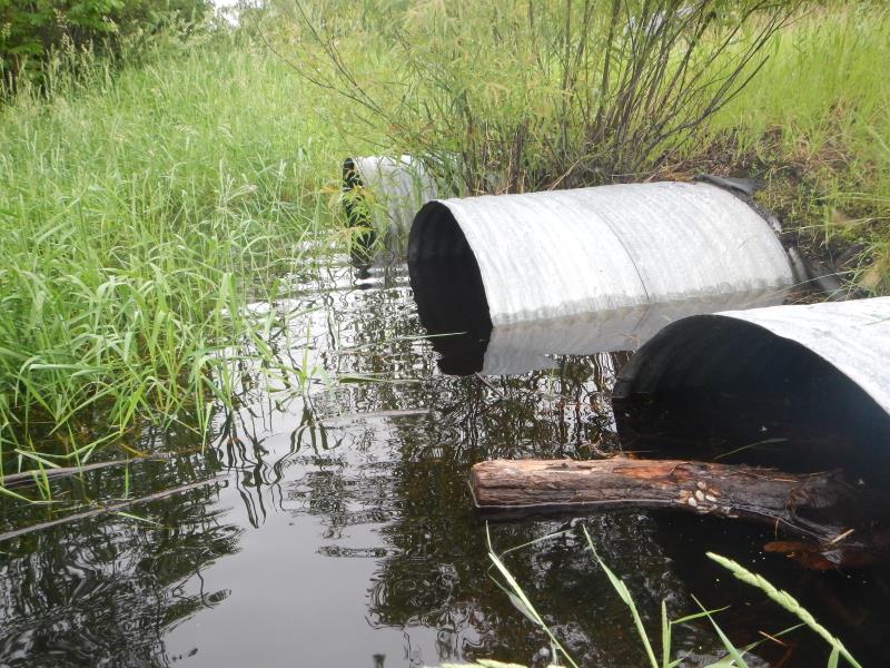
Inlet
Outlet
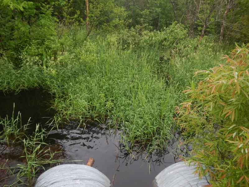
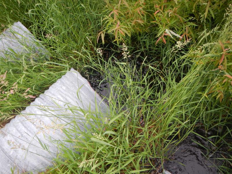
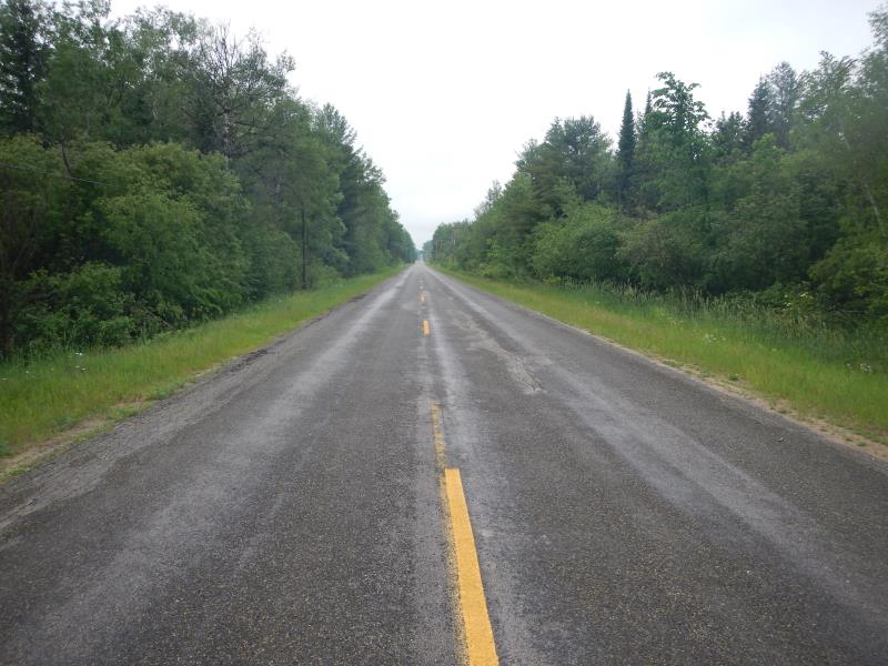
Upstream Conditions
Downstream Conditions
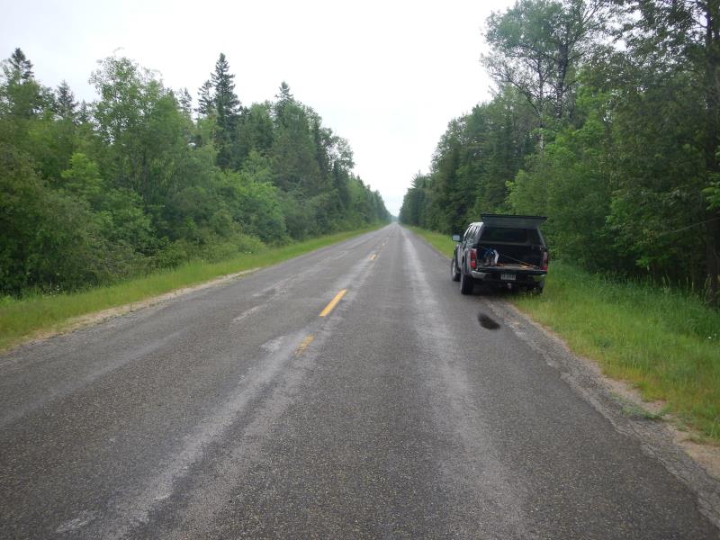
Road Approach - Left
Road Approach - Right
Crossing Information
Type of Crossing: culvert(s)
Number of Structures: 3
Structure Shape: Round
Inlet Type: Projecting
Outlet Type: At Stream Grade
Structure Material: Metal
Structure Substrate: Mixture
General Conditions: Good
Multiple Culverts/Spans | ||||
Culvert/Span | Width | Length | Height | Material |
1 |
3 ft. |
59 ft. |
3 ft. |
Metal |
2 |
3 ft. |
59 ft. |
3 ft. |
Metal |
3 |
3 ft. |
9 ft. |
3 ft. |
Metal |
Structure Interior: corrugated
Dimensions of Structure: Length 59 ft.
, Width 3 ft.
, Height 3 ft.
Percentage Plugged:
In Pipe: 26% to 50%
Structure Inlet
Water Depth: 1.25 ft.
Embedded Depth of Structure: 0.67 ft.
Water Velocity*: 0.13 ft./sec.
Structure Outlet
Water Depth: 1.42 ft.
Embedded Depth of Structure: 0.25 ft.
Water Velocity*: 0.16 ft./sec.
*Water Velocities were measured 15 ft. below Surface
(with Meter)
Stream Information
Stream Flow: Bankfull
Upstream Pond: Length 60 ft.
, Width 40 ft.
, Depth 2 ft.
Riffle Information
Water Depth: 0 ft.
Bankfull Width: 0 ft.
Wetted Width: 0 ft.
(Measured with Meter)
Road Information
Paved
County Road
Road Condition: Good
Road Width at Culvert: 26 ft.
Location of Low Point: Other
Runoff Path: Ditch
Embankments
Upstream
Fill Depth: 2 ft.
Slope: 1:1.5
Downstream
Fill Depth: 3 ft.
Slope: 1:2
Approaches
Left Approach
Length: 50 ft.
Slope: Less Than 1%
Vegetation: Heavy
LS Factor: 0.05
Erosion: 0.0021 tons/year
Right Approach
Length: 50 ft.
Slope: Less Than 1%
Vegetation: Heavy
LS Factor: 0.05
Erosion: 0.0021 tons/year
Erosion Information
Total Erosion at Crossing: 0.0043 tons/year
Summary Information
Fish Passability 0.9
�