Road Stream Crossing Site ST002
Sturgeon River Watershed, Sturgeon River
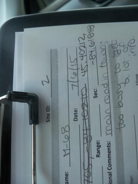
M-68
Tuscarora Twp,
Cheboygan County
Information collected by:
Site Location
GPS Coordinates: 45.402255
, -84.618017
T35N
R03W
Sec 25
Owned by Private
State
State
Fish Passability 1
Structure is NOT Perched
Total Erosion: 0.0039 tons/year
Severity: Minor
Year Inventoried: 2015
Site ID
Outlet
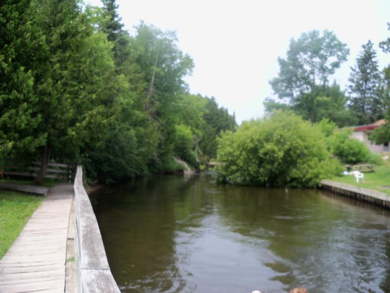
Downstream Conditions
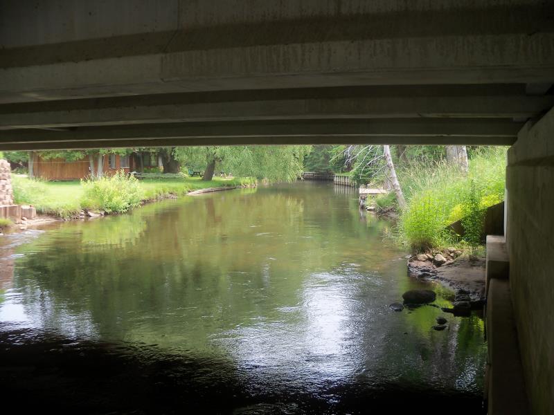
Upstream Conditions
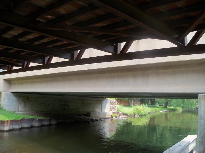
Crossing Information
Type of Crossing: Bridge
Structure Shape: Open Bottom Square/Rectangle
Inlet Type: Wingwall 10-30 Degree
Outlet Type: At Stream Grade
Structure Material: Concrete
Structure Substrate: Mixture
General Conditions: Good
Structure Interior: smooth
Dimensions of Structure: Length 47 ft.
, Width 60 ft.
Structure is NOT Perched
Embedded Depth of Structure: 0 ft.
Embedded Depth of Structure: 0 ft.
Additional Comments
Main road through town, too busy to collect all of the info.
Stream Information
Stream Flow: Less than Bankfull
Scour Pool: Length 0 ft.
, Width 0 ft.
, Depth 0 ft.
Upstream Pond: Length 0 ft.
, Width 0 ft.
, Depth 0 ft.
Road Information
Paved
State Road
Road Condition: Good
Road Width at Culvert: 47 ft.
Location of Low Point: At Stream
Runoff Path: Ditch
Fill Depth: 0 ft.
Slope: Vertical
Fill Depth: 0 ft.
Slope: Vertical
Approaches
Left Approach
Length: 25 ft.
Slope: Less Than 1%
Vegetation: None
LS Factor: 0.05
Erosion: 0.0019 tons/year
Right Approach
Length: 25 ft.
Slope: Less Than 1%
Vegetation: None
LS Factor: 0.05
Erosion: 0.0019 tons/year
Erosion Information
Total Erosion at Crossing: 0.0039 tons/year
Summary Information
Fish Passability 1
�