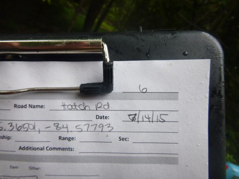
Road Stream Crossing Site ST006
Sturgeon River Watershed, Little Sturgeon River
Hatch Rd
Ellis Twp,
Cheboygan County
Information collected by:
Site Location
GPS Coordinates: 45.365022
, -84.577904
T34N
R02W
Sec 5
Owned by Private
Fish Passability 0.5
Structure is NOT Perched
Total Erosion: 0.3563 tons/year
Severity: Moderate
Year Inventoried: 2015
Site ID
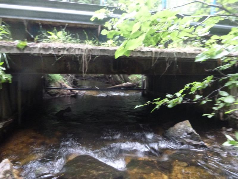
Inlet
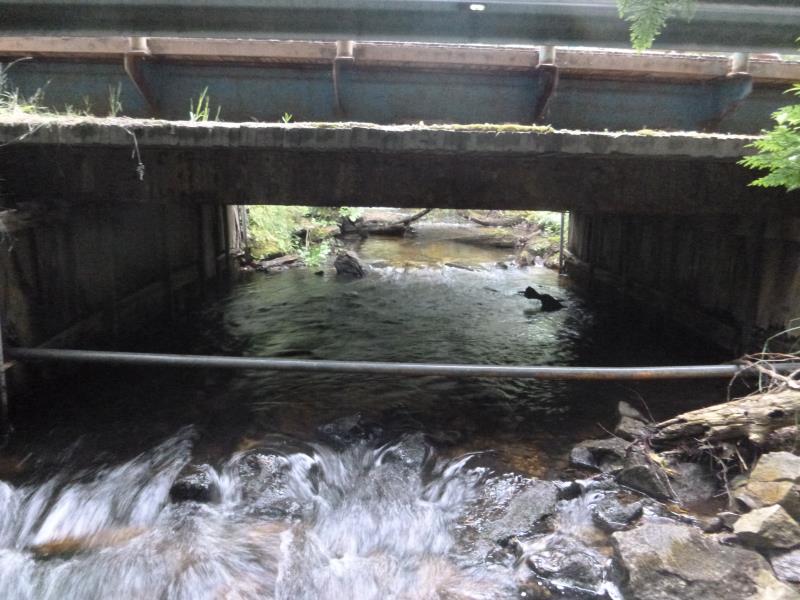
Outlet
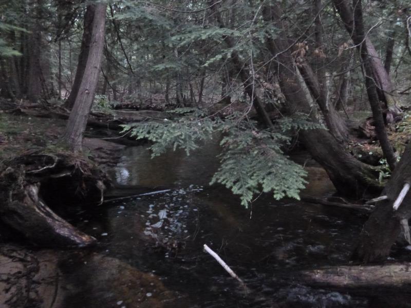
Downstream Conditions
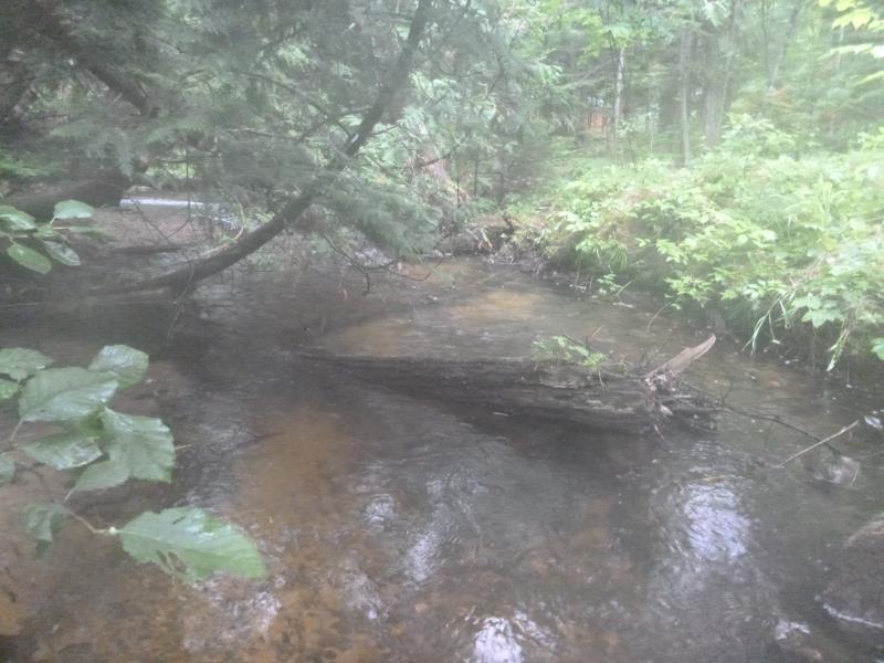
Upstream Conditions
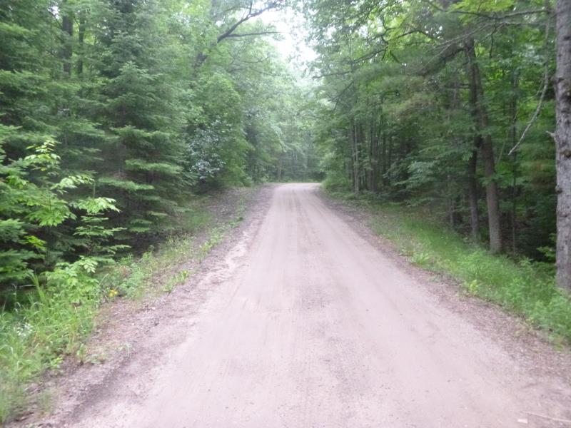
Road Approach - Left
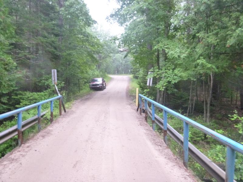
Road Approach - Right
Crossing Information
Type of Crossing: Bridge
Structure Shape: Open Bottom Square/Rectangle
Inlet Type: Other
Outlet Type: At Stream Grade
Structure Material: Wood
Structure Substrate: Mixture
General Conditions: Good
Structure Interior: smooth
Dimensions of Structure: Length 15.8 ft.
, Width 14.4 ft.
, Height 4.4 ft.
Structure is NOT Perched
Structure Inlet
Water Depth: 0.9 ft.
Embedded Depth of Structure: 0 ft.
Water Velocity*: 2.2 ft./sec.
Structure Outlet
Water Depth: 1.1 ft.
Embedded Depth of Structure: 0 ft.
Water Velocity*: 2.1 ft./sec.
*Water Velocities were measured 0.5 ft. below Surface
(with Meter)
Stream Information
Stream Flow: Less than Bankfull
Scour Pool: Length 0 ft.
, Width 0 ft.
, Depth 0 ft.
Upstream Pond: Length 0 ft.
, Width 0 ft.
, Depth 0 ft.
Riffle Information
Water Depth: 0.9 ft.
Bankfull Width: 17.4 ft.
Wetted Width: 14.6 ft.
Water Velocity: 1.7 ft./sec.
(Measured with Meter)
Dominant Substrate: Cobble
Road Information
Sand
State Road
Road Condition: Fair
Road Width at Culvert: 11.7 ft.
Location of Low Point: At Stream
Runoff Path: Ditch
Fill Depth: 0 ft.
Slope: Vertical
Fill Depth: 0 ft.
Slope: Vertical
Approaches
Left Approach
Length: 0 ft.
Slope: Less Than 1%
Vegetation: Heavy
LS Factor: 0.05
Erosion: 0 tons/year
Right Approach
Length: 251 ft.
Slope: 1% to 5%
Vegetation: Heavy
LS Factor: 0.44
Erosion: 0.3563 tons/year
Erosion Information
Total Erosion at Crossing: 0.3563 tons/year
Summary Information
Fish Passability 0.5
A future visit to this site is recommended. Erosion
�