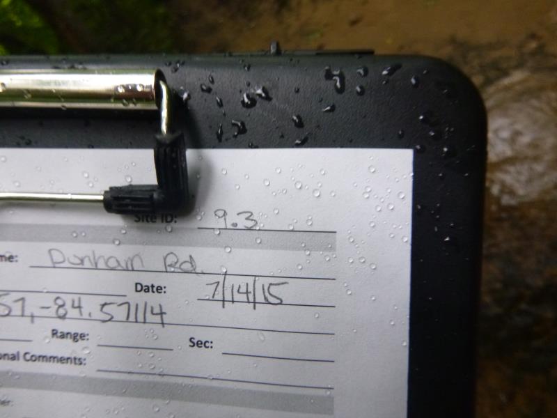
Road Stream Crossing Site ST009.3
Sturgeon River Watershed, Johnson Creek
Dunham Rd
Ellis Twp,
Cheboygan County
Information collected by:
Site Location
GPS Coordinates: 45.327183
, -84.570534
T34N
R02W
Sec 20
Owned by State
Fish Passability 1
Structure is NOT Perched
Total Erosion: 0.0609 tons/year
Severity: Minor
Year Inventoried: 2015
Site ID
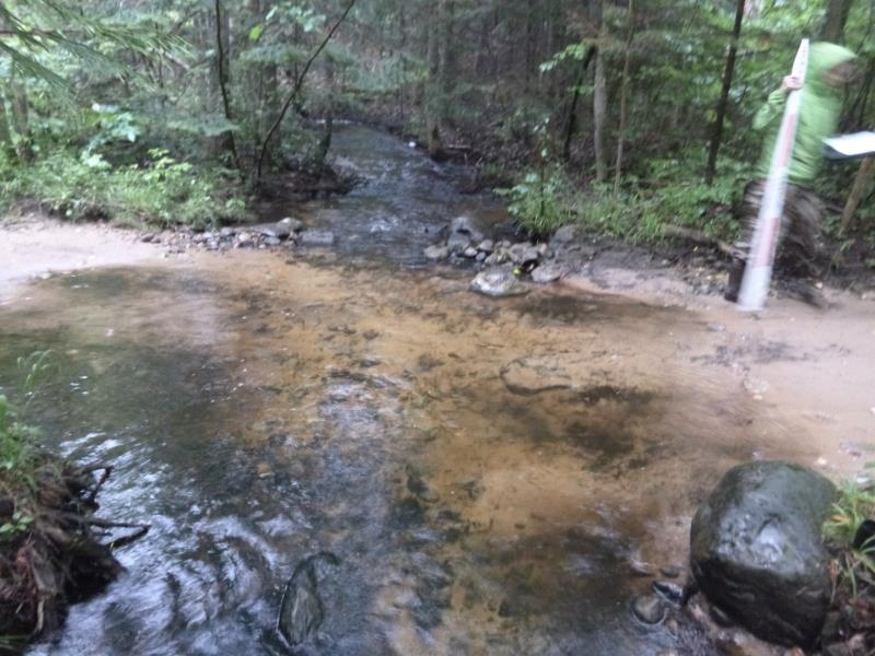
Inlet
Outlet
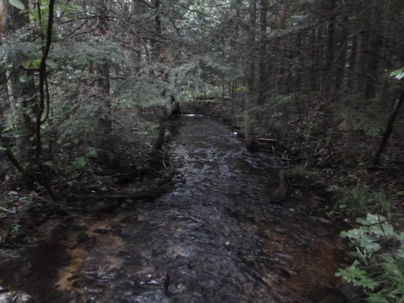
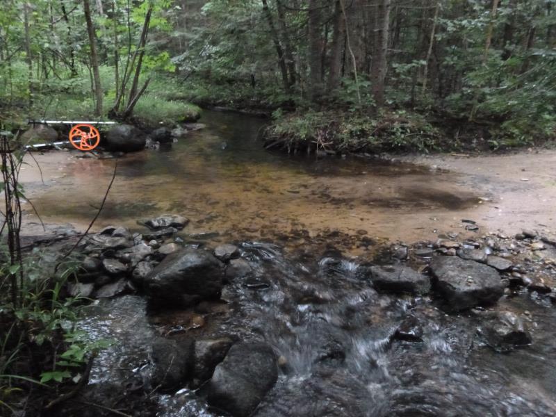
Downstream Conditions
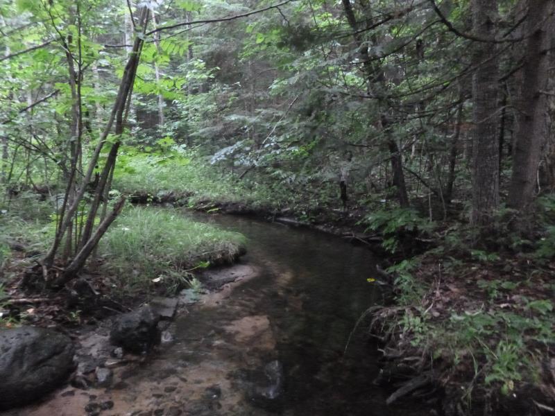
Upstream Conditions
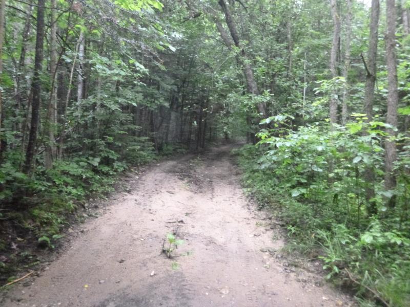
Road Approach - Left
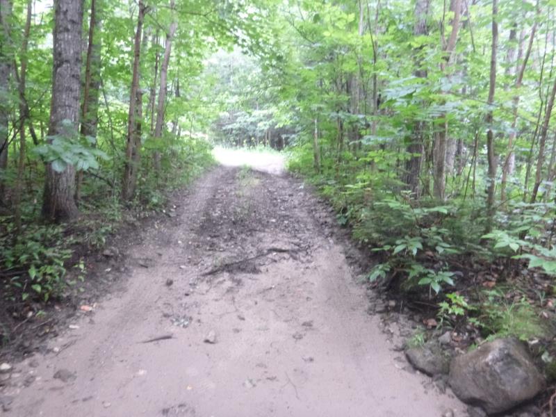
Road Approach - Right
Crossing Information
Type of Crossing: Ford
Structure Shape: Square/Rectangle
Inlet Type: Other
Outlet Type: Other
Structure Substrate: Sand
General Conditions: Good
Dimensions of Structure: Length 9.6 ft.
, Width 15 ft.
, Height 0.3 ft.
Structure is NOT Perched
Structure Inlet
Water Depth: 0.7 ft.
Embedded Depth of Structure: 0 ft.
Water Velocity*: 0.3 ft./sec.
Structure Outlet
Water Depth: 0.4 ft.
Embedded Depth of Structure: 0 ft.
Water Velocity*: 1.3 ft./sec.
*Water Velocities were measured 0.3 ft. below Surface
(with Meter)
Stream Information
Stream Flow: Less than Bankfull
Scour Pool: Length 0 ft.
, Width 0 ft.
, Depth 0 ft.
Upstream Pond: Length 0 ft.
, Width 0 ft.
, Depth 0 ft.
Riffle Information
Water Depth: 0.3 ft.
Bankfull Width: 9.8 ft.
Wetted Width: 8.1 ft.
Water Velocity: 0.5 ft./sec.
(Measured with Meter)
Dominant Substrate: Gravel
Road Information
Sand
State Road
Road Condition: Poor
Road Width at Culvert: 15 ft.
Location of Low Point: At Stream
Runoff Path: Ditch
Fill Depth: 0 ft.
Slope: More than 1:2
Fill Depth: 0 ft.
Slope: More than 1:2
Approaches
Left Approach
Length: 23 ft.
Slope: 1% to 5%
Vegetation: Partial
LS Factor: 0.244
Erosion: 0.0232 tons/year
Right Approach
Length: 33.4 ft.
Slope: 1% to 5%
Vegetation: Partial
LS Factor: 0.274
Erosion: 0.0378 tons/year
Erosion Information
Total Erosion at Crossing: 0.0609 tons/year
Extent of Erosion: Minor
Summary Information
Fish Passability 1
�