Road Stream Crossing Site ST010
Sturgeon River Watershed, Sturgeon River
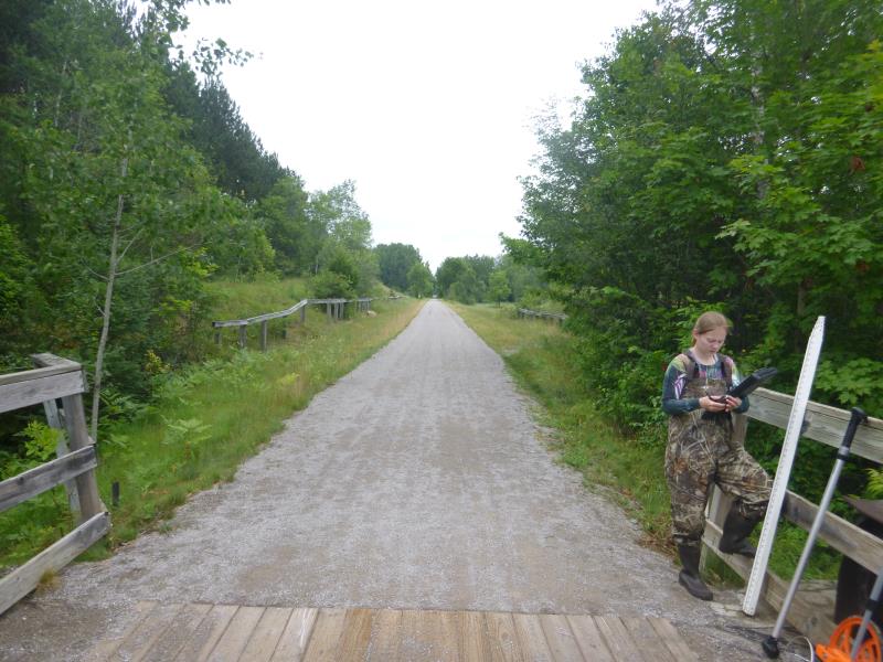
North Central State Trail
Mentor Twp,
Cheboygan County
Information collected by:
Site Location
GPS Coordinates: 45.322333
, -84.622867
T34N
R03W
Sec 24
Owned by Private
Fish Passability 1
Structure is NOT Perched
Total Erosion: 0.0955 tons/year
Severity: Moderate
Year Inventoried: 2015
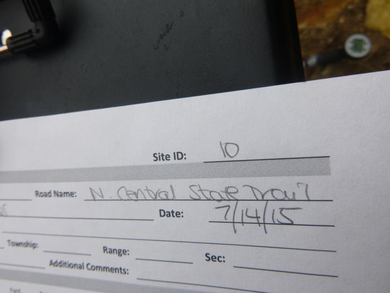
Site ID
Inlet
Outlet
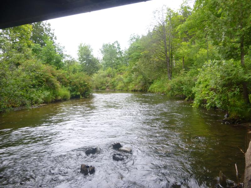
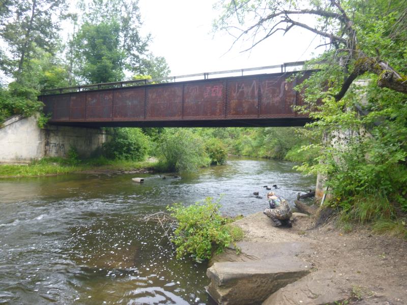
Upstream Conditions
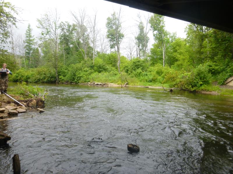
Downstream Conditions
Road Approach - Left
Road Approach - Right
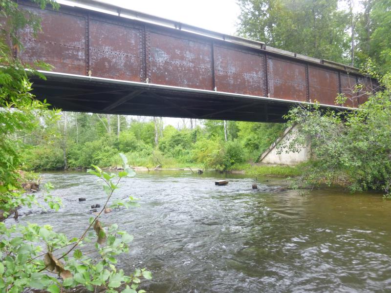
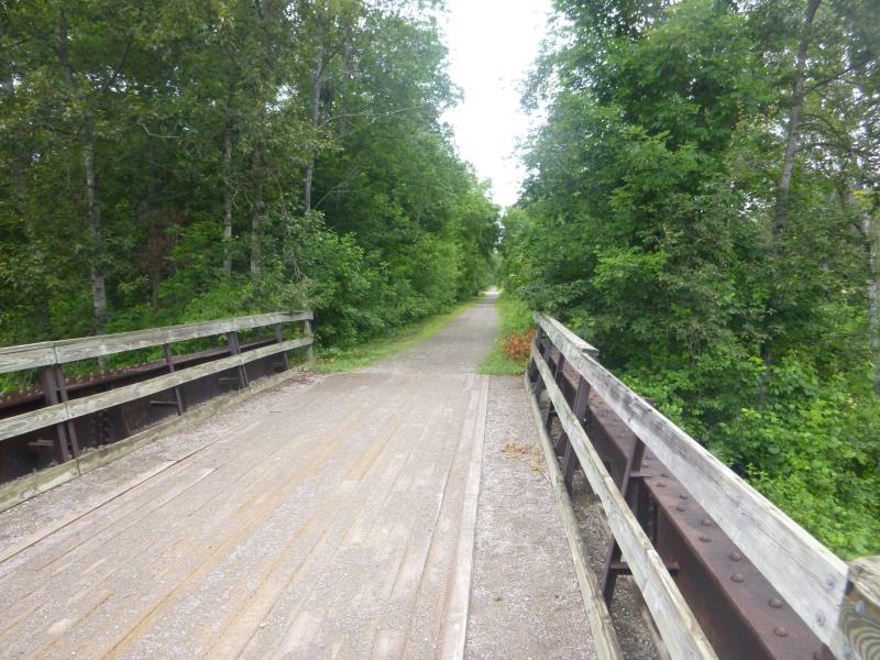
Crossing Information
Type of Crossing: Bridge
Structure Shape: Open Bottom Square/Rectangle
Inlet Type: Wingwall 30-70 Degree
Outlet Type: At Stream Grade
Structure Material: Concrete
Structure Substrate: Mixture
General Conditions: Good
Structure Interior: smooth
Dimensions of Structure: Length 20.1 ft.
, Width 38.5 ft.
, Height 11.9 ft.
Structure is NOT Perched
Structure Inlet
Water Depth: 3 ft.
Embedded Depth of Structure: 0 ft.
Water Velocity*: 3.8 ft./sec.
Structure Outlet
Water Depth: 4 ft.
Embedded Depth of Structure: 0 ft.
Water Velocity*: 4.5 ft./sec.
*Water Velocities were measured 2 ft. below Surface
(with Meter)
Stream Information
Stream Flow: Less than Bankfull
Scour Pool: Length 0 ft.
, Width 0 ft.
, Depth 0 ft.
Upstream Pond: Length 0 ft.
, Width 0 ft.
, Depth 0 ft.
Road Information
Gravel
State Road
Road Condition: Good
Road Width at Culvert: 12.1 ft.
Location of Low Point: Other
Runoff Path: Ditch
Fill Depth: 0 ft.
Slope: Vertical
Fill Depth: 0 ft.
Slope: Vertical
Approaches
Left Approach
Length: 434.5 ft.
Slope: Less Than 1%
Vegetation: Heavy
LS Factor: 0.05
Erosion: 0.0724 tons/year
Right Approach
Length: 0 ft.
Slope: Less Than 1%
Vegetation: Heavy
LS Factor: 0.05
Erosion: 0 tons/year
Erosion Information
Total Erosion at Crossing: 0.0955 tons/year
Extent of Erosion: Moderate
Erosion is occurring and corrective actions can be installed to address the problem.
Notes: Access point- stairs, dock, and bench
Location of Erosion | Erosion Dimensions | Eroded Material | Material Eroded | Total Erosion | ||
facing downstream | Length | Width | Depth | Reaching Stream? | (tons/year) | |
Left Downstream Streambank |
30 ft. |
9 ft. |
0.1 ft. |
yes |
Sand |
0.0231 |
Summary Information
Fish Passability 1
A future visit to this site is recommended. Monitor erosion around access
These non-native species were observerd at this site: Buckthorn, wild parsnip
�