Road Stream Crossing Site ST035
Sturgeon River Watershed, Sturgeon River
Freeway Trail
Nunda Twp,
Cheboygan County
Information collected by:
Site Location
GPS Coordinates: 45.236595
, -84.586079
T33N
R02W
Sec 20
Owned by Private
Fish Passability 1
Structure is NOT Perched
Total Erosion: 0 tons/year
Severity: Minor
Year Inventoried: 2015
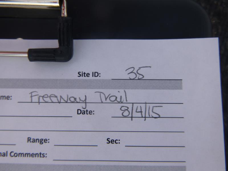
Site ID
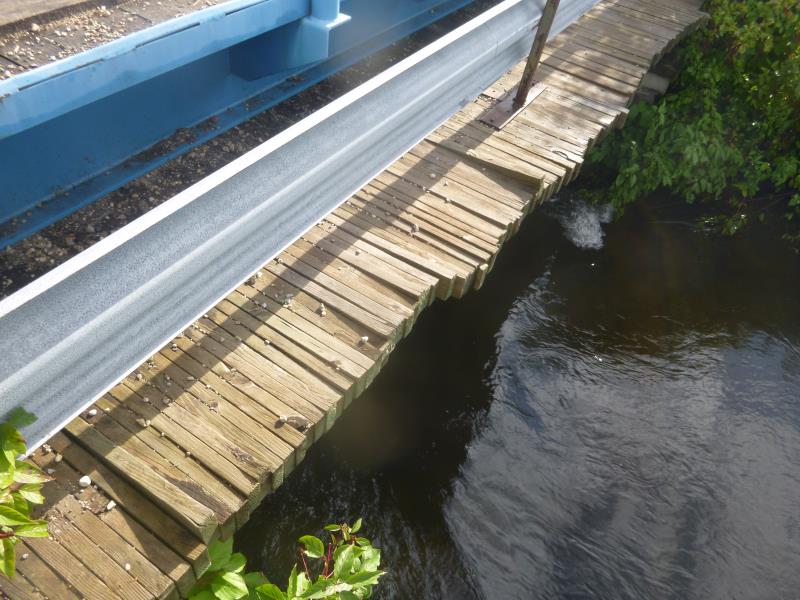
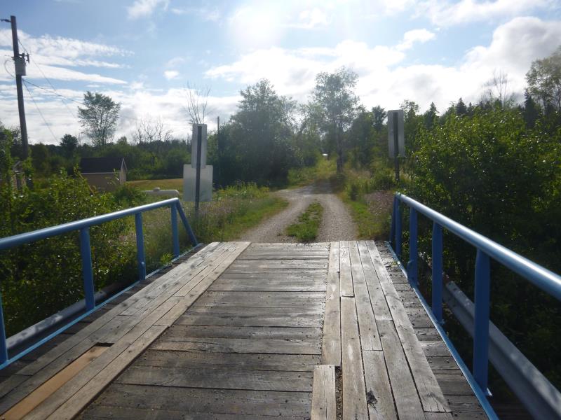
Inlet
Outlet
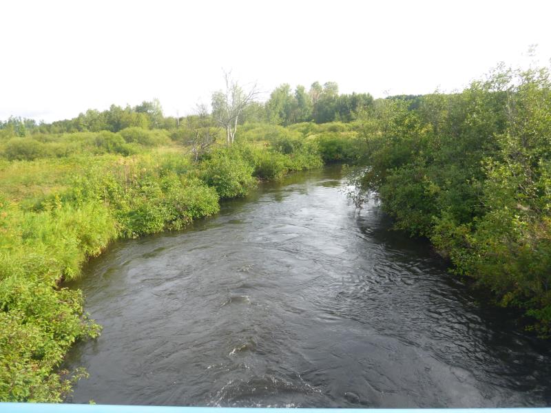
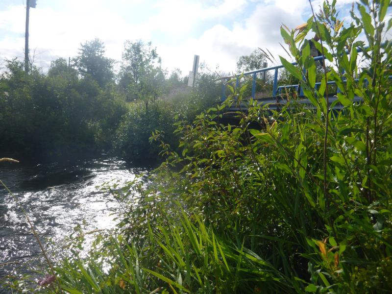
Downstream Conditions
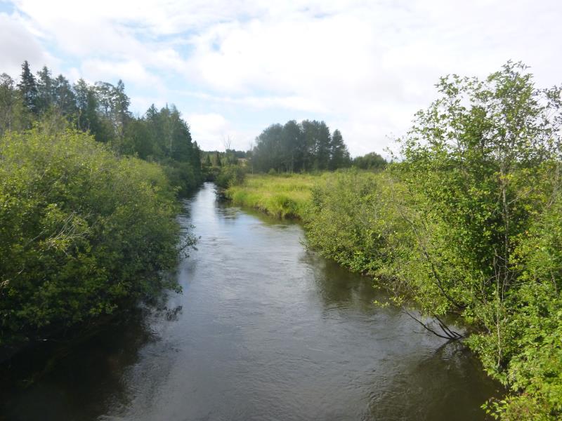
Upstream Conditions
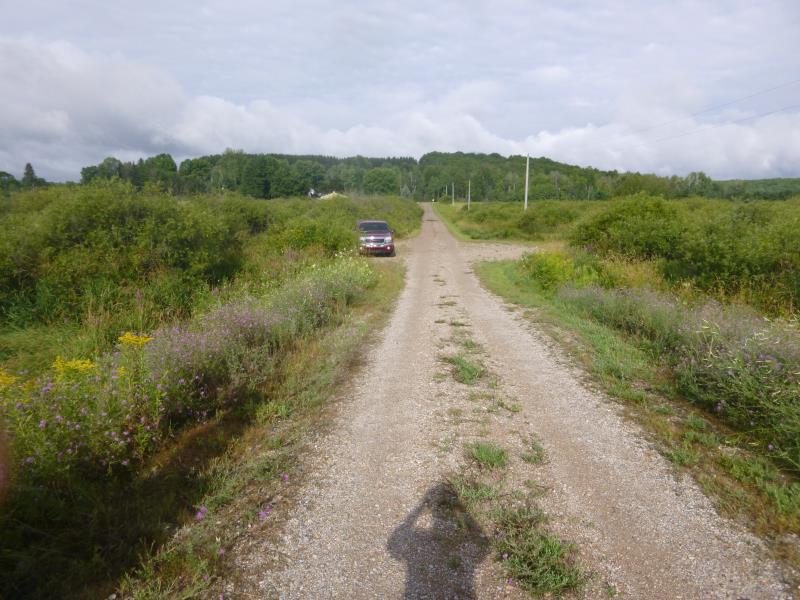
Road Approach - Left
Road Approach - Right
Crossing Information
Type of Crossing: Bridge
Structure Shape: Open Bottom Square/Rectangle
Inlet Type: Other
Outlet Type: At Stream Grade
Structure Material: Wood
Structure Substrate: Mixture
General Conditions: Good
Structure Interior: smooth
Dimensions of Structure: Length 16.1 ft.
, Width 37.5 ft.
, Height 8.2 ft.
Structure is NOT Perched
Structure Inlet
Water Depth: 2.7 ft.
Embedded Depth of Structure: 0 ft.
Water Velocity*: 2.3 ft./sec.
Structure Outlet
Water Depth: 3 ft.
Embedded Depth of Structure: 0 ft.
Water Velocity*: 2.3 ft./sec.
*Water Velocities were measured at the Surface
(with Float Test)
Stream Information
Stream Flow: Less than Bankfull
Scour Pool: Length 0 ft.
, Width 0 ft.
, Depth 0 ft.
Upstream Pond: Length 0 ft.
, Width 0 ft.
, Depth 0 ft.
Road Information
Gravel
County Road
Road Condition: Fair
Road Width at Culvert: 16.1 ft.
Location of Low Point: Other
Runoff Path: Ditch
Fill Depth: 0 ft.
Slope: Vertical
Fill Depth: 0 ft.
Slope: Vertical
Approaches
Left Approach
Length: 0 ft.
Slope: Less Than 1%
Vegetation: Heavy
LS Factor: 0.05
Erosion: 0 tons/year
Right Approach
Length: 0 ft.
Slope: Less Than 1%
Vegetation: Heavy
LS Factor: 0.05
Erosion: 0 tons/year
Erosion Information
Total Erosion at Crossing: 0 tons/year
Summary Information
Fish Passability 1
These non-native species were observerd at this site: Purple loosestrife
�