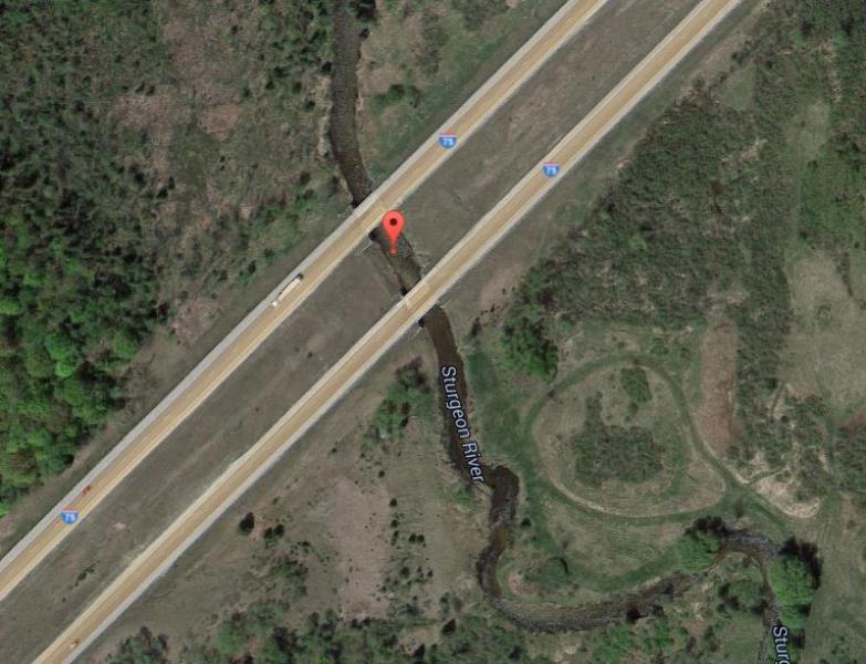
Road Stream Crossing Site ST060
Sturgeon River Watershed, Sturgeon River
I-75
Nunda Twp,
Cheboygan County
Information collected by:
Site Location
GPS Coordinates: 45.217266
, -84.570136
T33N
R02W
Sec 30
Owned by Private
Federal
Federal
Total Erosion: 0 tons/year
Year Inventoried: 2015
Other
Crossing Information
Type of Crossing: Bridge
Structure Shape: Open Bottom Square/Rectangle
Inlet Type: Other
Outlet Type: At Stream Grade
Structure Material: Concrete
Structure Substrate: Mixture
General Conditions: Good
Structure Interior: smooth
Additional Comments
Crosses I-75: Not fully inventoried (safety concern and should be in good condition resource-wise)
Road Information
Paved
Federal Road
Road Condition: Good
Erosion Information
Total Erosion at Crossing: 0 tons/year
Summary Information
�