Road Stream Crossing Site ST070
Sturgeon River Watershed, West Branch Sturgeon River
Real Water Rd
Wilmot Twp,
Cheboygan County
Information collected by:
Site Location
GPS Coordinates: 45.228239
, -84.691286
T33N
R03W
Sec 28
Owned by State
Fish Passability 0.5
Structure is NOT Perched
Total Erosion: 1.659 tons/year
Severity: Severe
Year Inventoried: 2015
Site ID
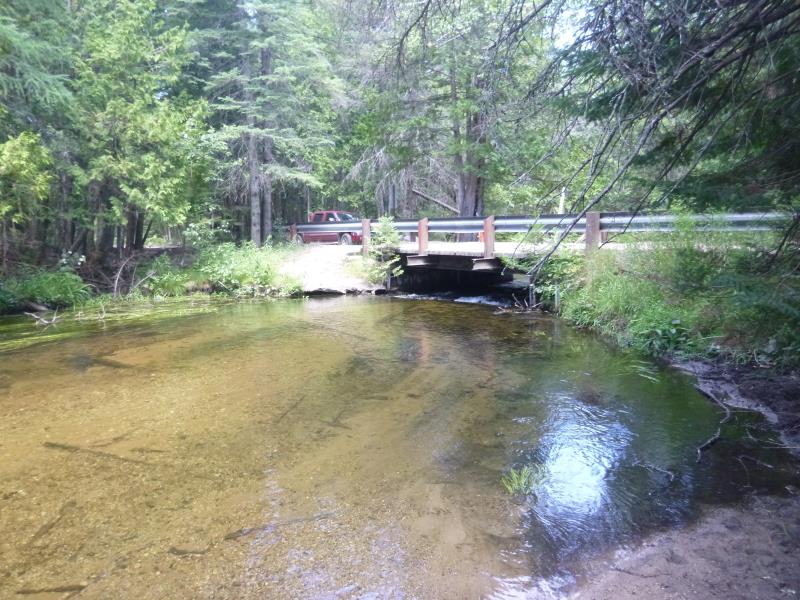
Inlet
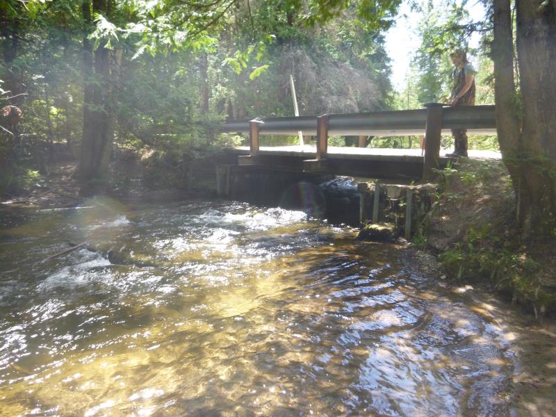
Outlet
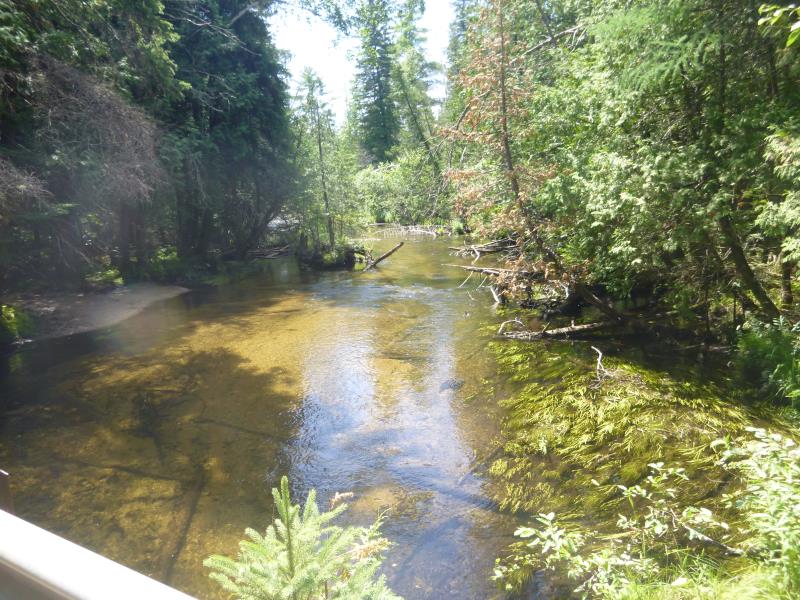
Upstream Conditions
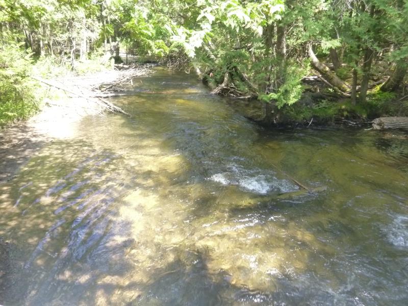
Downstream Conditions
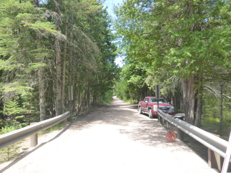
Road Approach - Left
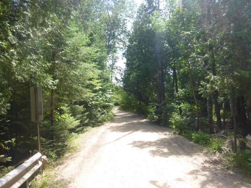
Road Approach - Right
Crossing Information
Type of Crossing: Bridge
Structure Shape: Open Bottom Square/Rectangle
Inlet Type: Other
Outlet Type: At Stream Grade
Structure Material: Wood
Structure Substrate: Mixture
General Conditions: Poor
Structure Interior: smooth
Dimensions of Structure: Length 15 ft.
, Width 16.3 ft.
, Height 5 ft.
Structure is NOT Perched
Structure Inlet
Water Depth: 1.7 ft.
Embedded Depth of Structure: 0 ft.
Water Velocity*: 2.5 ft./sec.
Structure Outlet
Water Depth: 1.5 ft.
Embedded Depth of Structure: 0 ft.
Water Velocity*: 2.5 ft./sec.
*Water Velocities were measured at the Surface
(with Float Test)
Stream Information
Stream Flow: Less than Bankfull
Scour Pool: Length 46 ft.
, Width 30 ft.
, Depth 4.9 ft.
Upstream Pond: Length 74 ft.
, Width 39 ft.
, Depth 2.2 ft.
Riffle Information
Water Depth: 1.7 ft.
Bankfull Width: 31.5 ft.
Wetted Width: 30 ft.
Water Velocity: 1.25 ft./sec.
(Measured with Float Test)
Dominant Substrate: Cobble
Road Information
Sand
State Road
Road Condition: Fair
Road Width at Culvert: 15 ft.
Location of Low Point: At Stream
Runoff Path: Ditch
Fill Depth: 0 ft.
Slope: Vertical
Fill Depth: 0 ft.
Slope: Vertical
Approaches
Left Approach
Length: 500 ft.
Slope: 1% to 5%
Vegetation: Heavy
LS Factor: 0.5
Erosion: 1.0331 tons/year
Right Approach
Length: 239 ft.
Slope: 1% to 5%
Vegetation: Heavy
LS Factor: 0.438
Erosion: 0.4324 tons/year
Erosion Information
Total Erosion at Crossing: 1.659 tons/year
Extent of Erosion: Severe
Erosion is occurring and corrective actions can be installed to address the problem.
Notes: Access point to the river, the left upstream streambank was filled with concrete to help stabilize it
Location of Erosion | Erosion Dimensions | Eroded Material | Material Eroded | Total Erosion | ||
facing downstream | Length | Width | Depth | Reaching Stream? | (tons/year) | |
Left Downstream Streambank |
30 ft. |
14 ft. |
0.1 ft. |
yes |
Sand |
0.066 |
Left Upstream Streambank |
12 ft. |
8 ft. |
0.1 ft. |
yes |
Sand |
0.0264 |
Right Upstream Streambank |
23 ft. |
22 ft. |
0.2 ft. |
yes |
Sand |
0.1012 |
Summary Information
Fish Passability 0.5
Erosion is an area of concern for this site.
Bridge is too narrow for the natural width of the stream
A future visit to this site is recommended. Monitor erosion
�