Road Stream Crossing Site ST106
Sturgeon River Watershed, West Branch Sturgeon River
Thumb Lake Rd
Corwith Twp,
Otsego County
Information collected by:
Site Location
GPS Coordinates: 45.1867
, -84.6977
T32N
R03W
Sec 8
Owned by Private
Fish Passability 0
Structure is NOT Perched
Total Erosion: 4.0661 tons/year
Severity: Severe
Year Inventoried: 2015

Site ID
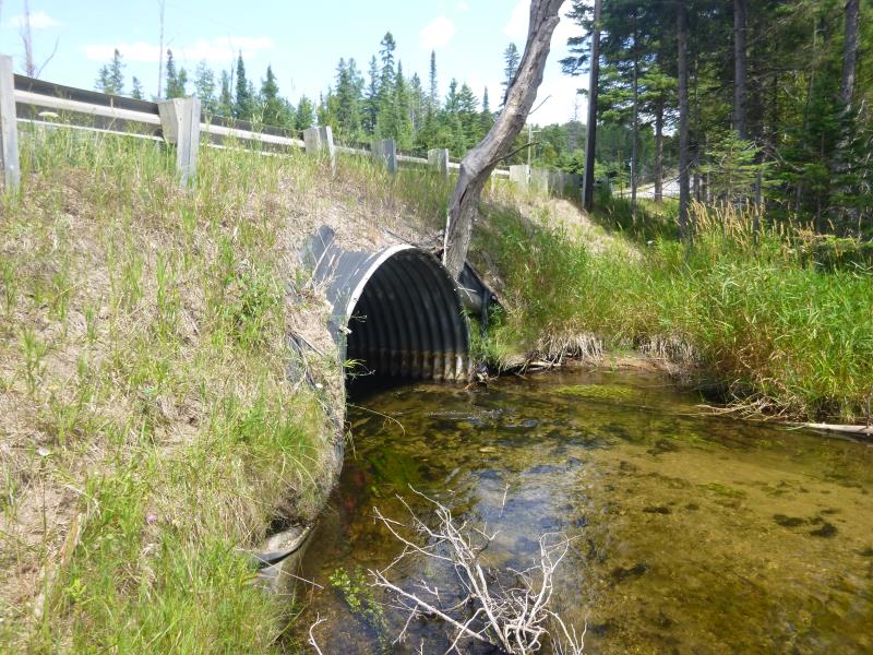
Inlet
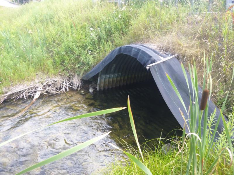
Outlet
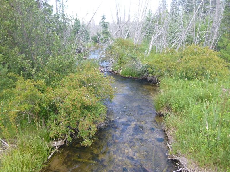
Downstream Conditions
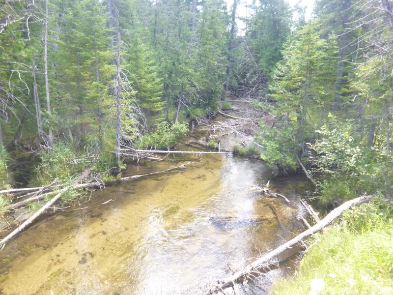
Upstream Conditions
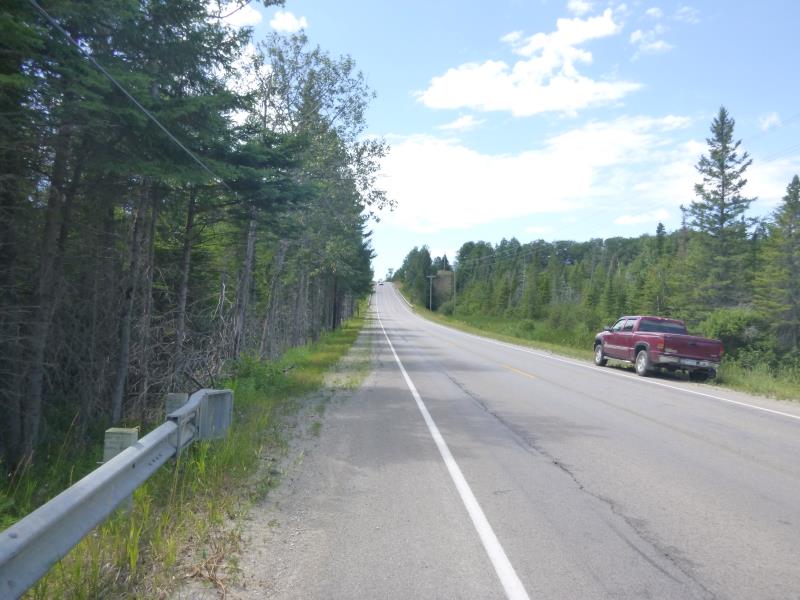
Road Approach - Left
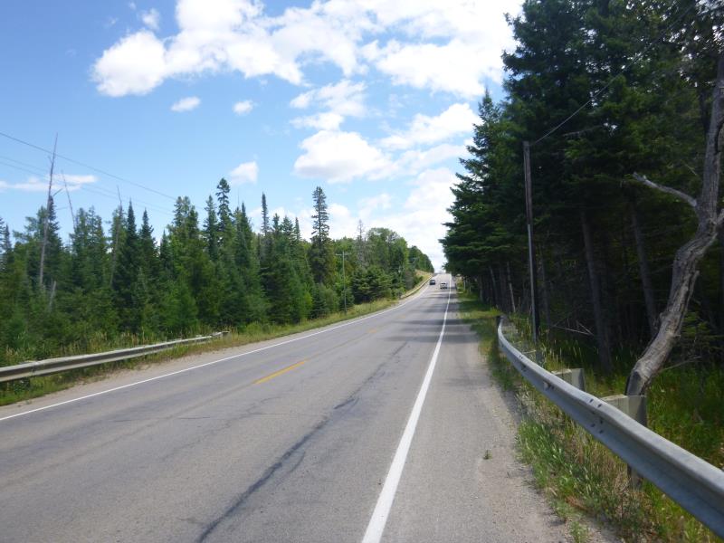
Road Approach - Right
Crossing Information
Type of Crossing: culvert(s)
Number of Structures: 1
Structure Shape: Pipe Arch
Inlet Type: Projecting
Outlet Type: At Stream Grade
Structure Material: Metal
Structure Substrate: Mixture
General Conditions: New
Structure Interior: corrugated
Dimensions of Structure: Length 45 ft.
, Width 10 ft.
, Height 6.6 ft.
Structure is NOT Perched
Structure Inlet
Water Depth: 1.1 ft.
Embedded Depth of Structure: 0.2 ft.
Water Velocity*: 3.75 ft./sec.
Structure Outlet
Water Depth: 2.2 ft.
Embedded Depth of Structure: 0.2 ft.
Water Velocity*: 3.75 ft./sec.
*Water Velocities were measured at the Surface
(with Float Test)
Stream Information
Stream Flow: Less than Bankfull
Scour Pool: Length 0 ft.
, Width 0 ft.
, Depth 0 ft.
Upstream Pond: Length 0 ft.
, Width 0 ft.
, Depth 0 ft.
Riffle Information
Water Depth: 1.8 ft.
Bankfull Width: 23.5 ft.
Wetted Width: 20 ft.
Water Velocity: 1 ft./sec.
(Measured with Float Test)
Dominant Substrate: Sand
Road Information
Paved
State Road
Road Condition: Good
Road Width at Culvert: 30 ft.
Location of Low Point: At Stream
Runoff Path: Ditch
Embankments
Upstream
Fill Depth: 2.7 ft.
Slope: 1:2
Downstream
Fill Depth: 2.6 ft.
Slope: 1:2
Approaches
Left Approach
Length: 1000 ft.
Slope: 6% to 10%
Vegetation: Heavy
LS Factor: 2.05
Erosion: 2.0331 tons/year
Right Approach
Length: 1000 ft.
Slope: 6% to 10%
Vegetation: Heavy
LS Factor: 2.05
Erosion: 2.0331 tons/year
Erosion Information
Total Erosion at Crossing: 4.0661 tons/year
Location of Erosion | Erosion Dimensions | Eroded Material | Material Eroded | Total Erosion | ||
facing downstream | Length | Width | Depth | Reaching Stream? | (tons/year) | |
Right Upstream Embankment |
10 ft. |
20 ft. |
0.2 ft. |
yes |
Sand |
|
Summary Information
Fish Passability 0
A future visit to this site is recommended. Watch for erosion from road
These non-native species were observerd at this site: Queen Anne's lace, reed canary grass
�