Road Stream Crossing Site ST127
Sturgeon River Watershed, Unknown
Myrtle Lane
Corwith Twp,
Otsego County
Information collected by:
Site Location
GPS Coordinates: 45.173133
, -84.73475
T32N
R03W
Sec 18
Owned by Private
Fish Passability 0.5
Structure is NOT Perched
Total Erosion: 6.0081 tons/year
Severity: Severe
Year Inventoried: 2015
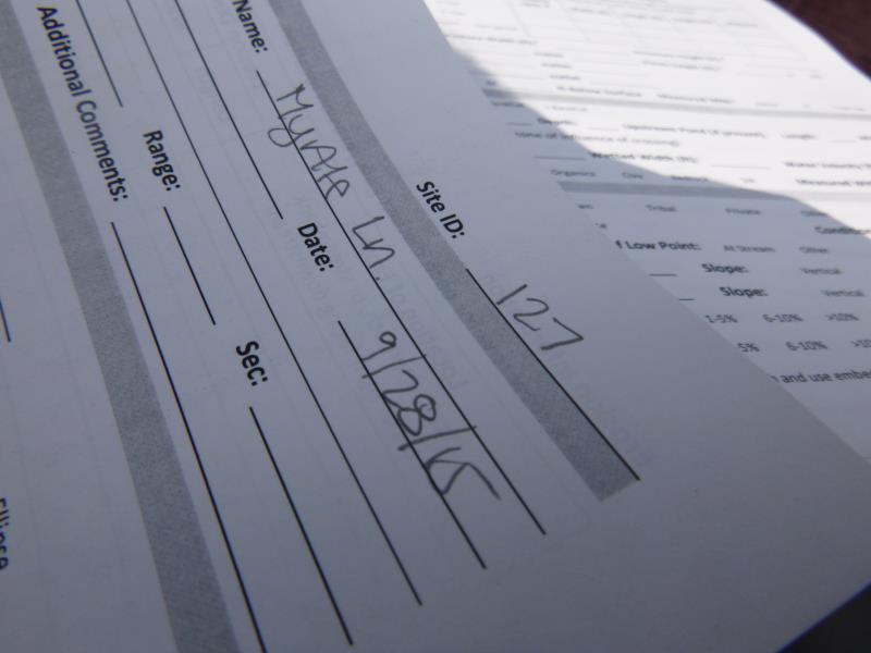
Site ID

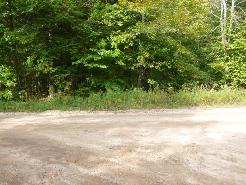
Inlet
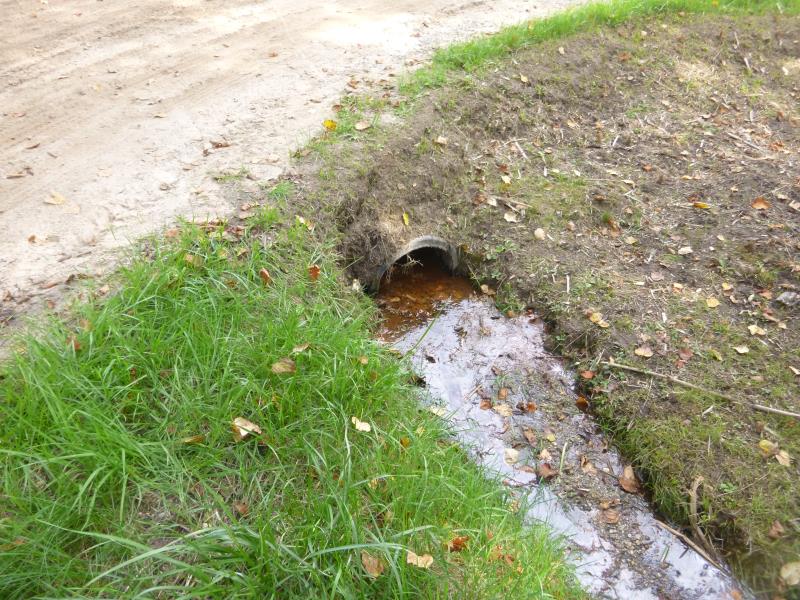
Outlet
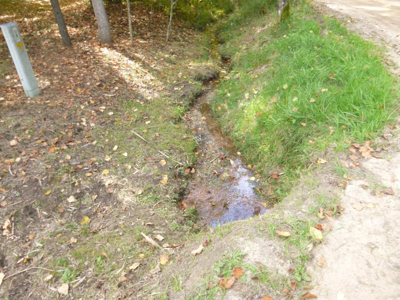
Downstream Conditions
Upstream Conditions
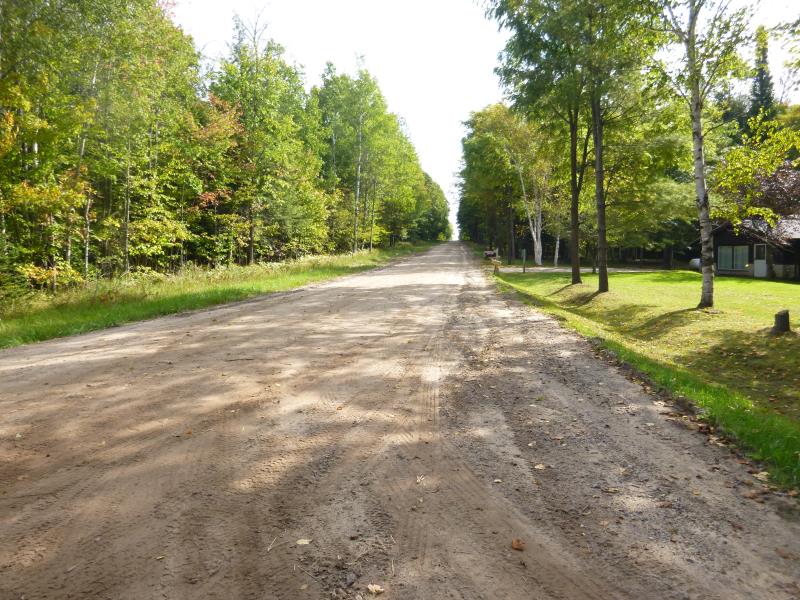
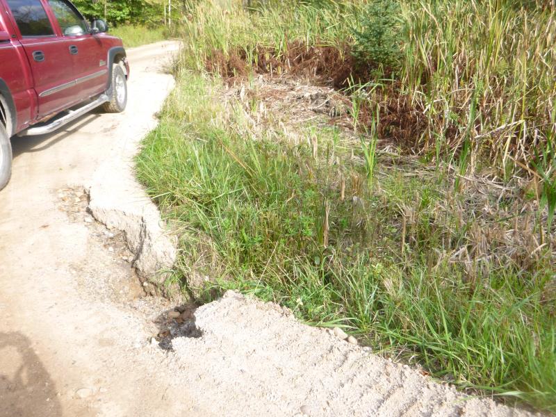
Road Approach - Left
Road Approach - Right
Crossing Information
Type of Crossing: culvert(s)
Number of Structures: 1
Structure Shape: Round
Inlet Type: Projecting
Outlet Type: At Stream Grade
Structure Material: Plastic
Structure Substrate: Sand
General Conditions: Fair
Structure Interior: smooth
Dimensions of Structure: Length 47 ft.
, Width 1.4 ft.
, Height 1.2 ft.
Structure is NOT Perched
Structure Inlet
Water Depth: 0.5 ft.
Embedded Depth of Structure: 0.1 ft.
Water Velocity*: 0.1 ft./sec.
Structure Outlet
Water Depth: 0.15 ft.
Embedded Depth of Structure: 0.1 ft.
Water Velocity*: 0.1 ft./sec.
*Water Velocities were measured at the Surface
(with Float Test)
Stream Information
Stream Flow: Less than 1/2 Bankfull
Scour Pool: Length 0 ft.
, Width 0 ft.
, Depth 0 ft.
Upstream Pond: Length 0 ft.
, Width 0 ft.
, Depth 0 ft.
Riffle Information
Water Depth: 0.1 ft.
Bankfull Width: 3 ft.
Wetted Width: 1.8 ft.
Water Velocity: 0.1 ft./sec.
(Measured with Float Test)
Dominant Substrate: Sand
Road Information
Sand
County Road
Road Condition: Fair
Road Width at Culvert: 37.5 ft.
Location of Low Point: Other
Runoff Path: Ditch
Embankments
Upstream
Fill Depth: 1.4 ft.
Slope: Vertical
Downstream
Fill Depth: 1.4 ft.
Slope: 1:1.5
Approaches
Left Approach
Length: 1000 ft.
Slope: 1% to 5%
Vegetation: Heavy
LS Factor: 0.57
Erosion: 5.8884 tons/year
Right Approach
Length: 0 ft.
Slope: Less Than 1%
Vegetation: None
LS Factor: 0.05
Erosion: 0 tons/year
Erosion Information
Total Erosion at Crossing: 6.0081 tons/year
Extent of Erosion: Moderate
Erosion is occurring and corrective actions can be installed to address the problem.
Location of Erosion | Erosion Dimensions | Eroded Material | Material Eroded | Total Erosion | ||
facing downstream | Length | Width | Depth | Reaching Stream? | (tons/year) | |
Left Upstream Streambank |
9 ft. |
2.5 ft. |
1.9 ft. |
yes |
Gravel |
0.1197 |
Summary Information
Fish Passability 0.5
A future visit to this site is recommended. Road washout/erosion area
�