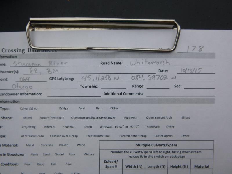
Road Stream Crossing Site ST178
Sturgeon River Watershed, Sturgeon River
Whitmarsh Rd
Dover Twp,
Otsego County
Information collected by:
Site Location
GPS Coordinates: 45.11275
, -84.59735
T31N
R02W
Sec 6
Owned by Private
Fish Passability 1
Structure is NOT Perched
Total Erosion: 4.9748 tons/year
Severity: Severe
Year Inventoried: 2015
Site ID
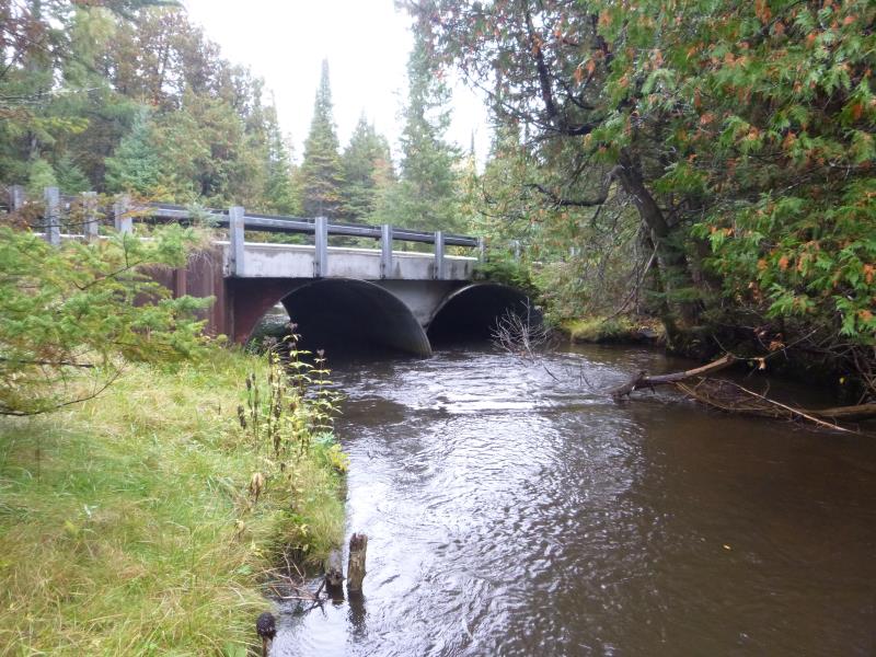
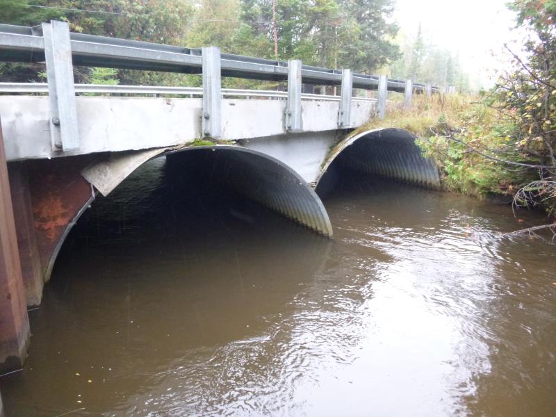
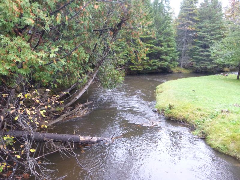
Inlet
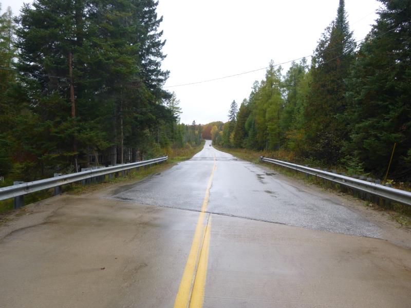
Outlet
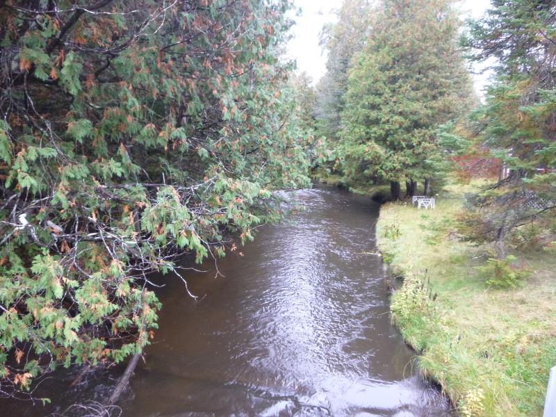
Upstream Conditions
Downstream Conditions
Road Approach - Left
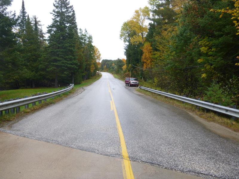
Road Approach - Right
Crossing Information
Type of Crossing: culvert(s)
Number of Structures: 2
Structure Shape: Round
Inlet Type: Projecting
Outlet Type: At Stream Grade
Structure Material: Metal
Structure Substrate: Rock
General Conditions: Good
Multiple Culverts/Spans | ||||
Culvert/Span | Width | Length | Height | Material |
2 |
13 ft. |
35 ft. |
8.5 ft. |
Metal |
Structure Interior: corrugated
Dimensions of Structure: Length 35 ft.
, Width 30 ft.
, Height 10.5 ft.
Structure is NOT Perched
Structure Inlet
Water Depth: 2.9 ft.
Embedded Depth of Structure: 0 ft.
Water Velocity*: 1.6 ft./sec.
Structure Outlet
Water Depth: 2.9 ft.
Embedded Depth of Structure: 0 ft.
Water Velocity*: 1.9 ft./sec.
*Water Velocities were measured 0.5 ft. below Surface
(with Meter)
Additional Comments
Embedded depth= hard rock and sand
Stream Information
Stream Flow: Less than Bankfull
Scour Pool: Length 0 ft.
, Width 0 ft.
, Depth 0 ft.
Upstream Pond: Length 0 ft.
, Width 0 ft.
, Depth 0 ft.
Riffle Information
Water Depth: 1.6 ft.
Bankfull Width: 29 ft.
Wetted Width: 34 ft.
Water Velocity: 1.8 ft./sec.
(Measured with Meter)
Dominant Substrate: Sand
Road Information
Paved
County Road
Road Condition: Good
Road Width at Culvert: 26 ft.
Location of Low Point: At Stream
Runoff Path: Ditch
Embankments
Upstream
Fill Depth: 10.5 ft.
Slope: Vertical
Downstream
Fill Depth: 10.5 ft.
Slope: Vertical
Approaches
Left Approach
Length: 60 ft.
Slope: Less Than 1%
Vegetation: Heavy
LS Factor: 0.05
Erosion: 0.0026 tons/year
Right Approach
Length: 1000 ft.
Slope: More Than 10%
Vegetation: Heavy
LS Factor: 5.785
Erosion: 4.9722 tons/year
Erosion Information
Total Erosion at Crossing: 4.9748 tons/year
Summary Information
Fish Passability 1
�