Road Stream Crossing Site UBR_ER0.5
Upper Black River Watershed, East Branch Rainy River
Northeastern State Trail
Case Twp,
Presque Isle County
Information collected by:
Site Location
GPS Coordinates: 45.32851
, -84.12566
T34N
R3E
Sec 18
Owned by Private
State
State
Fish Passability 0.9
Structure is NOT Perched
Total Erosion: 1.9396 tons/year
Severity: Moderate
Year Inventoried: 2015
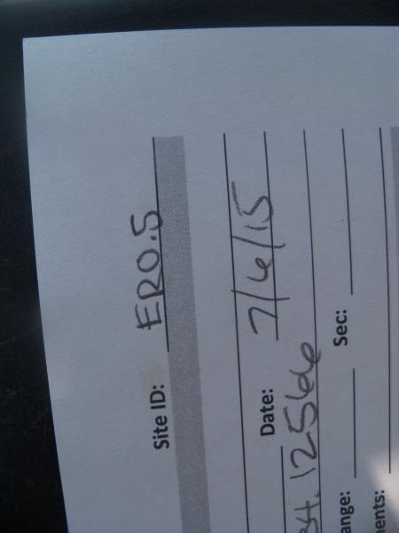
Site ID
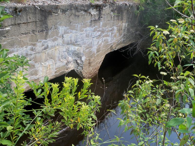
Inlet
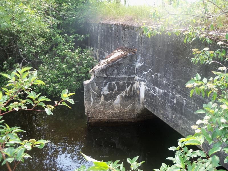
Outlet
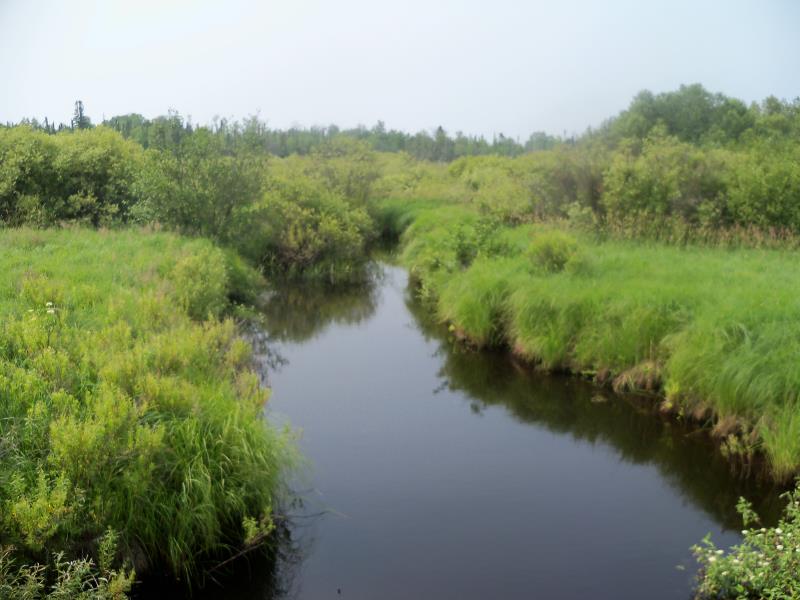
Upstream Conditions
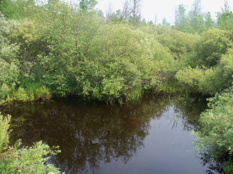
Downstream Conditions
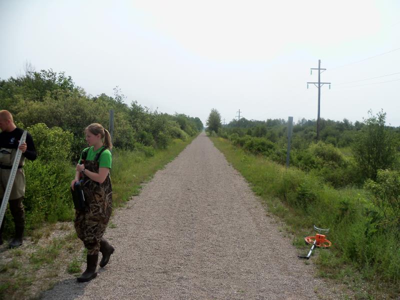
Road Approach - Right
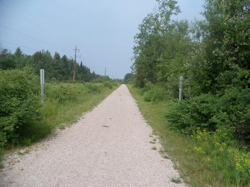
Road Approach - Left
Crossing Information
Type of Crossing: culvert(s)
Number of Structures: 2
Structure Shape: Open Bottom Square/Rectangle
Inlet Type: Wingwall 10-30 Degree
Outlet Type: At Stream Grade
Structure Material: Concrete
Structure Substrate: Sand
General Conditions: Fair
Multiple Culverts/Spans | ||||
Culvert/Span | Width | Length | Height | Material |
2 |
10.6 ft. |
32 ft. |
5.2 ft. |
Concrete |
Structure Interior: smooth
Dimensions of Structure: Length 32 ft.
, Width 10.6 ft.
, Height 5 ft.
Structure is NOT Perched
Structure Inlet
Water Depth: 3.35 ft.
Embedded Depth of Structure: 0.05 ft.
Water Velocity*: 0.1 ft./sec.
Structure Outlet
Water Depth: 3.6 ft.
Embedded Depth of Structure: 0.3 ft.
Water Velocity*: 0.1 ft./sec.
*Water Velocities were measured 2.5 ft. below Surface
(with Meter)
Stream Information
Stream Flow: Less than Bankfull
Scour Pool: Length 0 ft.
, Width 0 ft.
, Depth 0 ft.
Upstream Pond: Length 0 ft.
, Width 0 ft.
, Depth 0 ft.
Riffle Information
Water Depth: 0 ft.
Bankfull Width: 0 ft.
Wetted Width: 0 ft.
Water Velocity: 0 ft./sec.
Road Information
Gravel
State Road
Road Condition: Good
Road Width at Culvert: 15 ft.
Location of Low Point: At Stream
Runoff Path: Ditch
Embankments
Upstream
Fill Depth: 0.9 ft.
Slope: Vertical
Downstream
Fill Depth: 0.7 ft.
Slope: Vertical
Approaches
Left Approach
Length: 769 ft.
Slope: 1% to 5%
Vegetation: Heavy
LS Factor: 0.545
Erosion: 1.733 tons/year
Right Approach
Length: 1000 ft.
Slope: Less Than 1%
Vegetation: Heavy
LS Factor: 0.05
Erosion: 0.2066 tons/year
Erosion Information
Total Erosion at Crossing: 1.9396 tons/year
Extent of Erosion: Minor
Summary Information
Fish Passability 0.9
These non-native species were observerd at this site: Leafy Spurge, Honeysuckle
�