Road Stream Crossing Site UBR_MB10
Upper Black River Watershed, Little McMasters Creek
Clark Bridge Rd
Forest Twp,
Cheboygan County
Information collected by:
Site Location
GPS Coordinates: 45.22125
, -84.3523
T33N
R1E
Sec 30
Owned by Private
Fish Passability 0
Perch Height: 0.3 ft.
Total Erosion: 5.8099 tons/year
Severity: Severe
Year Inventoried: 2014

Site ID
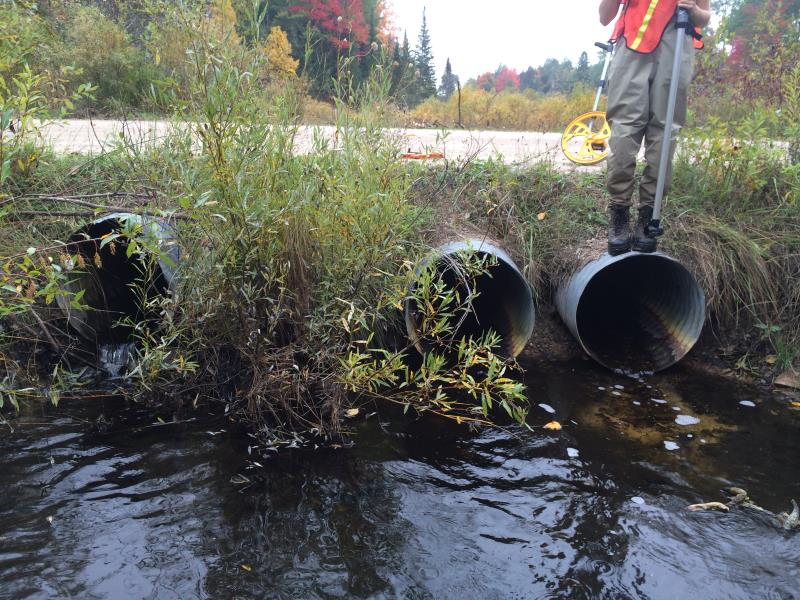
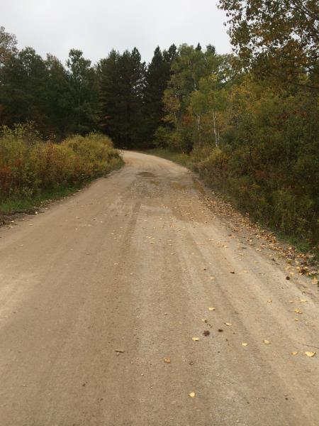
Outlet
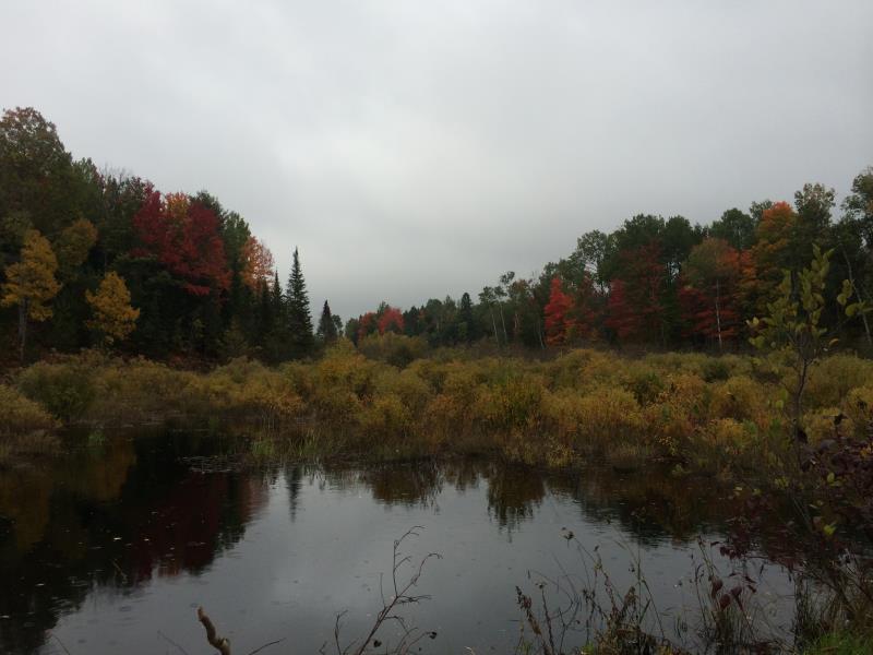
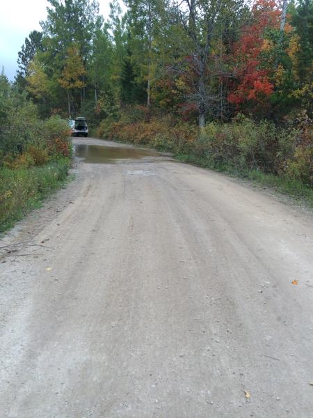
Upstream Conditions
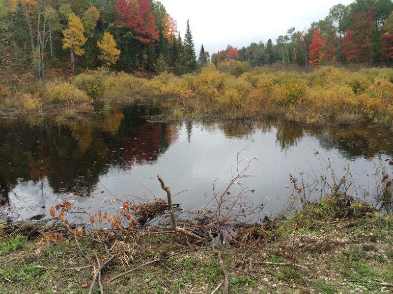
Upstream Conditions
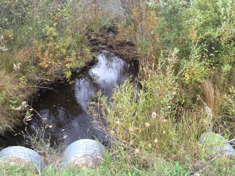
Downstream Conditions
Road Approach - Right
Road Approach - Left
Crossing Information
Type of Crossing: culvert(s)
Number of Structures: 3
Structure Shape: Round
Inlet Type: Projecting
Outlet Type: Freefall into Pool
Structure Material: Metal
Structure Substrate: Gravel
General Conditions: Poor
Multiple Culverts/Spans | ||||
Culvert/Span | Width | Length | Height | Material |
1 |
2.2 ft. |
28.4 ft. |
2.2 ft. |
Metal |
2 |
2.2 ft. |
28.4 ft. |
2.2 ft. |
Metal |
3 |
2.2 ft. |
28.4 ft. |
2.2 ft. |
Metal |
Structure Interior: corrugated
Dimensions of Structure: Length 28.4 ft.
, Width 2.2 ft.
, Height 2.2 ft.
Percentage Plugged:
Inlet: 76% to 100%
Outlet: 0%
In Pipe: 76% to 100%
Perch Height: 0.3 ft.
Structure Inlet
Water Depth: 3 ft.
Embedded Depth of Structure: 2.2 ft.
Water Velocity*: 0.1 ft./sec.
Structure Outlet
Water Depth: 0.6 ft.
Embedded Depth of Structure: 0 ft.
Water Velocity*: 0.1 ft./sec.
*Water Velocities were measured at the Surface
(with Meter)
Additional Comments
completely buried at inlet by beaver dams; flooding road in 2 areas; did not measure a riffle
Stream Information
Stream Flow: More than Bankfull
Scour Pool: Length 0 ft.
, Width 0 ft.
, Depth 0 ft.
Upstream Pond: Length 100 ft.
, Width 100 ft.
, Depth 3 ft.
Riffle Information
Water Depth: 0 ft.
Bankfull Width: 0 ft.
Wetted Width: 0 ft.
Water Velocity: 0 ft./sec.
(Measured with Meter)
Road Information
Gravel
County Road
Road Condition: Fair
Road Width at Culvert: 18.5 ft.
Location of Low Point: At Stream
Runoff Path: Ditch
Fill Depth: 0 ft.
Slope: Vertical
Fill Depth: 3 ft.
Slope: 1:2
Approaches
Left Approach
Length: 1000 ft.
Slope: 1% to 5%
Vegetation: Heavy
LS Factor: 0.57
Erosion: 2.905 tons/year
Right Approach
Length: 1000 ft.
Slope: 1% to 5%
Vegetation: Heavy
LS Factor: 0.57
Erosion: 2.905 tons/year
Erosion Information
Total Erosion at Crossing: 5.8099 tons/year
Summary Information
Fish Passability 0
Fish Passage is an area of concern for this site.
Completely blocked; passability = none
A future visit to this site is recommended. Beaver dam clogged upstream culverts- flooded road; perched culverts
�