Road Stream Crossing Site UBR_MB23
Upper Black River Watershed, Bowen Creek
E Tower Rd
Forest Twp,
Cheboygan County
Information collected by:
Site Location
GPS Coordinates: 45.35669
, -84.28824
T34N
R1E
Sec 2, 3
Owned by Private
Fish Passability 0
Structure is NOT Perched
Total Erosion: 4.7824 tons/year
Severity: Severe
Year Inventoried: 2014
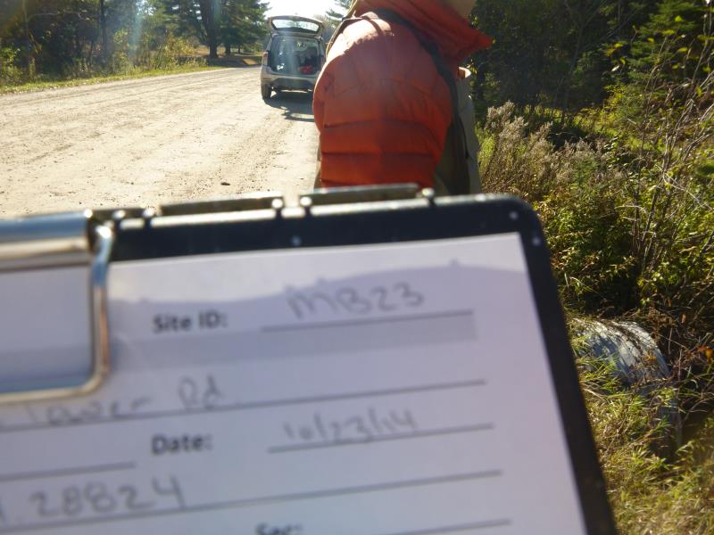
Site ID
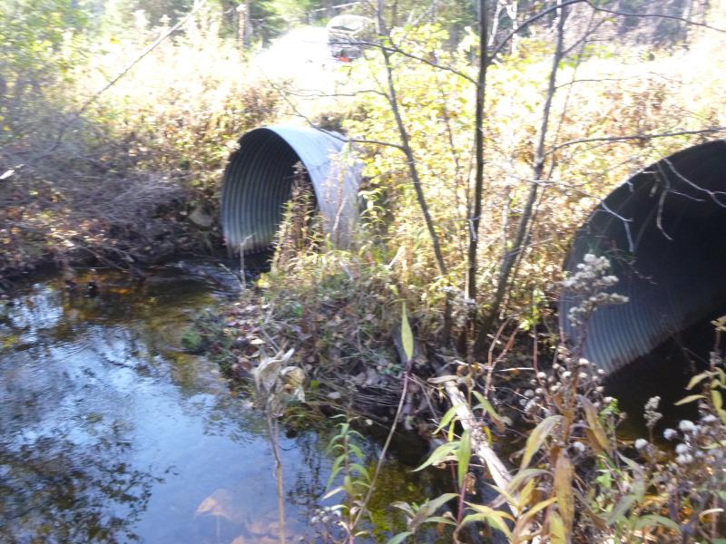
Inlet
Upstream Conditions
Downstream Conditions
Crossing Information
Type of Crossing: culvert(s)
Number of Structures: 2
Structure Shape: Round
Inlet Type: Projecting
Outlet Type: Cascade over Riprap
Structure Material: Metal
Structure Substrate: None
General Conditions: Good
Multiple Culverts/Spans | ||||
Culvert/Span | Width | Length | Height | Material |
1 |
6 ft. |
44 ft. |
6 ft. |
Metal |
2 |
6 ft. |
44 ft. |
6 ft. |
Metal |
Structure Interior: corrugated
Dimensions of Structure: Length 44 ft.
, Width 6 ft.
, Height 6 ft.
Percentage Plugged:
Inlet: 0%
Outlet: 1% to 25%
In Pipe: 0%
Structure is NOT Perched
Structure Inlet
Water Depth: 1.2 ft.
Embedded Depth of Structure: 0 ft.
Water Velocity*: 1.7 ft./sec.
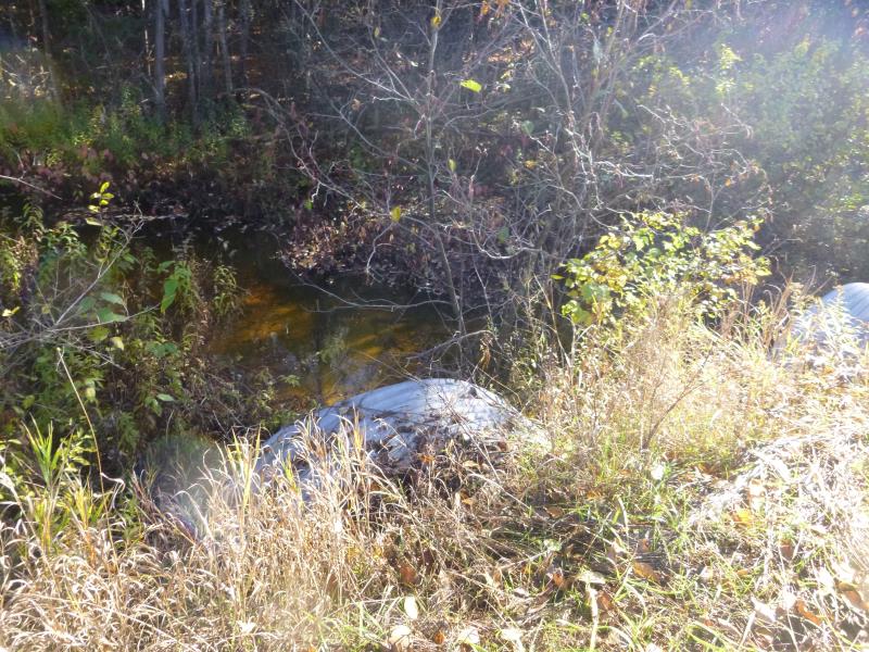
Structure Outlet
Water Depth: 0.8 ft.
Embedded Depth of Structure: 0 ft.
Water Velocity*: 3.4 ft./sec.
*Water Velocities were measured 0.5 ft. below Surface
(with Meter)
Additional Comments
#1 = main culvert
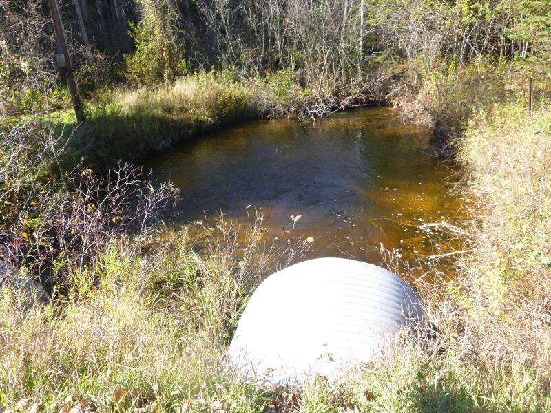
Stream Information
Stream Flow: Less than Bankfull
Scour Pool: Length 25 ft.
, Width 23 ft.
, Depth 3 ft.
Upstream Pond: Length 0 ft.
, Width 0 ft.
, Depth 0 ft.
Riffle Information
Water Depth: 0.8 ft.
Bankfull Width: 17 ft.
Wetted Width: 13 ft.
Water Velocity: 2.1 ft./sec.
(Measured with Meter)
Dominant Substrate: Gravel
Road Information
Gravel
County Road
Road Condition: Good
Road Width at Culvert: 28 ft.
Location of Low Point: At Stream
Runoff Path: Ditch
Embankments
Upstream
Fill Depth: 1.2 ft.
Slope: More than 1:2
Downstream
Fill Depth: 1 ft.
Slope: More than 1:2
Approaches
Left Approach
Length: 1000 ft.
Slope: Less Than 1%
Vegetation: Heavy
LS Factor: 0.05
Erosion: 0.3857 tons/year
Right Approach
Length: 1000 ft.
Slope: 1% to 5%
Vegetation: Heavy
LS Factor: 0.57
Erosion: 4.3967 tons/year
Erosion Information
Total Erosion at Crossing: 4.7824 tons/year
Summary Information
Fish Passability 0
�