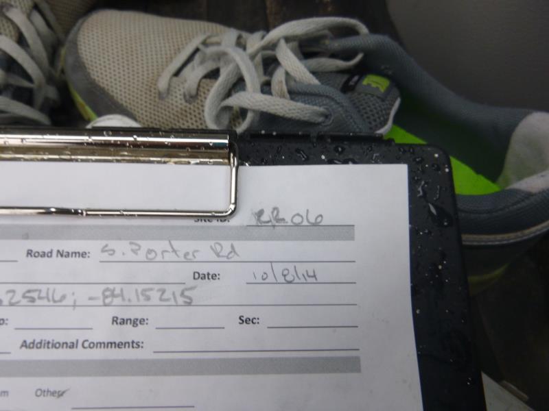
Road Stream Crossing Site UBR_RR06
Upper Black River Watershed, Rainy River
S Porter Rd
Allis Twp,
Presque Isle County
Information collected by:
Site Location
GPS Coordinates: 45.34067
, -84.15215
T34N
R2E
Sec 11, 12
Owned by Private
Fish Passability 0.9
Structure is NOT Perched
Total Erosion: 1.1117 tons/year
Severity: Moderate
Year Inventoried: 2014
Site ID
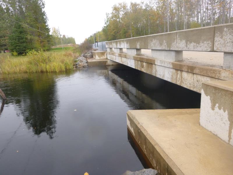
Inlet
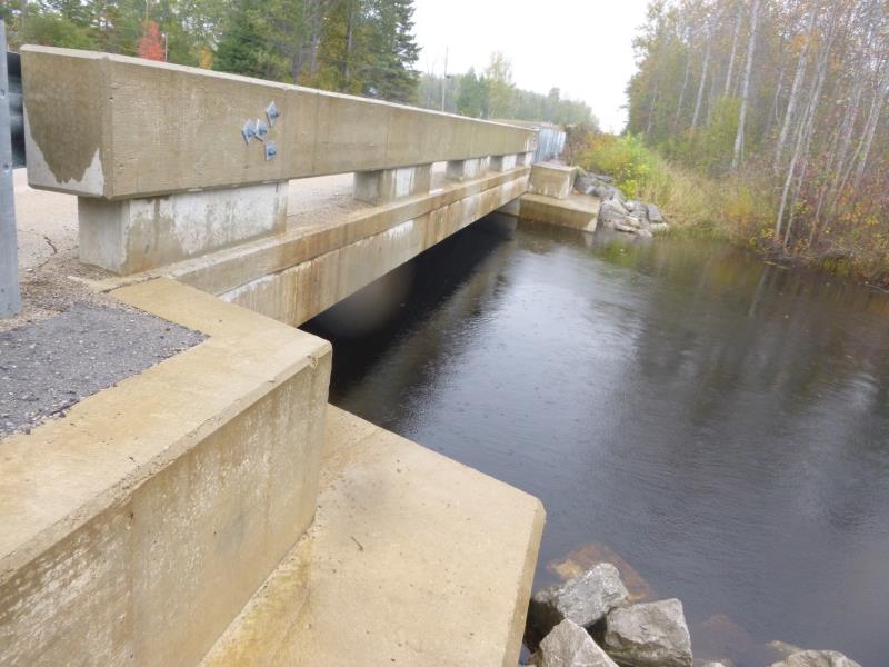
Outlet
Upstream Conditions
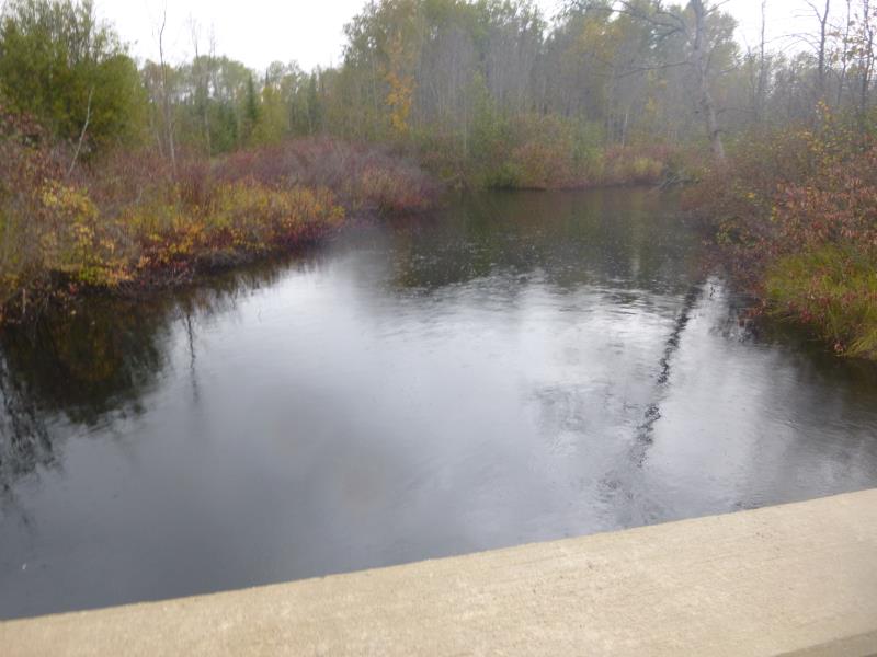
Downstream Conditions
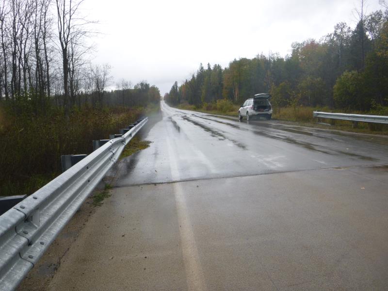
Road Approach - Right
Road Approach - Left
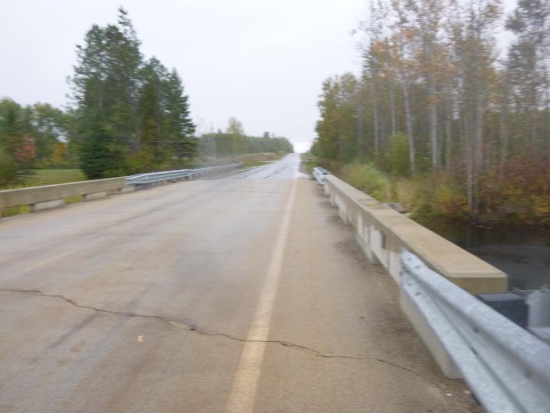
Crossing Information
Type of Crossing: Bridge
Structure Shape: Open Bottom Square/Rectangle
Inlet Type: Headwall
Outlet Type: At Stream Grade
Structure Material: Concrete
Structure Substrate: Mixture
General Conditions: New
Structure Interior: corrugated
Dimensions of Structure: Length 31.8 ft.
, Width 37 ft.
, Height 6.5 ft.
Structure is NOT Perched
Structure Inlet
Water Depth: 4.9 ft.
Embedded Depth of Structure: 0 ft.
Water Velocity*: 1 ft./sec.
Structure Outlet
Water Depth: 4.7 ft.
Embedded Depth of Structure: 0 ft.
Water Velocity*: 1 ft./sec.
*Water Velocities were measured 1 ft. below Surface
(with Meter)
Additional Comments
high water; did not do riffle, water too high
Stream Information
Stream Flow: Less than Bankfull
Scour Pool: Length 0 ft.
, Width 0 ft.
, Depth 0 ft.
Upstream Pond: Length 0 ft.
, Width 0 ft.
, Depth 0 ft.
Riffle Information
Water Depth: 0 ft.
Bankfull Width: 0 ft.
Wetted Width: 0 ft.
Water Velocity: 0 ft./sec.
Road Information
Paved
State Road
Road Condition: Good
Road Width at Culvert: 29.5 ft.
Location of Low Point: At Stream
Runoff Path: Roadway
Fill Depth: 0 ft.
Slope: Vertical
Fill Depth: 0 ft.
Slope: Vertical
Approaches
Left Approach
Length: 1000 ft.
Slope: 1% to 5%
Vegetation: Heavy
LS Factor: 0.57
Erosion: 0.5559 tons/year
Right Approach
Length: 1000 ft.
Slope: 1% to 5%
Vegetation: Heavy
LS Factor: 0.57
Erosion: 0.5559 tons/year
Erosion Information
Total Erosion at Crossing: 1.1117 tons/year
Summary Information
Fish Passability 0.9
�