Road Stream Crossing Site UBR_SC05B
Upper Black River Watershed, Stony Creek
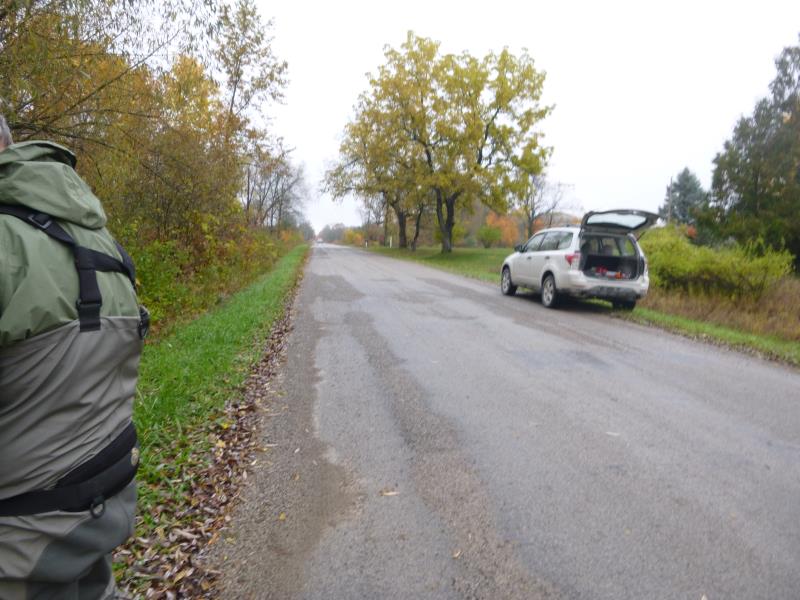
County Line Rd
Allis Twp,
Presque Isle County
Information collected by:
Site Location
GPS Coordinates: 45.407365
, -84.247481
T35N
R2E
Sec 19
Owned by Private
Structure is NOT Perched
Total Erosion: 0.0661 tons/year
Severity: Minor
Year Inventoried: 2014
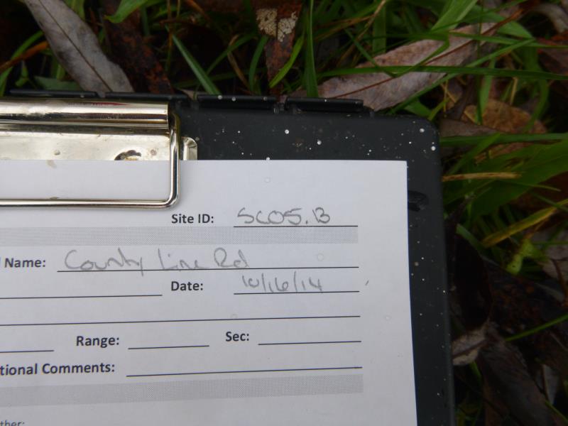
Site ID
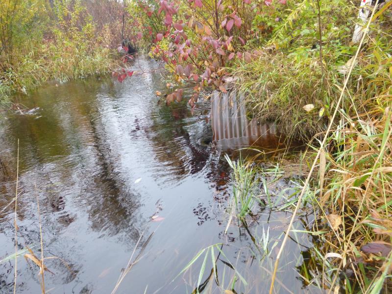
Inlet
Outlet
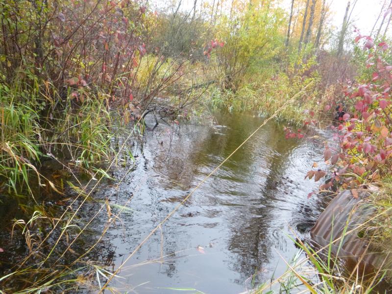
Upstream Conditions
Downstream Conditions
Road Approach - Right
Road Approach - Left
Crossing Information
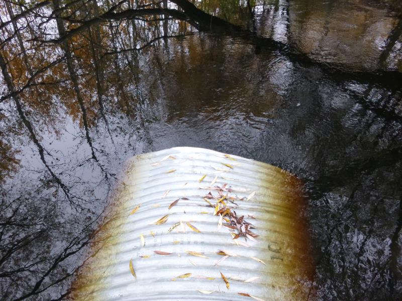
Type of Crossing: culvert(s)
Number of Structures: 1
Structure Shape: Round
Inlet Type: Projecting
Outlet Type: At Stream Grade
Structure Material: Metal
Structure Substrate: None
General Conditions: Poor
Structure Interior: corrugated
Dimensions of Structure: Length 55 ft.
, Width 5 ft.
, Height 5 ft.
Structure is NOT Perched
Structure Inlet
Water Depth: 3.9 ft.
Embedded Depth of Structure: 0 ft.
Water Velocity*: 1.7 ft./sec.
Structure Outlet
Water Depth: 5 ft.
Embedded Depth of Structure: 0 ft.
Water Velocity*: 1.5 ft./sec.
*Water Velocities were measured 2 ft. below Surface
(with Meter)
Additional Comments
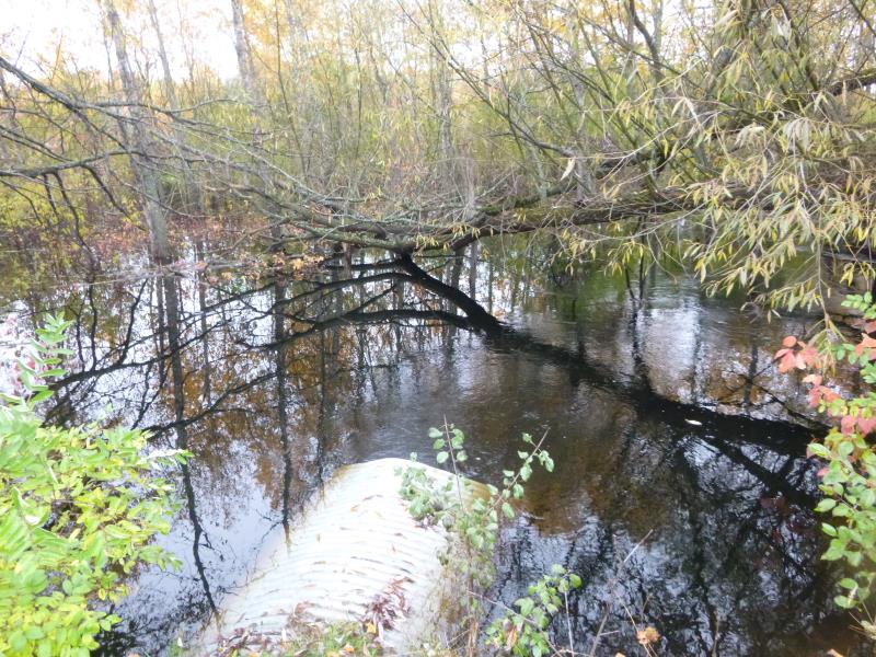
One of two culverts at this crossing of County Line Rd and Stony Creek (along with SC05A to the south). The culverts are wide apart and each takes a branch of Stony Creek; the creek then rejoins west of County Line Rd. Area up- and downstream flooded, did not do riffle since it widens out into a flood plain/swamp.
Stream Information
Stream Flow: More than Bankfull
Scour Pool: Length 0 ft.
, Width 0 ft.
, Depth 0 ft.
Upstream Pond: Length 0 ft.
, Width 0 ft.
, Depth 0 ft.
Road Information
Paved
County Road
Road Condition: Fair
Road Width at Culvert: 20 ft.
Location of Low Point: At Stream
Runoff Path: Ditch
Embankments
Upstream
Fill Depth: 1.5 ft.
Slope: More than 1:2
Downstream
Fill Depth: 2.2 ft.
Slope: More than 1:2
Approaches
Left Approach
Length: 1000 ft.
Slope: Less Than 1%
Vegetation: Heavy
LS Factor: 0.05
Erosion: 0.0331 tons/year
Right Approach
Length: 1000 ft.
Slope: Less Than 1%
Vegetation: Heavy
LS Factor: 0.05
Erosion: 0.0331 tons/year
Erosion Information
Total Erosion at Crossing: 0.0661 tons/year
Summary Information
A future visit to this site is recommended. The culvert has been pieced together- upstream is old and rusty, downstream end clean and new. It is not handling flow, leading to large flooded areas. If addressed, need to consider SC05A as well.
These non-native species were observerd at this site: Thistle
�