Road Stream Crossing Site CLHW_BC-004
Big Creek Watershed, Big Creek
Maple Ridge Rd
Mason Twp,
Arenac County
Information collected by:
Site Location
GPS Coordinates: 44.14192
, -83.89526
T20N
R5E
Sec 17
Owned by Private
Structure is NOT Perched
Total Erosion: 0 tons/year
Severity: Minor
Year Inventoried: 2016
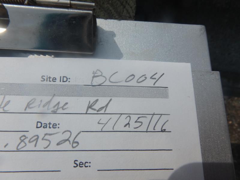
Site ID
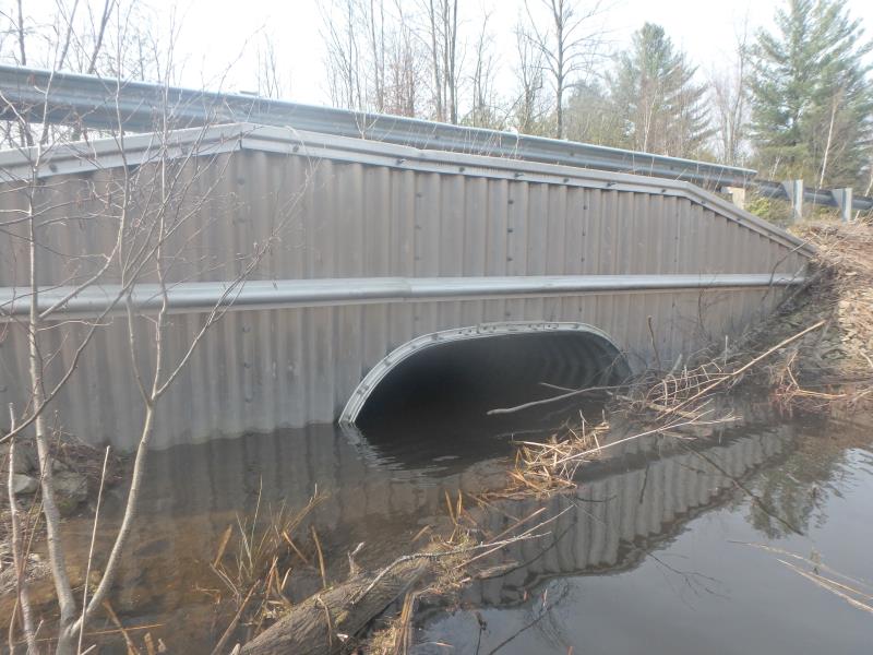
Inlet
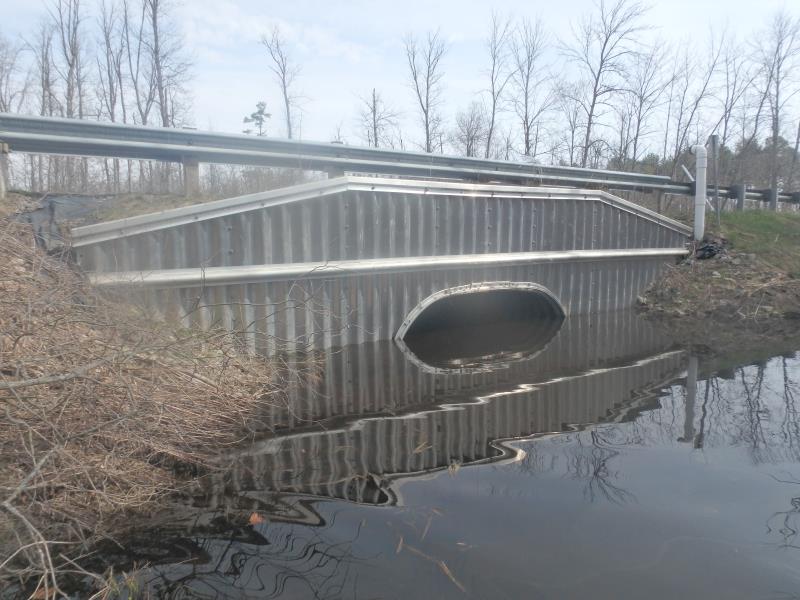
Outlet
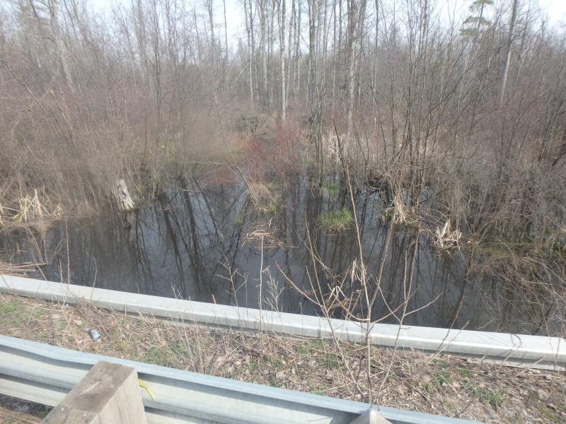
Upstream Conditions
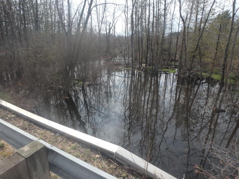
Downstream Conditions
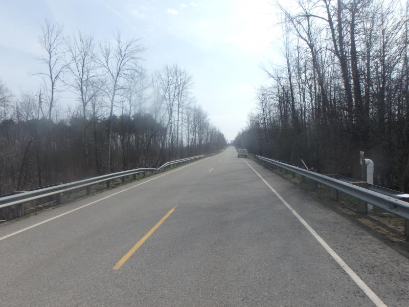
Road Approach - Left
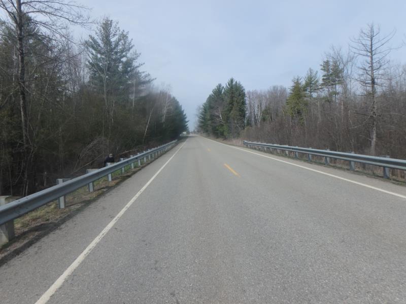
Road Approach - Right
Crossing Information
Type of Crossing: culvert(s)
Number of Structures: 1
Structure Shape: Open Bottom Square/Rectangle
Inlet Type: Headwall
Outlet Type: At Stream Grade
Structure Material: Metal
Structure Substrate: Mixture
General Conditions: Good
Structure Interior: corrugated
Dimensions of Structure: Length 40 ft.
, Width 12.5 ft.
, Height 5 ft.
Percentage Plugged:
Inlet: 1% to 25%
Outlet: 0%
In Pipe: 0%
Structure is NOT Perched
Structure Inlet
Water Depth: 3.2 ft.
Embedded Depth of Structure: 0 ft.
Water Velocity*: 0.1 ft./sec.
Structure Outlet
Water Depth: 2.6 ft.
Embedded Depth of Structure: 0.5 ft.
Water Velocity*: 0.1 ft./sec.
*Water Velocities were measured at the Surface
(with Float Test)
Additional Comments
water backed up pretty bad; flooded swamp area preventing a riffle measurement from occuring
Stream Information
Stream Flow: More than Bankfull
Scour Pool: Length 55 ft.
, Width 35 ft.
, Depth 4 ft.
Upstream Pond: Length 0 ft.
, Width 0 ft.
, Depth 0 ft.
Road Information
Paved
County Road
Road Condition: Good
Road Width at Culvert: 30 ft.
Location of Low Point: Other
Runoff Path: Ditch
Fill Depth: 0 ft.
Fill Depth: 0 ft.
Approaches
Left Approach
Length: 0 ft.
Slope: Less Than 1%
Vegetation: Heavy
LS Factor: 0.05
Erosion: 0 tons/year
Right Approach
Length: 0 ft.
Slope: Less Than 1%
Vegetation: Heavy
LS Factor: 0.05
Erosion: 0 tons/year
Erosion Information
Total Erosion at Crossing: 0 tons/year
Summary Information
�