Road Stream Crossing Site CLHW_BC-019
Big Creek Watershed, Big Creek
W Townsend Rd
Mason Twp,
Arenac County
Information collected by:
Site Location
GPS Coordinates: 44.09872
, -83.83824
T20N
R5E
Sec 35
Owned by Private
Fish Passability 1
Structure is NOT Perched
Total Erosion: 1.4373 tons/year
Severity: Moderate
Year Inventoried: 2016
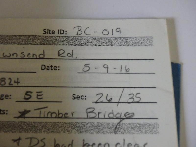
Site ID
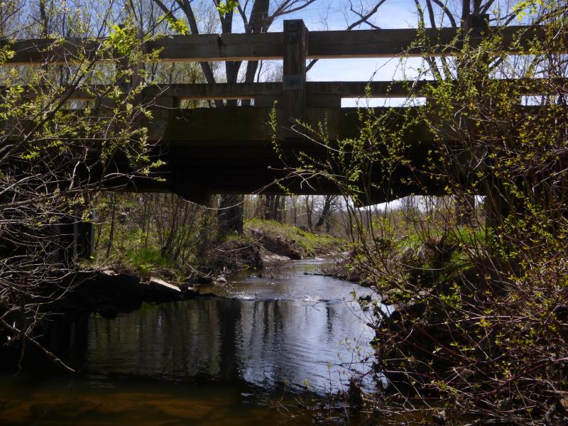
Inlet
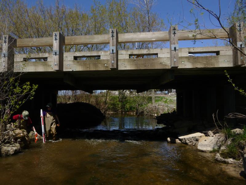
Outlet
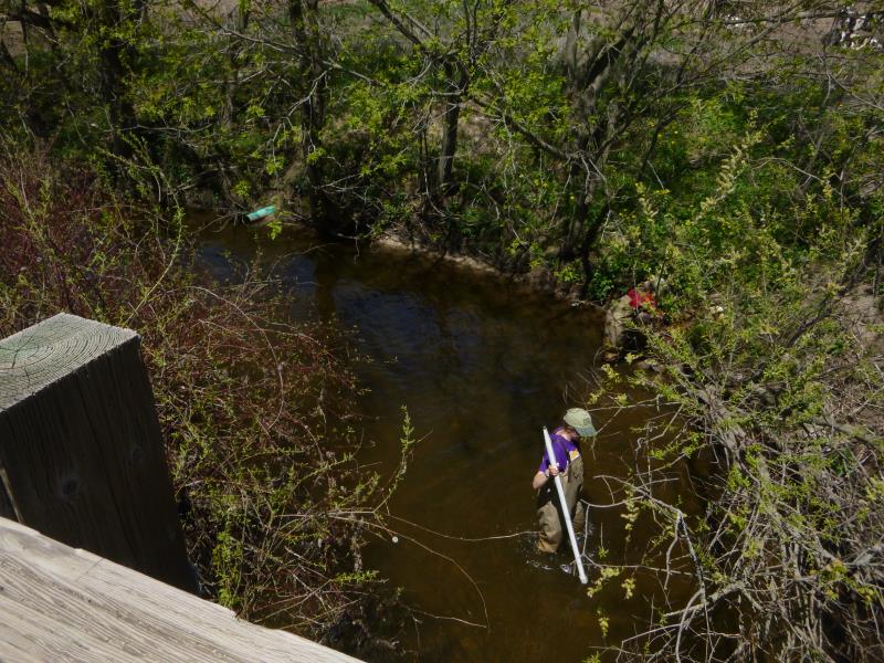
Upstream Conditions
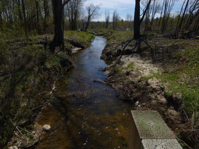
Downstream Conditions
Road Approach - Left
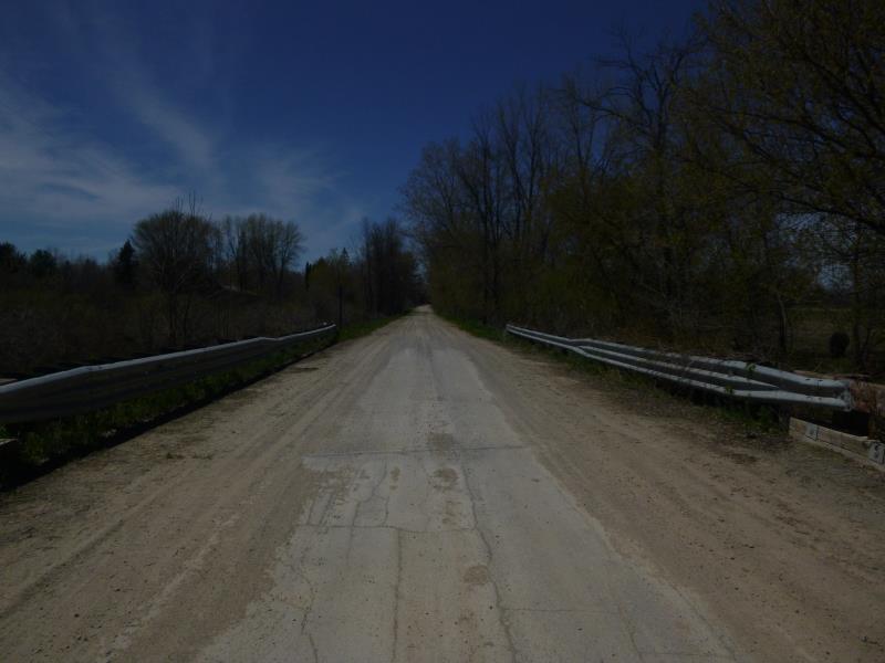
Road Approach - Right
Crossing Information
Type of Crossing: Bridge
Structure Shape: Open Bottom Square/Rectangle
Inlet Type: Wingwall 10-30 Degree
Outlet Type: At Stream Grade
Structure Material: Wood
Structure Substrate: Mixture
General Conditions: Good
Structure Interior: smooth
Dimensions of Structure: Length 24 ft.
, Width 34.5 ft.
, Height 9 ft.
Structure is NOT Perched
Structure Inlet
Water Depth: 2 ft.
Embedded Depth of Structure: 0.2 ft.
Water Velocity*: 0.7 ft./sec.
Structure Outlet
Water Depth: 1 ft.
Embedded Depth of Structure: 0.2 ft.
Water Velocity*: 0.7 ft./sec.
*Water Velocities were measured at the Surface
(with Float Test)
Additional Comments
Downstream banks beyond outlet have been clear cut
Stream Information
Stream Flow: Less than 1/2 Bankfull
Scour Pool: Length 0 ft.
, Width 0 ft.
, Depth 0 ft.
Upstream Pond: Length 0 ft.
, Width 0 ft.
, Depth 0 ft.
Riffle Information
Water Depth: 0.7 ft.
Bankfull Width: 24.3 ft.
Wetted Width: 18.4 ft.
Water Velocity: 1.4 ft./sec.
(Measured with Float Test)
Dominant Substrate: Gravel
Road Information
Gravel
County Road
Road Condition: Poor
Road Width at Culvert: 18 ft.
Location of Low Point: At Stream
Runoff Path: Ditch
Fill Depth: 0 ft.
Slope: More than 1:2
Fill Depth: 0 ft.
Slope: More than 1:2
Approaches
Left Approach
Length: 483 ft.
Slope: 1% to 5%
Vegetation: Heavy
LS Factor: 0.497
Erosion: 1.1894 tons/year
Right Approach
Length: 1000 ft.
Slope: Less Than 1%
Vegetation: Heavy
LS Factor: 0.05
Erosion: 0.2479 tons/year
Erosion Information
Total Erosion at Crossing: 1.4373 tons/year
Summary Information
Fish Passability 1
�