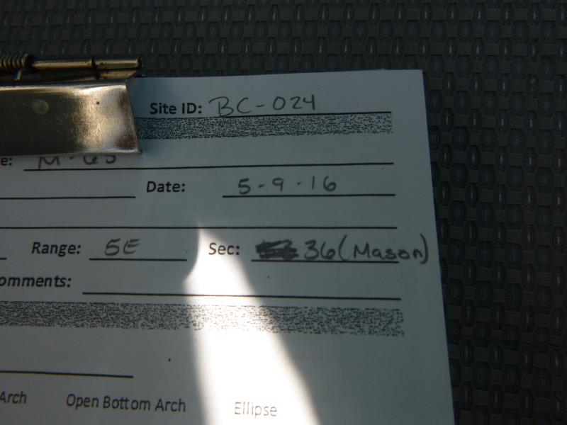
Road Stream Crossing Site CLHW_BC-024
Big Creek Watershed, Big Creek
M-65
Mason Twp,
Arenac County
Information collected by:
Site Location
GPS Coordinates: 44.08416
, -83.80676
T20N
R5E
Sec 36
Owned by Private
Fish Passability 0.5
Structure is NOT Perched
Total Erosion: 0.6969 tons/year
Severity: Moderate
Year Inventoried: 2016
Site ID
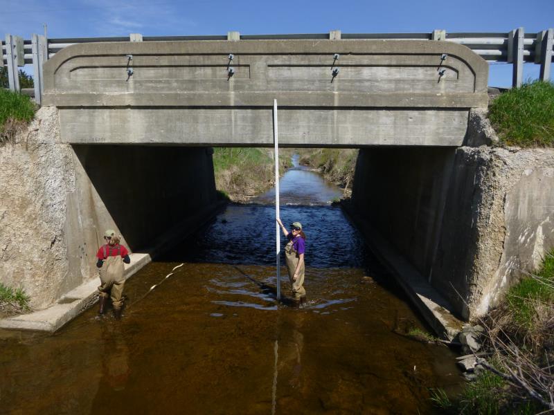
Inlet
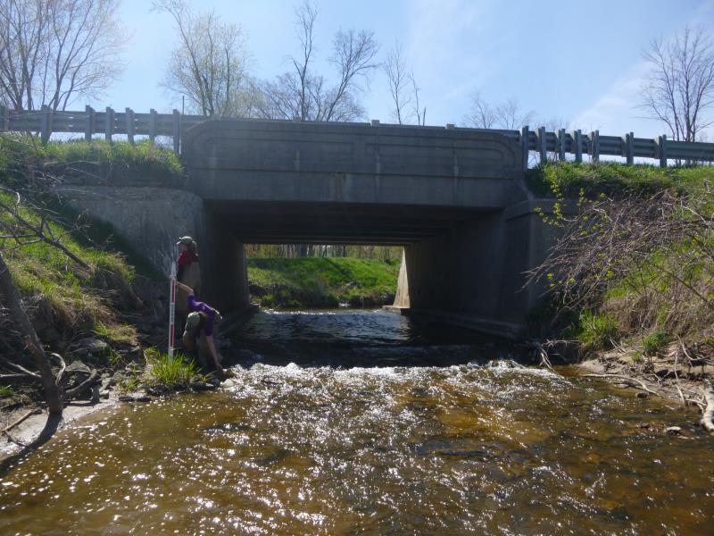
Outlet
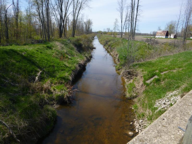
Upstream Conditions
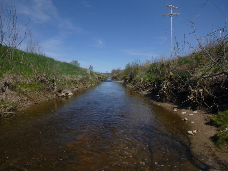
Downstream Conditions
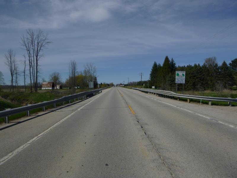
Road Approach - Left
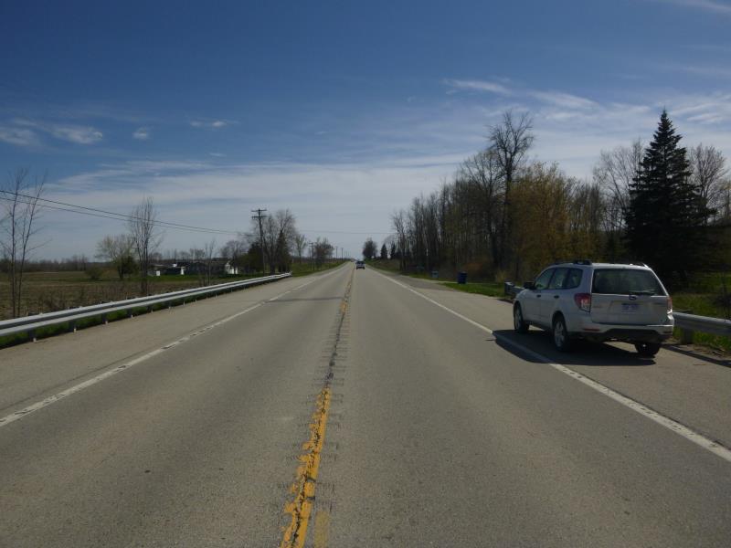
Road Approach - Right
Crossing Information
Type of Crossing: Bridge
Structure Shape: Square/Rectangle
Inlet Type: Headwall
Outlet Type: Cascade over Riprap
Structure Material: Concrete
Structure Substrate: None
General Conditions: Fair
Structure Interior: smooth
Dimensions of Structure: Length 39.4 ft.
, Width 22.8 ft.
, Height 10 ft.
Percentage Crushed:
Inlet: 1% to 25%
Outlet: 0%
In Pipe: 0%
Structure is NOT Perched
Structure Inlet
Water Depth: 0.5 ft.
Embedded Depth of Structure: 0 ft.
Water Velocity*: 2.3 ft./sec.
Structure Outlet
Water Depth: 0.5 ft.
Embedded Depth of Structure: 0 ft.
Water Velocity*: 2.3 ft./sec.
*Water Velocities were measured at the Surface
(with Float Test)
Additional Comments
Exposed rebar underneath bridge
Stream Information
Stream Flow: Less than 1/2 Bankfull
Scour Pool: Length 0 ft.
, Width 0 ft.
, Depth 0 ft.
Upstream Pond: Length 0 ft.
, Width 0 ft.
, Depth 0 ft.
Riffle Information
Water Depth: 1.4 ft.
Bankfull Width: 19.5 ft.
Wetted Width: 15 ft.
Water Velocity: 1.8 ft./sec.
(Measured with Float Test)
Dominant Substrate: Sand
Road Information
Paved
State Road
Road Condition: Fair
Road Width at Culvert: 34 ft.
Location of Low Point: At Stream
Runoff Path: Ditch
Fill Depth: 0 ft.
Slope: Vertical
Fill Depth: 0 ft.
Slope: Vertical
Approaches
Left Approach
Length: 1000 ft.
Slope: Less Than 1%
Vegetation: Heavy
LS Factor: 0.05
Erosion: 0.0562 tons/year
Right Approach
Length: 1000 ft.
Slope: 1% to 5%
Vegetation: Heavy
LS Factor: 0.57
Erosion: 0.6407 tons/year
Erosion Information
Total Erosion at Crossing: 0.6969 tons/year
Summary Information
Fish Passability 0.5
�