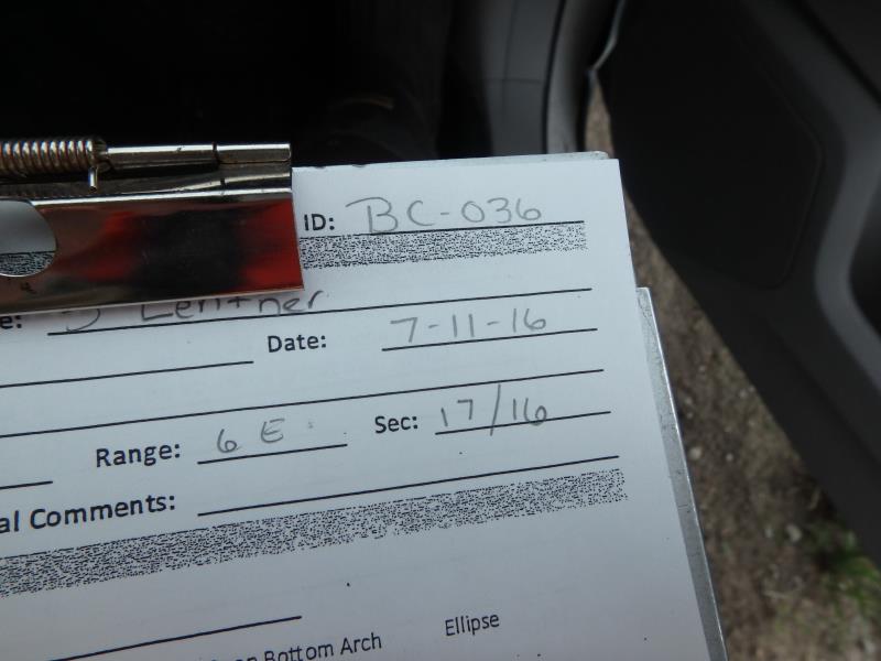
Road Stream Crossing Site CLHW_BC-036
Big Creek Watershed, Big Creek
L Lentner Rd
Au Gres,
Arenac County
Information collected by:
Site Location
GPS Coordinates: 44.05504
, -83.76598
T19N
R6E
Sec 17
Owned by Private
Fish Passability 0.9
Structure is NOT Perched
Total Erosion: 0.2066 tons/year
Severity: Minor
Year Inventoried: 2016
Site ID
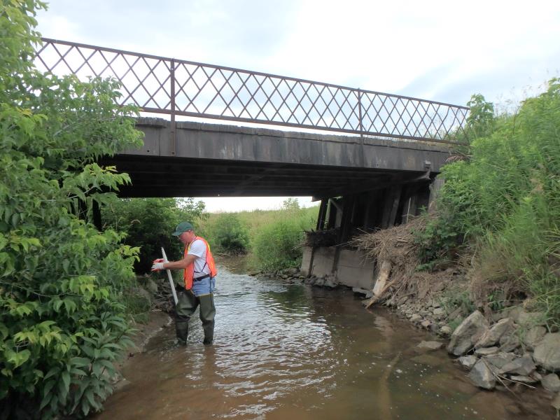
Inlet
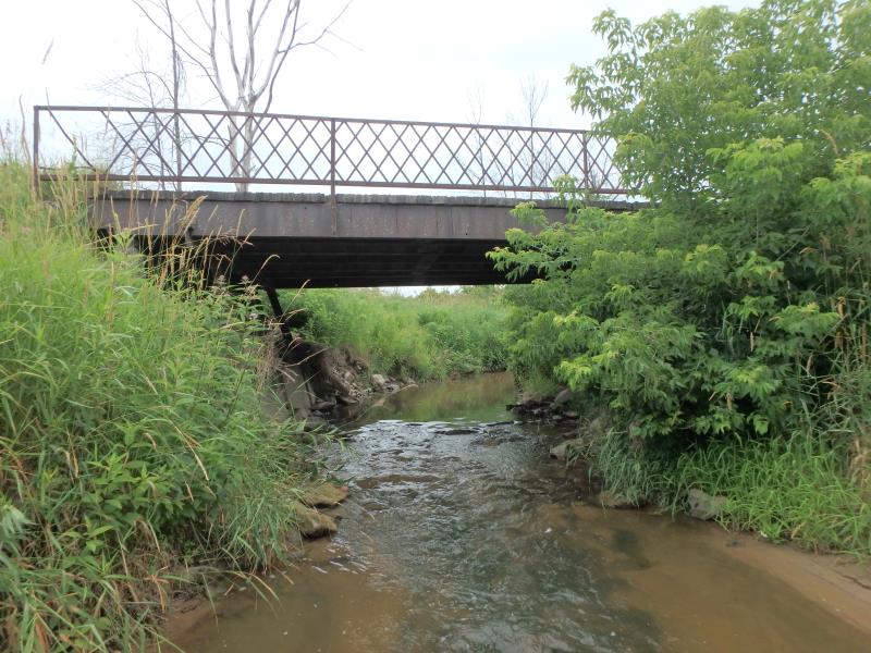
Outlet
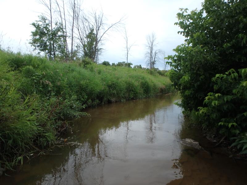
Upstream Conditions
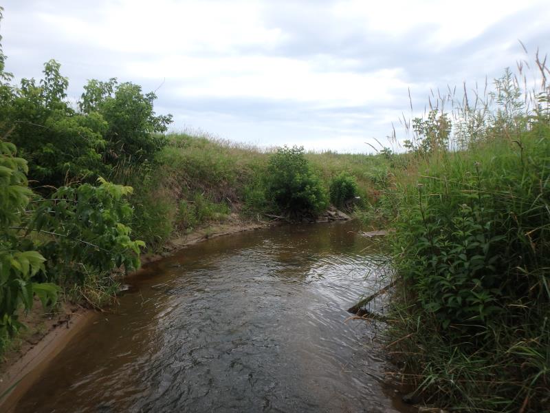
Downstream Conditions
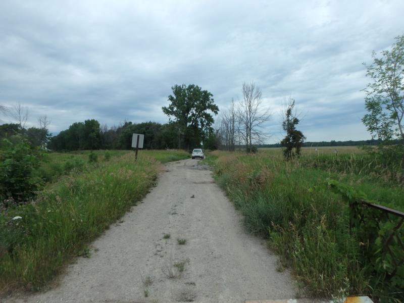
Road Approach - Left
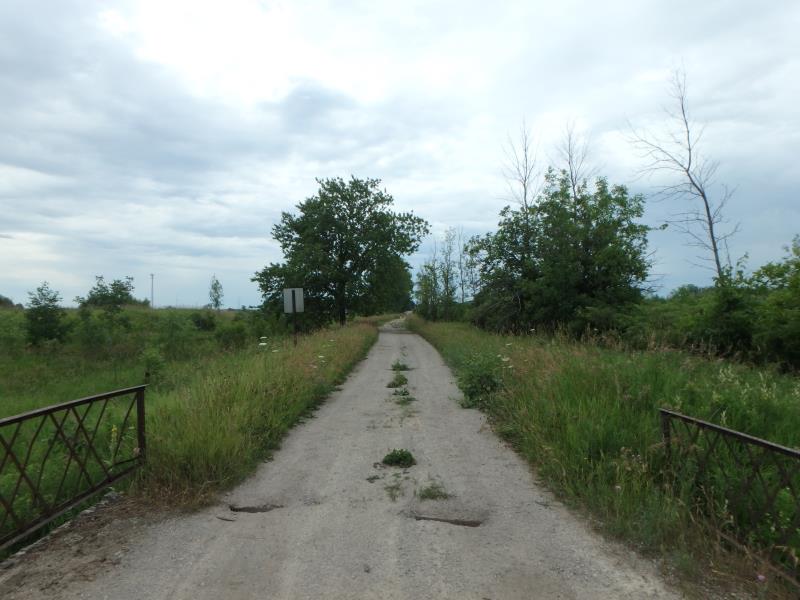
Road Approach - Right
Crossing Information
Type of Crossing: Bridge
Structure Shape: Open Bottom Square/Rectangle
Inlet Type: Headwall
Outlet Type: At Stream Grade
Structure Material: Metal
Structure Substrate: Sand
General Conditions: Poor
Structure Interior: smooth
Structure is Rusted through
Dimensions of Structure: Length 16 ft.
, Width 26 ft.
, Height 8.3 ft.
Percentage Crushed:
Inlet: 0%
Outlet: 0%
In Pipe: 1% to 25%
Structure is NOT Perched
Structure Inlet
Water Depth: 1 ft.
Embedded Depth of Structure: 0.1 ft.
Water Velocity*: 1.5 ft./sec.
Structure Outlet
Water Depth: 0.6 ft.
Embedded Depth of Structure: 0.1 ft.
Water Velocity*: 1.5 ft./sec.
*Water Velocities were measured at the Surface
(with Float Test)
Stream Information
Stream Flow: Less than 1/2 Bankfull
Scour Pool: Length 60 ft.
, Width 18 ft.
, Depth 1.1 ft.
Riffle Information
Water Depth: 0.6 ft.
Bankfull Width: 13 ft.
Wetted Width: 11 ft.
Water Velocity: 2.6 ft./sec.
(Measured with Float Test)
Dominant Substrate: Sand
Road Information
Gravel
County Road
Road Condition: Poor
Road Width at Culvert: 15 ft.
Location of Low Point: Other
Runoff Path: Ditch
Fill Depth: 0 ft.
Slope: Vertical
Fill Depth: 0 ft.
Slope: Vertical
Approaches
Left Approach
Length: 0 ft.
Slope: Less Than 1%
Vegetation: Heavy
LS Factor: 0.05
Erosion: 0 tons/year
Right Approach
Length: 1000 ft.
Slope: Less Than 1%
Vegetation: Heavy
LS Factor: 0.05
Erosion: 0.2066 tons/year
Erosion Information
Total Erosion at Crossing: 0.2066 tons/year
Summary Information
Fish Passability 0.9
�