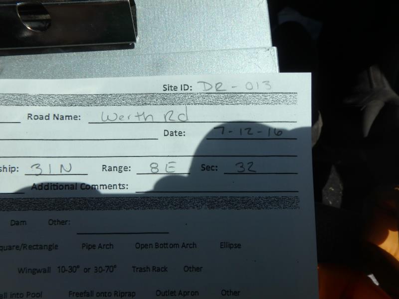
Road Stream Crossing Site CLHW_DR-013
Devils River Watershed, Mud Creek
Werth Rd
Alpena,
Alpena County
Information collected by:
Site Location
GPS Coordinates: 45.03333
, -83.48357
T31N
R8E
Sec 32
Owned by Private
Structure is NOT Perched
Total Erosion: 0.0992 tons/year
Severity: Minor
Year Inventoried: 2016
Site ID
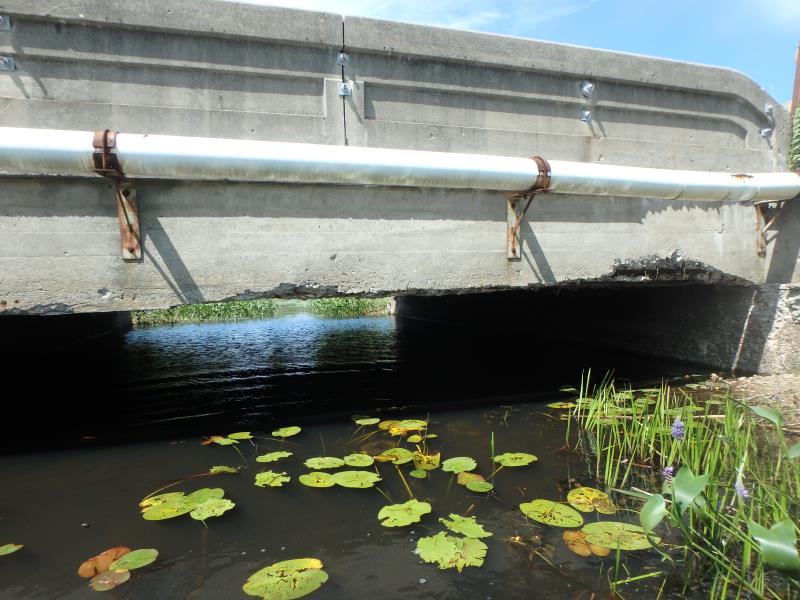
Inlet
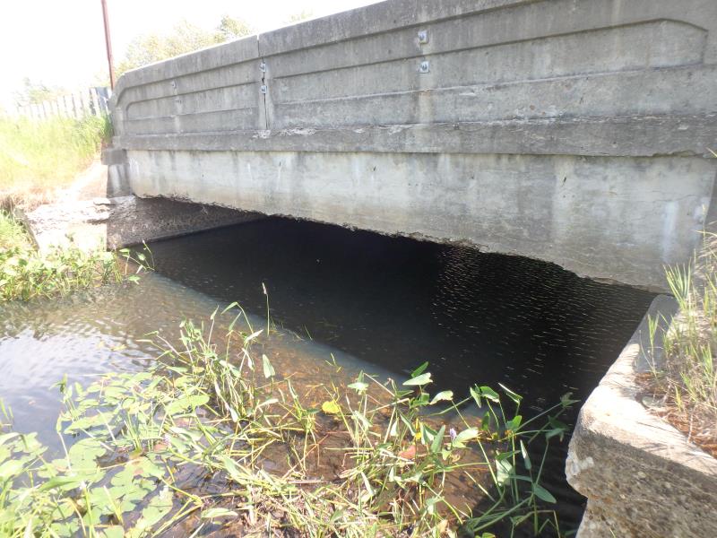
Outlet
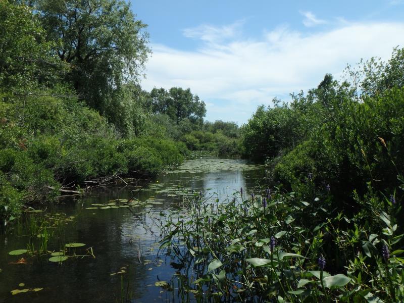
Upstream Conditions
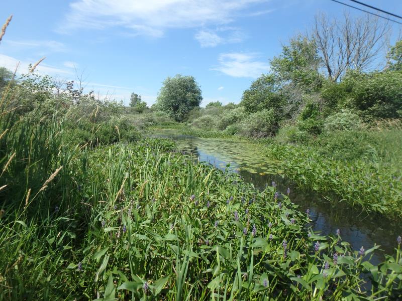
Downstream Conditions
Road Approach - Left
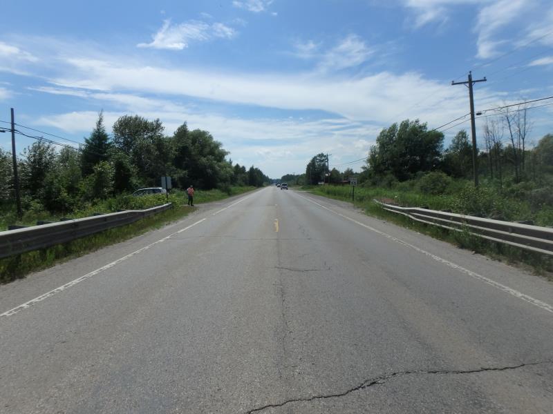
Road Approach - Right
Crossing Information
Type of Crossing: Bridge
Structure Shape: Open Bottom Square/Rectangle
Inlet Type: Headwall
Outlet Type: At Stream Grade
Structure Material: Concrete
Structure Substrate: Sand
General Conditions: Poor
Structure Interior: smooth
Dimensions of Structure: Length 32 ft.
, Width 24 ft.
, Height 5 ft.
Percentage Plugged:
Inlet: 0%
Outlet: 26% to 50%
In Pipe: 0%
Percentage Crushed:
Inlet: 1% to 25%
Outlet: 0%
In Pipe: 1% to 25%
Structure is NOT Perched
Structure Inlet
Water Depth: 2 ft.
Embedded Depth of Structure: 0.5 ft.
Water Velocity*: 0.1 ft./sec.
Structure Outlet
Water Depth: 1.8 ft.
Embedded Depth of Structure: 0.5 ft.
Water Velocity*: 0.1 ft./sec.
*Water Velocities were measured at the Surface
(with Float Test)
Additional Comments
Could not obtain riffle due to extremely deep muck
Stream Information
Stream Flow: Less than Bankfull
Scour Pool: Length 0 ft.
, Width 0 ft.
, Depth 0 ft.
Upstream Pond: Length 0 ft.
, Width 0 ft.
, Depth 0 ft.
Road Information
Paved
County Road
Road Condition: Good
Road Width at Culvert: 30 ft.
Location of Low Point: At Stream
Runoff Path: Ditch
Fill Depth: 0 ft.
Fill Depth: 0 ft.
Approaches
Left Approach
Length: 1000 ft.
Slope: Less Than 1%
Vegetation: Heavy
LS Factor: 0.05
Erosion: 0.0496 tons/year
Right Approach
Length: 1000 ft.
Slope: Less Than 1%
Vegetation: Heavy
LS Factor: 0.05
Erosion: 0.0496 tons/year
Erosion Information
Total Erosion at Crossing: 0.0992 tons/year
Summary Information
�