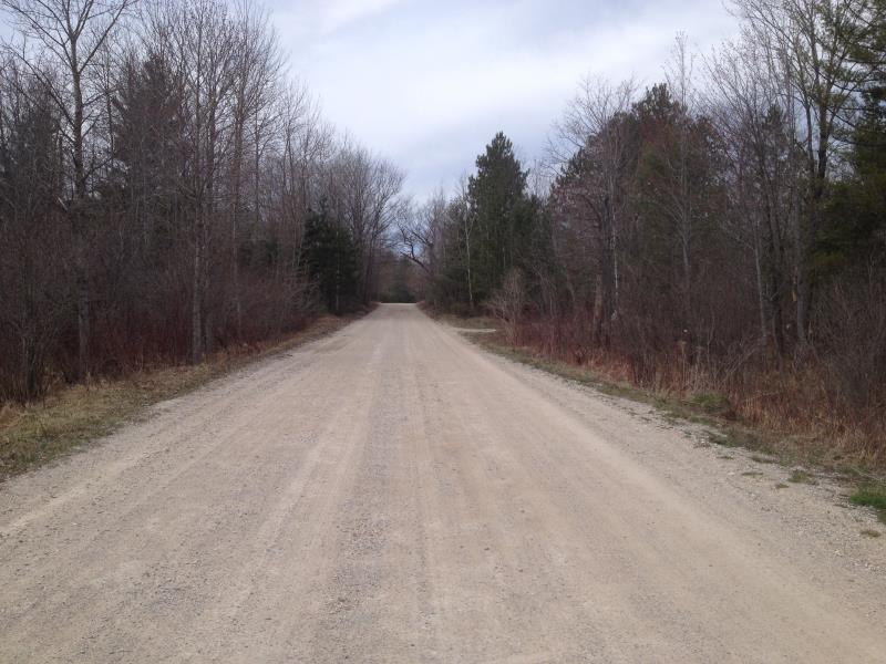
Road Stream Crossing Site CLHW_GCBM-006
Greene Creek-Black Mallard River Watershed, Elliot Creek
Alpena State Rd
Benton Twp,
Cheboygan County
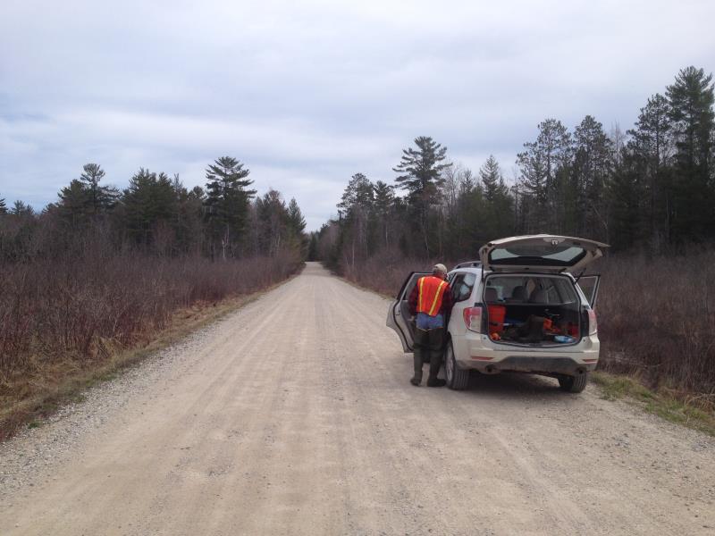
Information collected by:
Site Location
GPS Coordinates: 45.63738
, -84.39622
T38N
R1W
Sec 35
Owned by State
Fish Passability 0.9
Structure is NOT Perched
Total Erosion: 5.612 tons/year
Severity: Severe
Year Inventoried: 2016
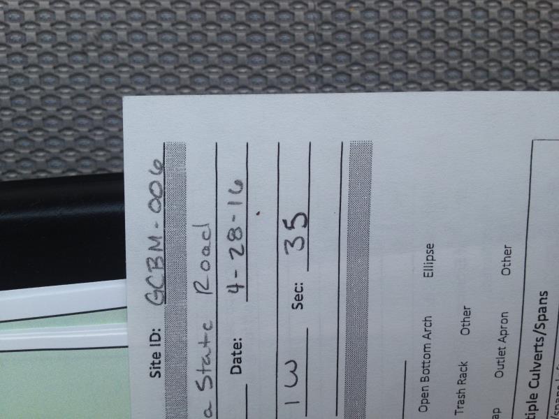
Site ID

Inlet
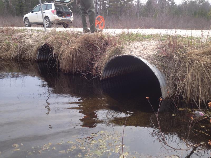
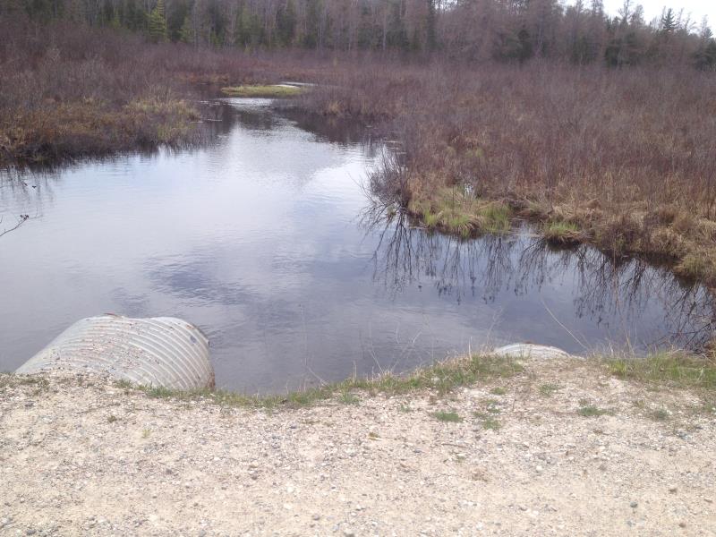
Outlet
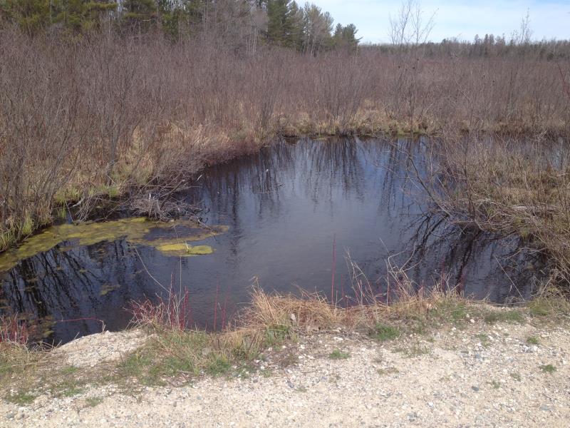
Upstream Conditions
Downstream Conditions
Road Approach - Left
Road Approach - Right
Crossing Information
Type of Crossing: culvert(s)
Number of Structures: 2
Structure Shape: Round
Inlet Type: Projecting
Outlet Type: At Stream Grade
Structure Material: Metal
Structure Substrate: Sand
General Conditions: Fair
Structure Interior: corrugated
Structure is Rusted through
Dimensions of Structure: Length 30 ft.
, Width 3.6 ft.
, Height 3.6 ft.
Structure is NOT Perched
Structure Inlet
Water Depth: 2.2 ft.
Embedded Depth of Structure: 0.1 ft.
Water Velocity*: 0.5 ft./sec.
Structure Outlet
Water Depth: 2.3 ft.
Embedded Depth of Structure: 0 ft.
Water Velocity*: 0.5 ft./sec.
*Water Velocities were measured at the Surface
(with Float Test)
Additional Comments
Culvert # 2 has been crushed on the inside of pipe
Stream Information
Stream Flow: Less than Bankfull
Riffle Information
Water Depth: 1.2 ft.
Bankfull Width: 23 ft.
Wetted Width: 17 ft.
Water Velocity: 1 ft./sec.
(Measured with Float Test)
Dominant Substrate: Sand
Road Information
Gravel
County Road
Road Condition: Fair
Road Width at Culvert: 24 ft.
Location of Low Point: At Stream
Runoff Path: Ditch
Embankments
Upstream
Fill Depth: 0.2 ft.
Slope: More than 1:2
Downstream
Fill Depth: 0.3 ft.
Slope: More than 1:2
Approaches
Left Approach
Length: 520 ft.
Slope: 1% to 5%
Vegetation: Heavy
LS Factor: 0.504
Erosion: 1.7328 tons/year
Right Approach
Length: 1000 ft.
Slope: 1% to 5%
Vegetation: Heavy
LS Factor: 0.57
Erosion: 3.7686 tons/year
Erosion Information
Total Erosion at Crossing: 5.612 tons/year
Extent of Erosion: Moderate
Erosion is occurring and corrective actions can be installed to address the problem.
Notes: Gravel from road making its way into water
Location of Erosion | Erosion Dimensions | Eroded Material | Material Eroded | Total Erosion | ||
facing downstream | Length | Width | Depth | Reaching Stream? | (tons/year) | |
Right Downstream Embankment |
3 ft. |
1.4 ft. |
3.8 ft. |
yes |
Gravel |
0.0798 |
Right Upstream Embankment |
2 ft. |
2.6 ft. |
2.2 ft. |
yes |
Gravel |
0.0308 |
Summary Information
Fish Passability 0.9
�