Road Stream Crossing Site CLHW_GCBM-009
Greene Creek-Black Mallard River Watershed, Unnamed stream
Highbanks Rd
Benton Twp,
Cheboygan County
Information collected by:
Site Location
GPS Coordinates: 45.655
, -84.3019
T38N
R1E
Sec 22
Owned by Private
Fish Passability 0
Perch Height: 1.7 ft.
Total Erosion: 0.0397 tons/year
Severity: Severe
Year Inventoried: 2016
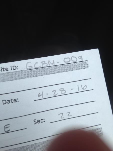
Site ID
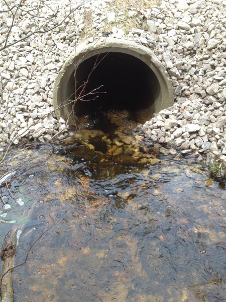
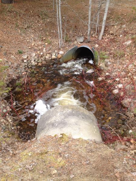
Inlet
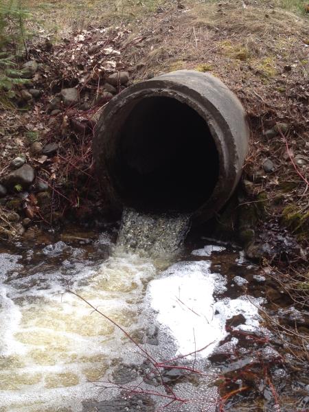
Outlet
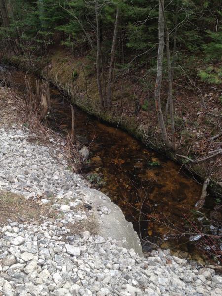
Upstream Conditions
Downstream Conditions
Road Approach - Left
Road Approach - Right
Crossing Information
Type of Crossing: culvert(s)
Number of Structures: 1
Structure Shape: Round
Inlet Type: Projecting
Outlet Type: Freefall into Pool
Structure Material: Concrete
Structure Substrate: None
General Conditions: Poor
Structure Interior: smooth
Dimensions of Structure: Length 43 ft.
, Width 3 ft.
, Height 3 ft.
Percentage Crushed:
Inlet: 1% to 25%
Outlet: 0%
In Pipe: 0%
Perch Height: 1.7 ft.
Structure Inlet
Water Depth: 0.6 ft.
Embedded Depth of Structure: 0 ft.
Water Velocity*: 4.7 ft./sec.
Structure Outlet
Water Depth: 0.4 ft.
Embedded Depth of Structure: 0 ft.
Water Velocity*: 4.7 ft./sec.
*Water Velocities were measured at the Surface
(with Float Test)
Stream Information
Stream Flow: Less than 1/2 Bankfull
Scour Pool: Length 10 ft.
, Width 12 ft.
, Depth 1.6 ft.
Riffle Information
Water Depth: 0.7 ft.
Bankfull Width: 7 ft.
Wetted Width: 4 ft.
Water Velocity: 1.4 ft./sec.
(Measured with Float Test)
Dominant Substrate: Sand
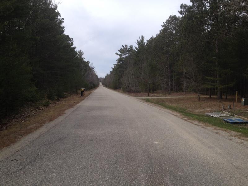
Road Information
Paved
Private Road
(Seasonal)
Road Condition: Good
Road Width at Culvert: 20 ft.
Location of Low Point: Other
Runoff Path: Ditch
Embankments
Upstream
Fill Depth: 1 ft.
Slope: More than 1:2
Downstream
Fill Depth: 1.6 ft.
Slope: More than 1:2
Approaches
Left Approach
Length: 1000 ft.
Slope: Less Than 1%
Vegetation: Partial
LS Factor: 0.06
Erosion: 0.0397 tons/year
Right Approach
Length: 0 ft.
Slope: Less Than 1%
Vegetation: Partial
LS Factor: 0.05
Erosion: 0 tons/year
Erosion Information
Total Erosion at Crossing: 0.0397 tons/year
Summary Information
Fish Passability 0
�