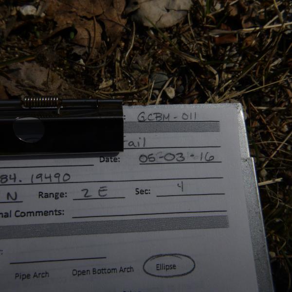
Road Stream Crossing Site CLHW_GCBM-011
Greene Creek-Black Mallard River Watershed, Mulligan Creek
Pine Tree Trail
Bearinger Twp,
Presque Isle County
Information collected by:
Site Location
GPS Coordinates: 45.61603
, -84.1949
T37N
R2E
Sec 4
Owned by Private
Fish Passability 0.5
Structure is NOT Perched
Total Erosion: 0 tons/year
Severity: Moderate
Year Inventoried: 2016
Site ID
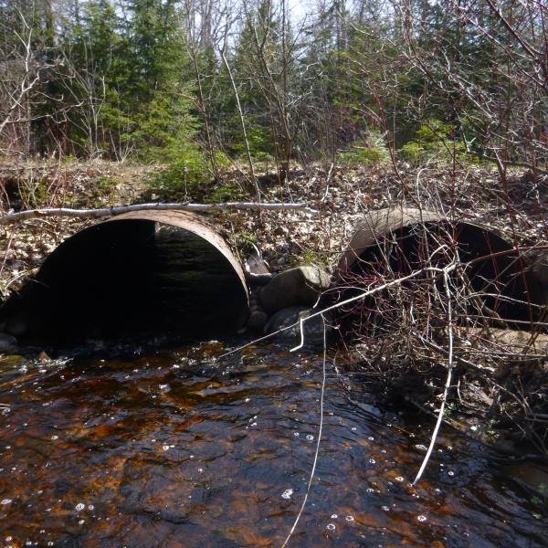
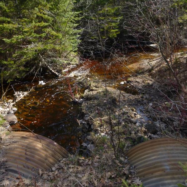
Inlet
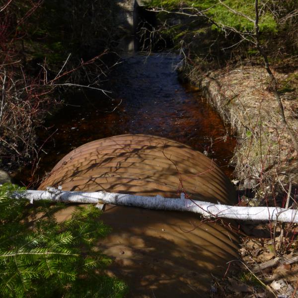
Outlet
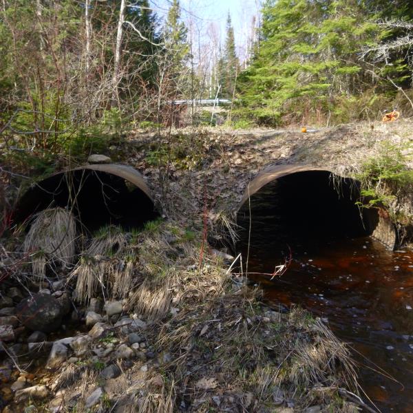
Upstream Conditions
Downstream Conditions
Road Approach - Left
Road Approach - Right
Crossing Information
Type of Crossing: culvert(s)
Number of Structures: 2
Structure Shape: Pipe Arch
Inlet Type: Projecting
Outlet Type: At Stream Grade
Structure Material: Concrete
Structure Substrate: None
General Conditions: Poor
Multiple Culverts/Spans | ||||
Culvert/Span | Width | Length | Height | Material |
1 |
5 ft. |
24 ft. |
4 ft. |
Metal |
2 |
5 ft. |
24 ft. |
4 ft. |
Metal |
Structure Interior: corrugated
Structure is Rusted through
Dimensions of Structure: Length 24 ft.
, Width 5 ft.
, Height 4 ft.
Structure is NOT Perched
Structure Inlet
Water Depth: 0.7 ft.
Embedded Depth of Structure: 0 ft.
Water Velocity*: 2.7 ft./sec.
Structure Outlet
Water Depth: 0.7 ft.
Embedded Depth of Structure: 0 ft.
Water Velocity*: 2.7 ft./sec.
*Water Velocities were measured at the Surface
(with Float Test)
Stream Information
Stream Flow: Less than 1/2 Bankfull
Riffle Information
Water Depth: 0.6 ft.
Bankfull Width: 14 ft.
Wetted Width: 12 ft.
Water Velocity: 1.7 ft./sec.
(Measured with Float Test)
Dominant Substrate: Cobble
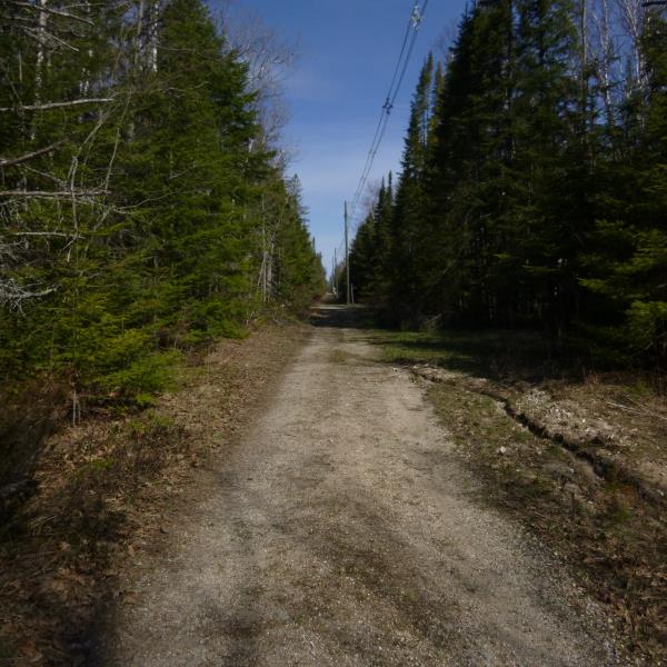
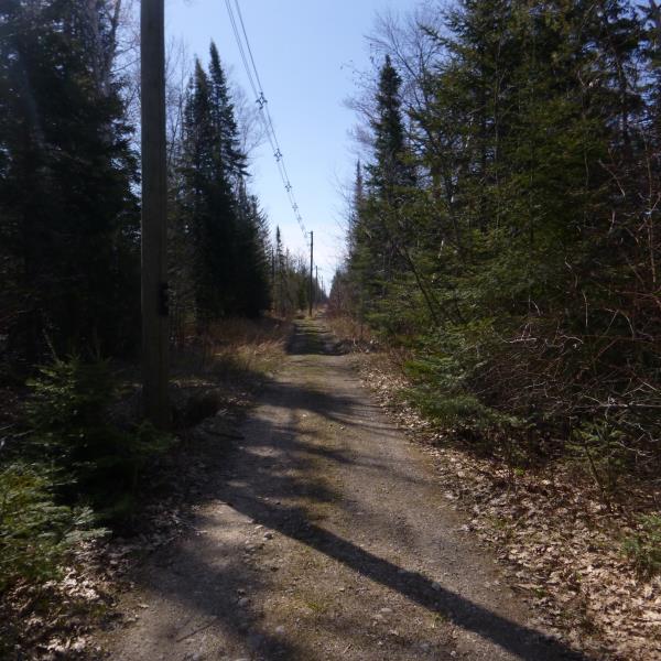
Road Information
Gravel
Private Road
(Seasonal)
Road Condition: Poor
Road Width at Culvert: 8 ft.
Location of Low Point: Other
Runoff Path: Ditch
Embankments
Upstream
Fill Depth: 1 ft.
Slope: More than 1:2
Downstream
Fill Depth: 1 ft.
Slope: More than 1:2
Approaches
Left Approach
Length: 0 ft.
Slope: Less Than 1%
Vegetation: Heavy
LS Factor: 0.05
Erosion: 0 tons/year
Right Approach
Length: 0 ft.
Slope: Less Than 1%
Vegetation: Heavy
LS Factor: 0.05
Erosion: 0 tons/year
Erosion Information
Total Erosion at Crossing: 0 tons/year
Summary Information
Fish Passability 0.5
Fish Passage is an area of concern for this site.
Culvert may be too small for proper fish passage
A future visit to this site is recommended. Revisit to determine if this stream should be a priority
�